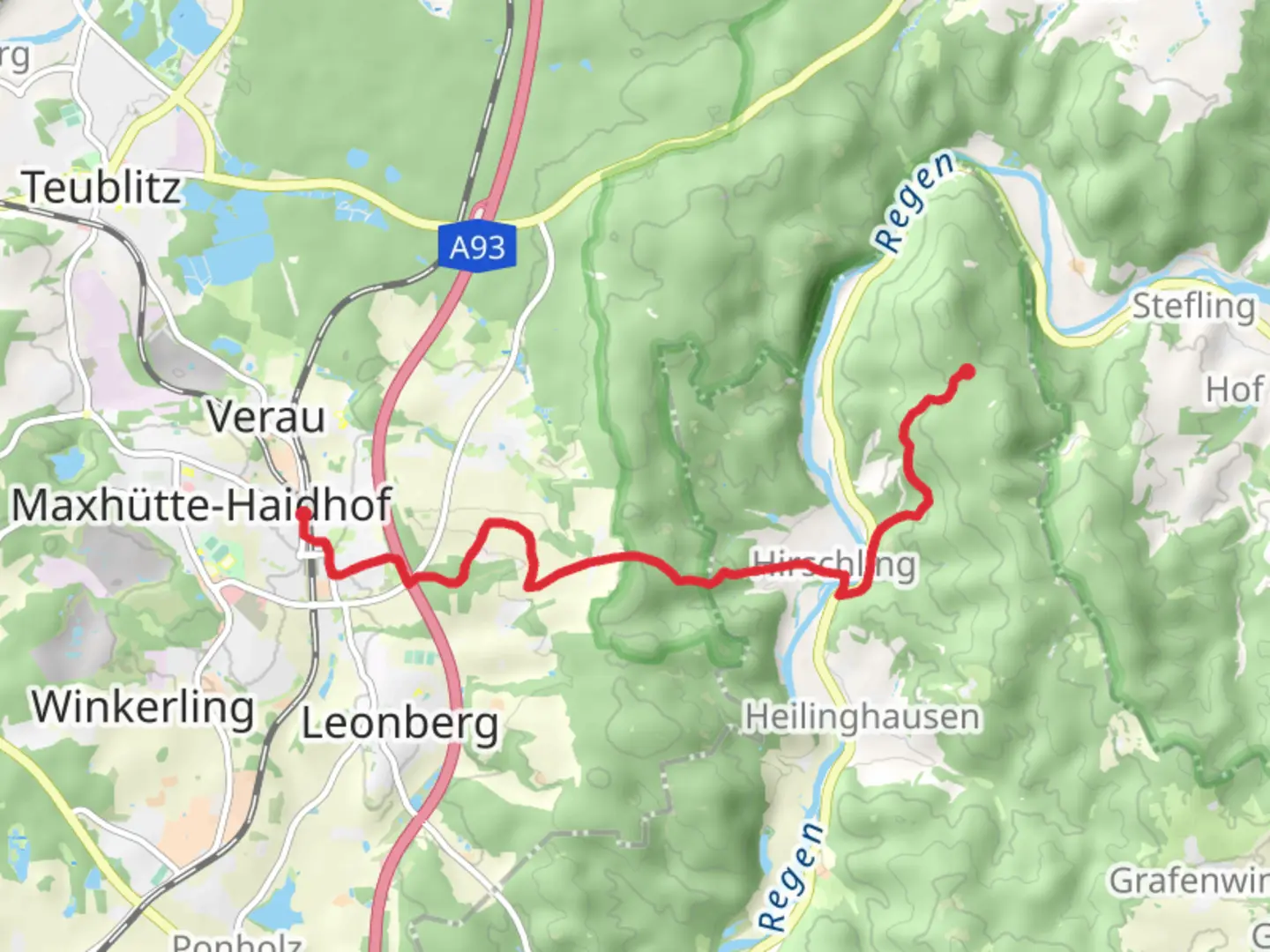
Maxhütte-Haidhof to Knotenpunkt Gailenberg via Leonberger Panoramaweg
Download
Preview
Add to list
More
9.0 km
~2 hrs 28 min
404 m
Point-to-Point
“Embark on a scenic, 9 km hike from Maxhütte-Haidhof to Knotenpunkt Gailenberg, showcasing Bavarian landscapes and historical landmarks.”
Starting near Schwandorf, Germany, the trail from Maxhütte-Haidhof to Knotenpunkt Gailenberg via Leonberger Panoramaweg is a picturesque 9 km (approximately 5.6 miles) journey with an elevation gain of around 400 meters (about 1,312 feet). This point-to-point trail is estimated to be of medium difficulty, making it suitable for moderately experienced hikers.
Getting There
To reach the trailhead, you can either drive or use public transport. If driving, head towards Schwandorf and follow local signage to Maxhütte-Haidhof. For those using public transport, take a train to Schwandorf station and then a local bus or taxi to Maxhütte-Haidhof.
Trail Overview
The trail begins in the charming town of Maxhütte-Haidhof, known for its historical significance in the iron and steel industry. As you set off, you'll quickly find yourself immersed in lush forests and rolling hills. The initial part of the trail is relatively gentle, allowing you to ease into the hike.
Leonberger Panoramaweg
Around the 3 km (1.9 miles) mark, you'll join the Leonberger Panoramaweg. This section offers stunning panoramic views of the surrounding Bavarian countryside. The elevation gain becomes more noticeable here, with a steady climb that rewards you with breathtaking vistas. Keep an eye out for local wildlife such as deer and various bird species that inhabit the area.
Historical Landmarks
As you continue, you'll pass by several historical landmarks. One notable site is the ruins of an old watchtower, dating back to medieval times. This tower once served as a lookout point to protect the region from invaders. The trail also meanders through areas that were significant during the industrial revolution, with remnants of old mining operations visible along the way.
Flora and Fauna
The trail is rich in biodiversity. You'll encounter a variety of flora, including oak, beech, and pine trees. In spring and summer, the path is adorned with wildflowers, adding a splash of color to your hike. The fauna is equally diverse, with opportunities to spot foxes, hares, and a variety of birdlife.
Navigation
For navigation, it's highly recommended to use the HiiKER app, which provides detailed maps and real-time updates. This will ensure you stay on track and can fully enjoy the trail without worrying about getting lost.
Final Stretch to Knotenpunkt Gailenberg
The final stretch towards Knotenpunkt Gailenberg involves a more challenging ascent. The trail becomes steeper, but the effort is well worth it. Upon reaching the summit, you'll be greeted with expansive views that stretch across the Bavarian landscape. This is an excellent spot to take a break, enjoy a snack, and soak in the scenery.
Practical Tips
- Footwear: Sturdy hiking boots are recommended due to the varied terrain.
- Weather: Check the weather forecast before you set out, as conditions can change rapidly.
- Water and Snacks: Carry sufficient water and snacks, especially since there are limited facilities along the trail.
- Clothing: Dress in layers to accommodate changing temperatures and conditions.
This trail offers a blend of natural beauty, historical intrigue, and moderate physical challenge, making it a rewarding experience for those who undertake it.

Comments and Reviews
User comments, reviews and discussions about the Maxhütte-Haidhof to Knotenpunkt Gailenberg via Leonberger Panoramaweg, Germany.
4.67
average rating out of 5
3 rating(s)