Download
Preview
Add to list
More
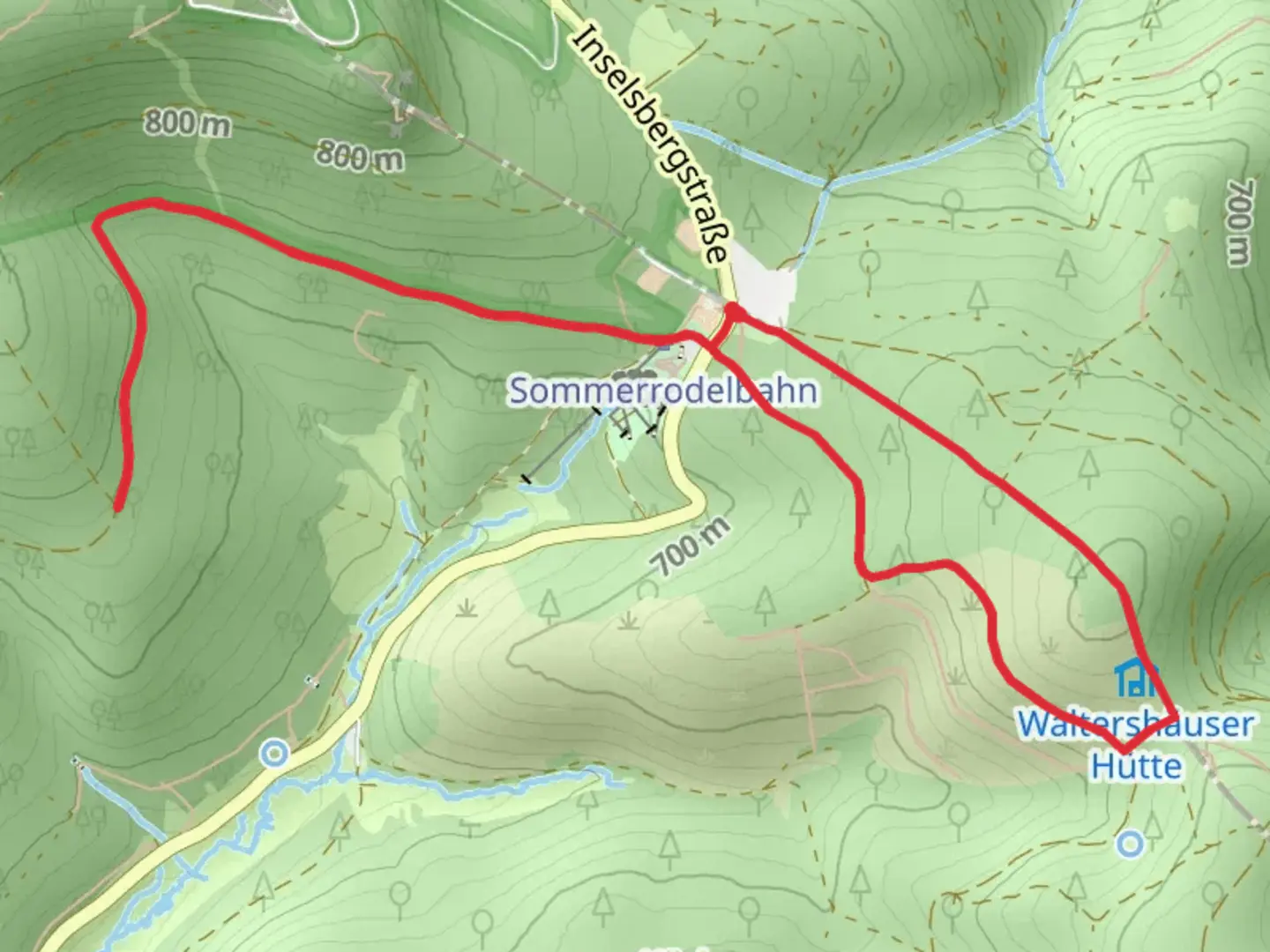
6.3 km
~1 hrs 30 min
155 m
Loop
“The Trockenberg Loop in Germany's Thuringian Forest offers stunning views, historical landmarks, and diverse wildlife.”
Starting near the picturesque town of Schmalkalden-Meiningen in Germany, the Trockenberg Loop is a delightful 6 km (approximately 3.7 miles) trail that offers a moderate challenge with an elevation gain of around 100 meters (328 feet). This loop trail is perfect for those looking to immerse themselves in the natural beauty and historical richness of the Thuringian Forest.
Getting There
To reach the trailhead, you can either drive or use public transport. If you're driving, set your GPS to Schmalkalden-Meiningen, and look for parking options near the town center. For those using public transport, the nearest significant landmark is the Schmalkalden train station. From there, local buses or a short taxi ride can take you to the trailhead.
Trail Overview
The Trockenberg Loop begins with a gentle ascent through dense, mixed forests. The initial 1 km (0.6 miles) is relatively easy, allowing you to acclimate to the surroundings. As you progress, the trail becomes steeper, gaining elevation more rapidly over the next 2 km (1.2 miles). This section offers stunning views of the surrounding valleys and is a great spot for photography.
Flora and Fauna
The Thuringian Forest is home to a diverse range of plant and animal life. Keep an eye out for native species such as red deer, wild boar, and various bird species like the Eurasian jay and the black woodpecker. The forest floor is often carpeted with wildflowers in the spring and summer, including wood anemones and wild garlic.
Historical Significance
The region around Schmalkalden-Meiningen is steeped in history. As you hike, you'll come across remnants of medieval structures and old trade routes that date back to the Middle Ages. The area was once a significant hub for iron mining and metallurgy, and you might notice old mining shafts and equipment along the way.
Key Landmarks
Around the 3 km (1.8 miles) mark, you'll reach the Trockenberg summit, which offers panoramic views of the Thuringian Forest. This is an excellent spot for a rest and a snack. Continuing on, the trail descends gradually, passing through more open meadows and small streams. At approximately 4.5 km (2.8 miles), you'll encounter a charming wooden bridge that crosses a babbling brook, a perfect spot for a quick photo.
Navigation
To ensure you stay on track, it's advisable to use the HiiKER app, which provides detailed maps and real-time navigation. The trail is well-marked, but having a reliable navigation tool can enhance your hiking experience and provide peace of mind.
Final Stretch
The last 1.5 km (0.9 miles) of the trail is relatively flat and takes you through a serene forest path that eventually loops back to the starting point. This section is particularly beautiful in the autumn when the leaves change color, creating a vibrant tapestry of reds, oranges, and yellows.
Practical Tips
- Wear sturdy hiking boots, as some sections can be rocky and uneven.
- Bring enough water and snacks, especially if you plan to take breaks and enjoy the scenery.
- Check the weather forecast before heading out, as conditions can change rapidly in the forest.
- Be mindful of local wildlife and maintain a respectful distance.
The Trockenberg Loop offers a perfect blend of natural beauty, historical intrigue, and moderate physical challenge, making it a must-visit for any hiking enthusiast exploring the Thuringian Forest.

What to expect?
Activity types
Comments and Reviews
User comments, reviews and discussions about the Trockenberg Loop, Germany.
average rating out of 5
0 rating(s)