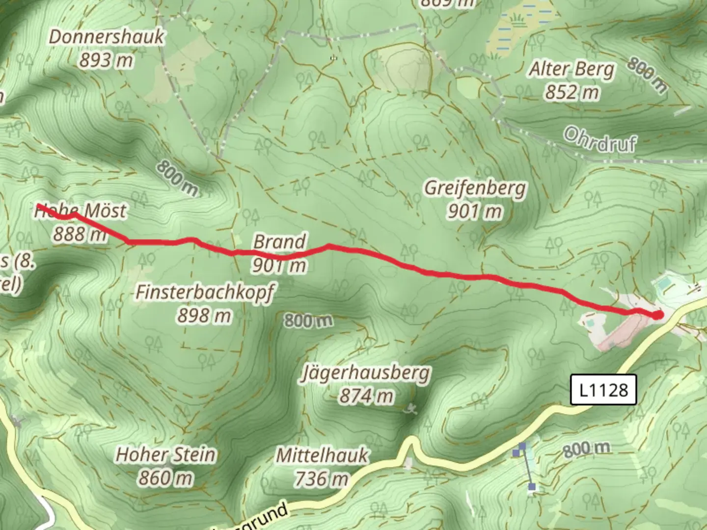
Brand, Hinterer Möstfelsen and Vorderer Möstfelsen via Brandweg
Download
Preview
Add to list
More
8.9 km
~1 hrs 59 min
121 m
Out and Back
“Embark on a 9 km scenic, moderately challenging hike near Schmalkalden, rich in history and natural beauty.”
Starting your adventure near Schmalkalden-Meiningen, Germany, this 9 km (approximately 5.6 miles) out-and-back trail offers a moderate challenge with an elevation gain of around 100 meters (328 feet). The trailhead is conveniently accessible by both car and public transport. If you're driving, you can park near the town of Schmalkalden, which is well-signposted and has ample parking facilities. For those using public transport, the nearest train station is Schmalkalden, from where local buses or a short taxi ride can take you to the trailhead.
Trail Overview
The trail begins with a gentle ascent through lush forested areas, providing a serene start to your hike. As you make your way along the Brandweg, you'll be surrounded by a mix of deciduous and coniferous trees, offering a rich tapestry of greens and the occasional burst of wildlife. Keep an eye out for deer and various bird species that inhabit this region.
Key Landmarks and Points of Interest
Hinterer Möstfelsen
Approximately 3 km (1.9 miles) into the hike, you'll reach the Hinterer Möstfelsen. This rock formation is a significant geological feature, offering a glimpse into the ancient natural history of the area. The rocks here are part of the Thuringian Forest, a region known for its rugged terrain and scenic beauty. Take a moment to rest and enjoy the panoramic views before continuing your journey.
Vorderer Möstfelsen
Continuing along the trail for another 1.5 km (0.9 miles), you'll arrive at the Vorderer Möstfelsen. This spot is not only a natural marvel but also holds historical significance. The area around Schmalkalden has a rich history dating back to medieval times, and the rocks here have witnessed centuries of change. The Vorderer Möstfelsen offers another excellent vantage point for taking in the surrounding landscape.
Flora and Fauna
The trail is a haven for nature enthusiasts. The forest floor is often carpeted with wildflowers in the spring and summer months, including species like wood anemones and wild garlic. The mixed forest provides a habitat for a variety of wildlife, so keep your camera ready for potential sightings of red squirrels, foxes, and a plethora of bird species, including woodpeckers and owls.
Navigation and Safety
Given the moderate difficulty rating, this trail is suitable for hikers with a reasonable level of fitness. The path is well-marked, but it's always wise to carry a reliable navigation tool. HiiKER is an excellent app for this purpose, offering detailed maps and real-time tracking to ensure you stay on course.
Getting There
To reach the trailhead, if you're driving, set your GPS to Schmalkalden, Germany. From there, follow local signs to the starting point near the forested area. For public transport users, take a train to Schmalkalden station. From the station, local buses or a short taxi ride will get you to the trailhead. The town of Schmalkalden itself is worth a visit, known for its well-preserved medieval architecture and charming streets.
Prepare adequately with water, snacks, and appropriate hiking gear, and you'll be set for a memorable hike through one of Germany's picturesque landscapes.

What to expect?
Activity types
Comments and Reviews
User comments, reviews and discussions about the Brand, Hinterer Möstfelsen and Vorderer Möstfelsen via Brandweg, Germany.
4.33
average rating out of 5
3 rating(s)