Download
3D Flyover
Add to list
More
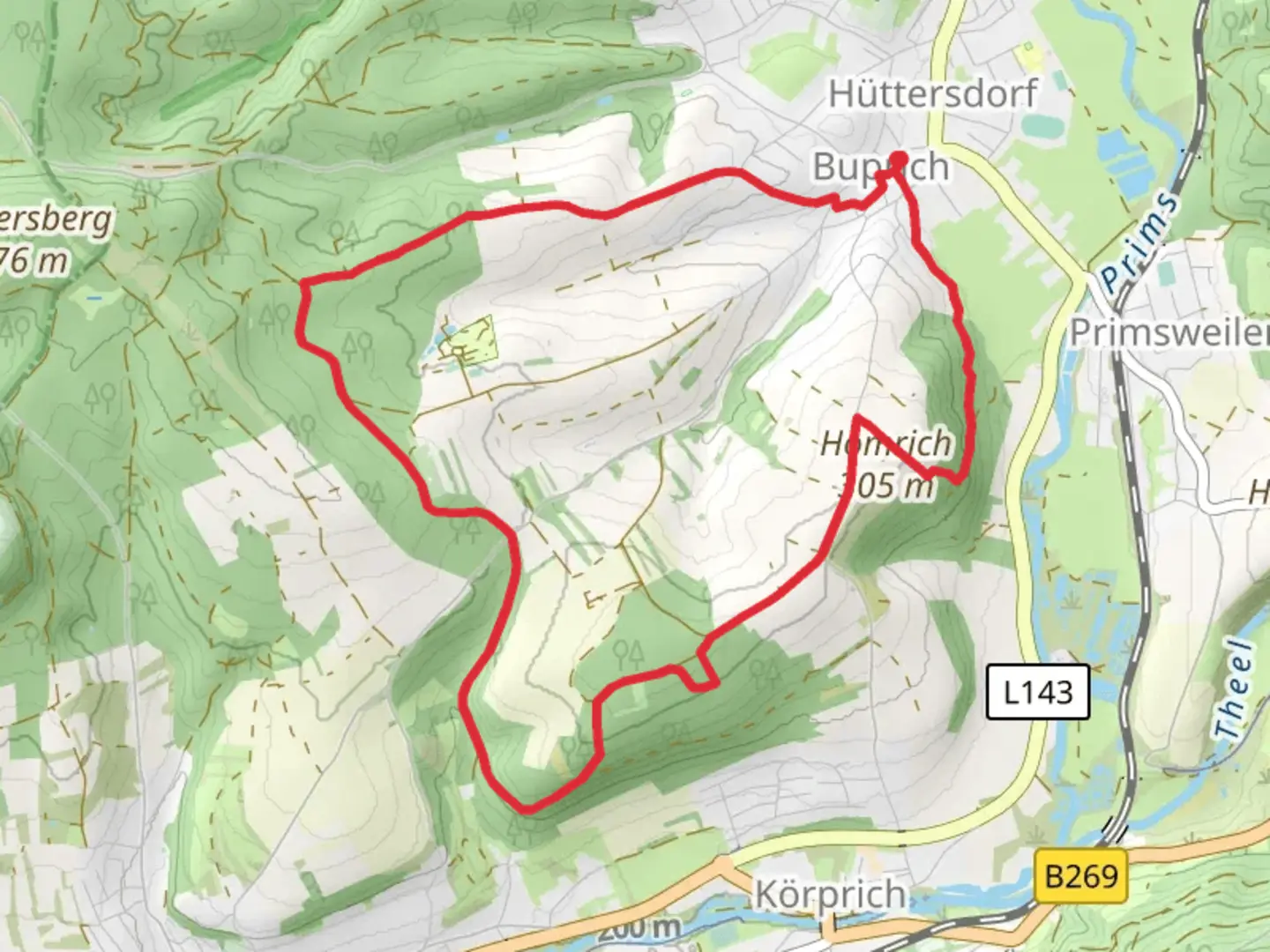
9.8 km
~2 hrs 19 min
221 m
Loop
“The Rötelweg trail near Saarlouis blends lush forests, historical landmarks, and panoramic views in a 10 km loop.”
Starting near the charming town of Saarlouis, Germany, the Rötelweg trail offers a delightful 10 km (6.2 miles) loop with an elevation gain of approximately 200 meters (656 feet). This medium-difficulty trail is perfect for those looking to immerse themselves in the natural beauty and historical richness of the region.
Getting There
To reach the trailhead, you can either drive or use public transport. If driving, set your GPS to Saarlouis, and look for parking near the town center. For those using public transport, Saarlouis is well-connected by train and bus services. The nearest train station is Saarlouis Hauptbahnhof, from where you can take a local bus or taxi to the trailhead.
Trail Highlights
As you embark on the Rötelweg, you'll find yourself surrounded by lush forests and rolling hills. The trail is well-marked, but it's always a good idea to have a reliable navigation tool like HiiKER to ensure you stay on track.
Nature and Wildlife
The trail meanders through dense woodlands, offering a serene environment filled with the sounds of chirping birds and rustling leaves. Keep an eye out for local wildlife, including deer, foxes, and a variety of bird species. The flora is equally impressive, with a mix of deciduous and coniferous trees providing a vibrant canopy overhead.
Historical Significance
The region around Saarlouis is steeped in history. Saarlouis itself was founded by Louis XIV of France in the late 17th century and served as a strategic military outpost. As you hike, you'll come across remnants of old fortifications and historical markers that tell the story of the area's past. One notable landmark is the Vauban Fortress, located near the trailhead, which offers a glimpse into the military architecture of the time.
Trail Sections
The trail can be divided into several sections, each offering its own unique experience.
Initial Ascent
The first part of the trail involves a gentle ascent through a forested area. This section is about 3 km (1.9 miles) long and gains approximately 100 meters (328 feet) in elevation. The path is well-trodden but can be slippery after rain, so sturdy hiking boots are recommended.
Midway Point
Around the 5 km (3.1 miles) mark, you'll reach a plateau that offers stunning panoramic views of the surrounding countryside. This is a great spot to take a break, enjoy a snack, and soak in the scenery. The elevation gain here is minimal, making it a relatively easy stretch.
Descent and Return
The final section involves a gradual descent back towards Saarlouis. This part of the trail is about 2 km (1.2 miles) long and loses around 100 meters (328 feet) in elevation. The path winds through open meadows and small streams, providing a picturesque end to your hike.
Practical Tips
- Footwear: Wear sturdy hiking boots, especially if the weather has been wet.
- Weather: Check the weather forecast before you go. The trail can be muddy and slippery after rain.
- Navigation: Use HiiKER for real-time navigation and to stay on the marked path.
- Supplies: Bring enough water and snacks, as there are no facilities along the trail.
- Wildlife: Be respectful of the local wildlife and maintain a safe distance.
The Rötelweg trail near Saarlouis offers a perfect blend of natural beauty and historical intrigue, making it a must-visit for any hiking enthusiast.

Comments and Reviews
User comments, reviews and discussions about the Rötelweg, Germany.
4.67
average rating out of 5
3 rating(s)