Download
3D Flyover
Add to list
More
8.0 km
~1 hrs 54 min
186 m
Loop
“Embark on an 8 km scenic loop through Bavarian villages, lush forests, and historical sites near Roth, Germany.”
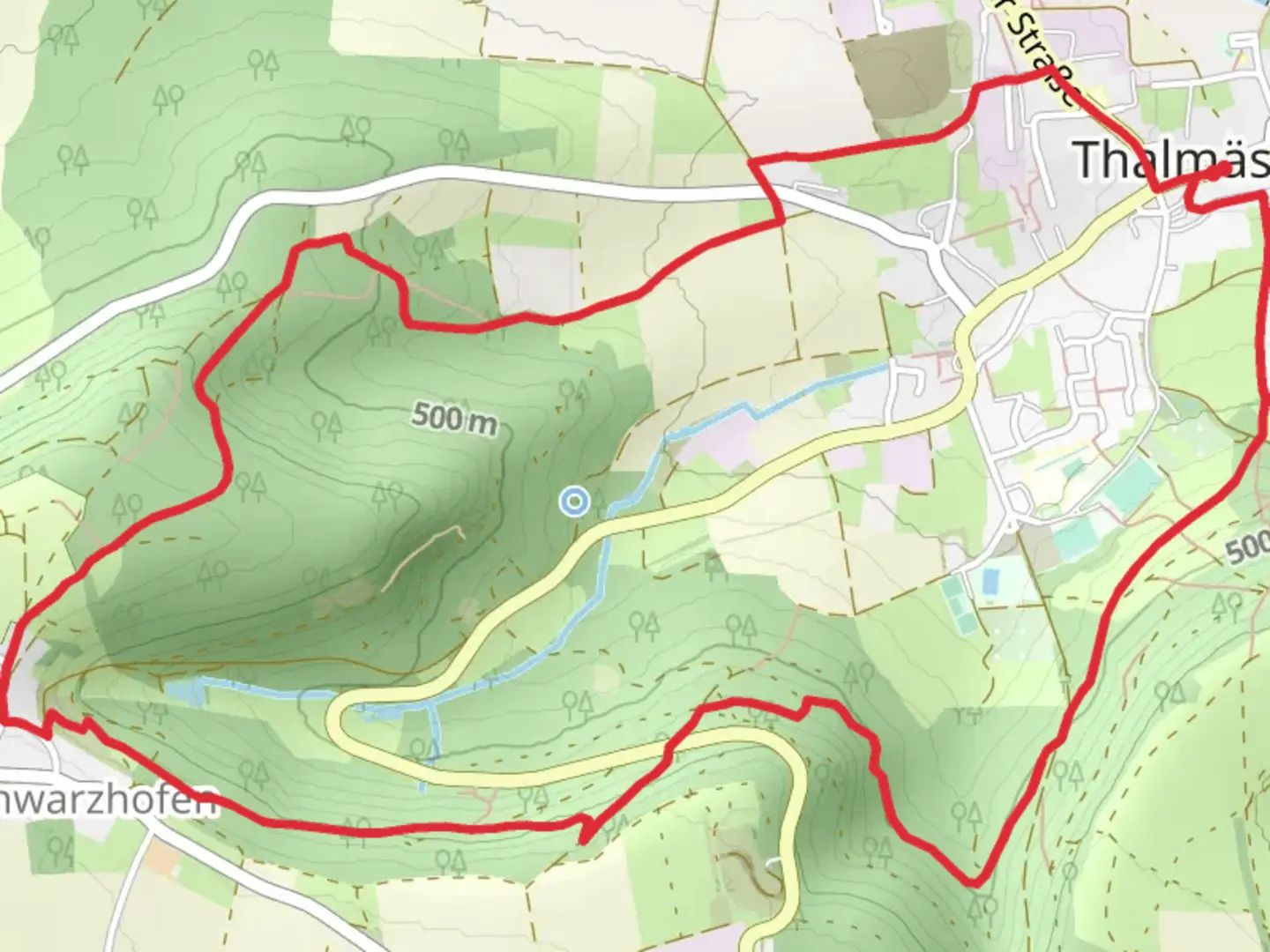
Starting near the charming town of Roth, Germany, the Thalmässing and Heimmühle Loop via Frankenweg offers an 8 km (approximately 5 miles) journey through picturesque landscapes and historical sites. With an elevation gain of around 100 meters (328 feet), this loop trail is rated as medium difficulty, making it suitable for moderately experienced hikers.
Getting There
To reach the trailhead, you can either drive or use public transport. If driving, set your GPS to Roth, Germany, and follow local signage to the trailhead. For those using public transport, take a train to Roth station and then a local bus or taxi to the starting point.
Trail Highlights
Thalmässing
The trail begins near Thalmässing, a quaint village known for its traditional Bavarian architecture. As you start your hike, you'll pass through the village, offering a glimpse into local life and culture. The cobblestone streets and historic buildings set a charming tone for the adventure ahead.
Frankenweg
As you continue, you'll join the Frankenweg, a long-distance trail that traverses the Franconian region. This section of the trail is well-marked and maintained, making navigation straightforward. For precise navigation, consider using the HiiKER app, which provides detailed maps and real-time updates.
Heimmühle
Approximately halfway through the loop, you'll encounter Heimmühle, an old mill that stands as a testament to the region's agricultural history. The mill, surrounded by lush greenery and a serene stream, offers a perfect spot for a short break. Take a moment to appreciate the historical significance of this site, which has been a part of the local community for centuries.
Nature and Wildlife
The trail meanders through diverse landscapes, including dense forests, open meadows, and rolling hills. Keep an eye out for local wildlife such as deer, foxes, and a variety of bird species. The flora is equally impressive, with seasonal wildflowers adding bursts of color to the scenery.
Elevation and Terrain
The elevation gain of around 100 meters (328 feet) is spread out over the 8 km (5 miles), making the ascents and descents manageable. The terrain varies from well-trodden paths to narrower, more rugged sections. Good hiking boots are recommended to navigate the occasional rocky or muddy patches.
Points of Interest
- Historical Markers: Along the trail, you'll find several informational plaques detailing the history and significance of the area. These markers provide a deeper understanding of the cultural and historical context of the region.
- Scenic Overlooks: There are a few spots along the trail that offer panoramic views of the surrounding countryside. These are excellent opportunities for photography or simply to take in the beauty of the Franconian landscape.
Preparation Tips
- Weather: Check the local weather forecast before setting out, as conditions can change rapidly.
- Water and Snacks: Bring sufficient water and snacks, as there are limited facilities along the trail.
- Clothing: Dress in layers to accommodate changing weather conditions and wear sturdy hiking boots.
This loop trail offers a delightful mix of natural beauty, historical intrigue, and moderate physical challenge, making it a rewarding experience for those who embark on it.

What to expect?
Activity types
Comments and Reviews
User comments, reviews and discussions about the Thalmässing and Heimmühle Loop via Frankenweg, Germany.
4.67
average rating out of 5
6 rating(s)