Download
3D Flyover
Add to list
More
11.7 km
~4 hrs 1 min
1017 m
Out and Back
“Challenge yourself on a breathtaking alpine adventure through Bavaria's rugged Zeller Scharte and Wendelstein trail.”
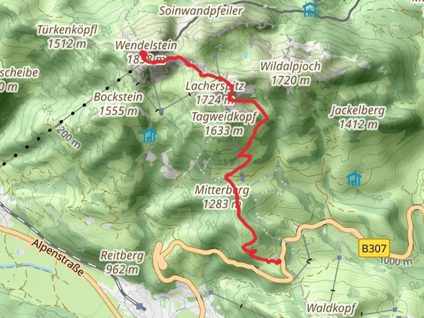
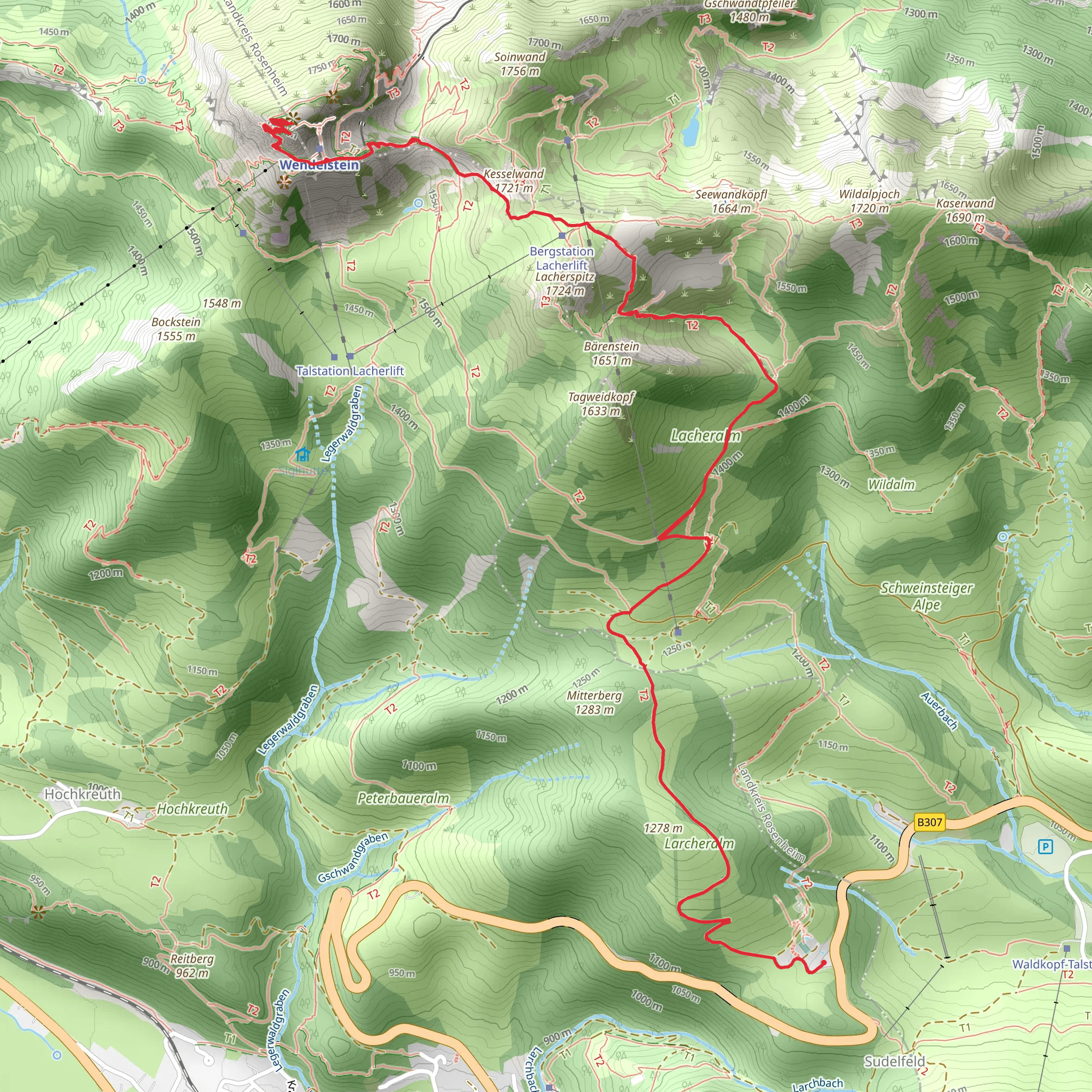
Nestled in the Bavarian Alps near Rosenheim, Germany, the Zeller Scharte and Wendelstein via Sudelfeld Passhoehe trail offers an exhilarating adventure for seasoned hikers. This challenging out-and-back trail spans approximately 12 kilometers (about 7.5 miles) with a significant elevation gain of around 1000 meters (approximately 3280 feet), making it an extra difficult trek that demands preparation and endurance.
Getting There
The trailhead is conveniently located near Rosenheim, a charming town in Bavaria. For those traveling by car, head towards Sudelfeld Passhoehe, which serves as the starting point. Ample parking is available at the pass. If you prefer public transport, take a train to Rosenheim and then a bus towards Bayrischzell, alighting at the Sudelfeld Passhoehe stop. From there, the trailhead is a short walk away.
Trail Overview
The journey begins at Sudelfeld Passhoehe, where the initial ascent sets the tone for the demanding hike ahead. As you climb, the trail offers breathtaking views of the surrounding alpine landscape, with lush meadows and dense forests providing a picturesque backdrop. The first few kilometers are a steady climb, gaining approximately 500 meters (1640 feet) in elevation, as you make your way towards Zeller Scharte.
Zeller Scharte
Upon reaching Zeller Scharte, around halfway through the hike, you'll be rewarded with panoramic vistas of the Bavarian Alps. This saddle is a perfect spot to take a break and soak in the stunning scenery. The area is known for its diverse flora and fauna, so keep an eye out for alpine flowers and, if you're lucky, you might spot chamois or marmots.
Wendelstein
Continuing from Zeller Scharte, the trail becomes more rugged and steep as you approach the Wendelstein summit. This section is particularly challenging, with rocky paths and narrow ridges requiring careful navigation. The use of HiiKER is recommended for precise trail guidance. The final push to the summit involves an additional elevation gain of about 500 meters (1640 feet), culminating in awe-inspiring views from the top. The Wendelstein is not only a natural marvel but also holds historical significance, with a small chapel and an observatory that dates back to the late 19th century.
Descent
The return journey follows the same path, allowing you to revisit the beautiful landscapes from a different perspective. The descent can be demanding on the knees, so trekking poles are advisable for added support. As you make your way back to Sudelfeld Passhoehe, take the opportunity to reflect on the rich history and natural beauty of this remarkable region.
Important Considerations
Given the trail's difficulty, it's crucial to be well-prepared with appropriate gear, including sturdy hiking boots, weather-appropriate clothing, and sufficient water and snacks. Weather conditions in the Alps can change rapidly, so check forecasts and be prepared for sudden shifts. This trail is best suited for experienced hikers with a good level of fitness, and it's advisable to start early in the day to ensure ample daylight for the hike.
What to expect?
Activity types
Comments and Reviews
User comments, reviews and discussions about the Zeller Scharte and Wendelstein via Sudelfeld Passhoehe, Germany.
average rating out of 5
0 rating(s)
