Download
Preview
Add to list
More
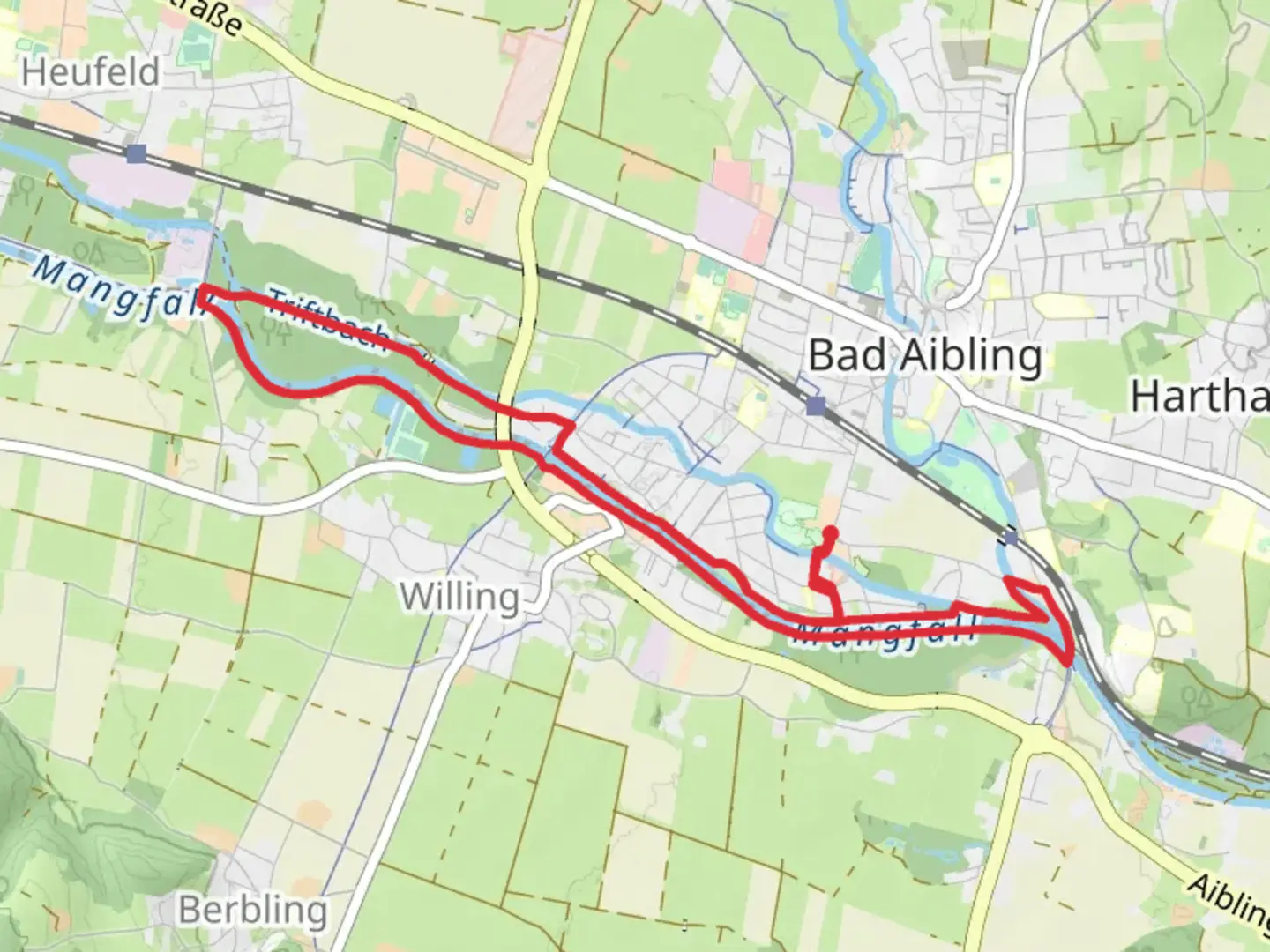
9.9 km
~2 hrs 1 min
25 m
Loop
“Explore lush meadows, serene forests, and historic towns on the accessible Mangfall via Bad Aibling loop.”
Starting near the charming town of Rosenheim, Germany, the Mangfall via Bad Aibling and Mittel trail offers a delightful 10 km (6.2 miles) loop with virtually no elevation gain, making it accessible for hikers of varying skill levels. The trailhead is conveniently located near Rosenheim, which can be reached by car or public transport. If you're driving, there are ample parking options in Rosenheim. For those using public transport, Rosenheim is well-connected by train, and from there, local buses can take you closer to the trailhead.
Trail Navigation and Terrain The trail is well-marked and can be easily navigated using the HiiKER app, which provides detailed maps and real-time updates. The terrain is predominantly flat, with well-maintained paths that meander through lush meadows, serene forests, and along the picturesque Mangfall River. The lack of significant elevation gain makes this trail suitable for families and casual hikers.
Key Landmarks and Points of Interest As you embark on this loop, you'll first encounter the tranquil banks of the Mangfall River. This river is a tributary of the Inn River and is known for its clear waters and abundant fish, making it a popular spot for local anglers. Approximately 3 km (1.9 miles) into the hike, you'll reach the historic town of Bad Aibling. This spa town is renowned for its therapeutic mud baths and thermal springs, which have been attracting visitors since Roman times. Take a moment to explore the town's charming streets and perhaps enjoy a coffee at one of the local cafes.
Continuing on, the trail leads you through the scenic Mittel region, characterized by its rolling fields and traditional Bavarian farmhouses. This area is particularly beautiful in the spring and summer months when wildflowers are in full bloom. Keep an eye out for local wildlife, including deer, foxes, and a variety of bird species.
Historical Significance The region around Rosenheim and Bad Aibling is steeped in history. Rosenheim itself dates back to Roman times and has been an important trading hub due to its strategic location near the Inn River. Bad Aibling's history as a spa town adds another layer of cultural richness to the hike. The trail also passes by several old mills and waterworks that were once vital to the local economy.
Flora and Fauna The Mangfall River and its surrounding areas are home to a diverse range of flora and fauna. The riverbanks are lined with willow and alder trees, providing a habitat for various bird species such as kingfishers and herons. In the forested sections, you might spot red squirrels and, if you're lucky, even a shy roe deer. The meadows are a riot of color in the warmer months, with wildflowers like daisies, buttercups, and poppies.
Practical Information The entire loop takes around 3 to 4 hours to complete at a leisurely pace, allowing time for breaks and exploration. There are several benches and picnic spots along the way, perfect for a rest or a snack. Make sure to carry enough water and some light snacks, as there are limited facilities once you leave Bad Aibling.
Whether you're a history buff, a nature lover, or simply looking for a pleasant day hike, the Mangfall via Bad Aibling and Mittel trail offers a rich and varied experience.

Comments and Reviews
User comments, reviews and discussions about the Mangfall via Bad Aibling and Mittel, Germany.
4.5
average rating out of 5
2 rating(s)