Download
3D Flyover
Add to list
More
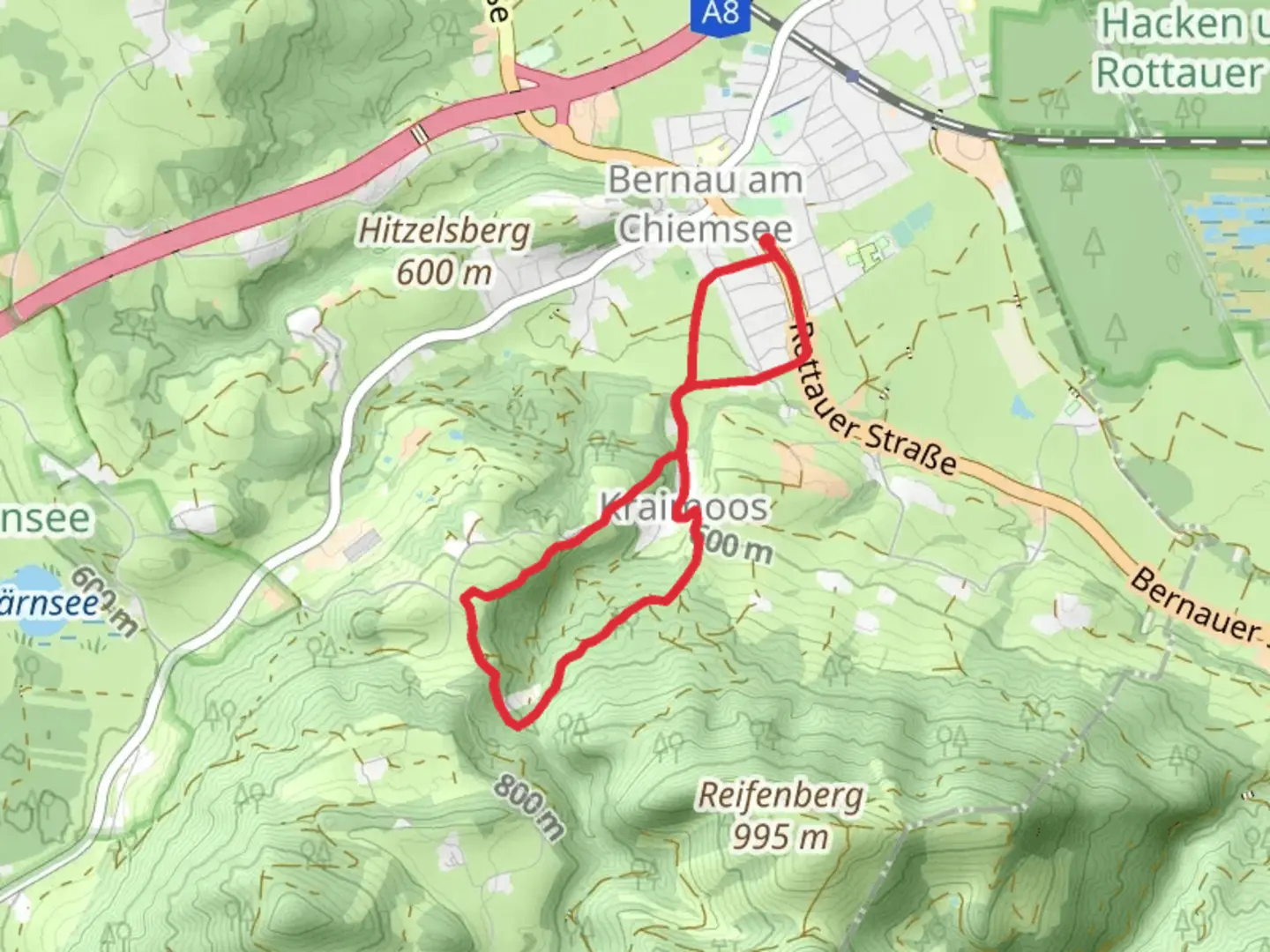
5.9 km
~1 hrs 34 min
228 m
Loop
“The Kraimoos Loop in Rosenheim is a 6 km trail blending lush forests, historical sites, and alpine views.”
Starting near the charming town of Rosenheim, Germany, the Kraimoos Loop is a delightful 6 km (3.7 miles) trail with an elevation gain of approximately 200 meters (656 feet). This loop trail offers a medium difficulty rating, making it suitable for moderately experienced hikers looking for a rewarding day hike.
Getting There
To reach the trailhead, you can either drive or use public transport. If driving, head towards Rosenheim and look for parking near the outskirts of the town. For those using public transport, take a train to Rosenheim station. From there, local buses or a short taxi ride will get you to the trailhead.
Trail Overview
The Kraimoos Loop begins with a gentle ascent through lush forests, where the air is filled with the scent of pine and the sounds of chirping birds. The initial 1.5 km (0.9 miles) of the trail takes you through dense woodland, gradually climbing about 100 meters (328 feet). Keep an eye out for deer and other wildlife that are often spotted in this area.
Historical Significance
As you continue, you'll come across remnants of old farmhouses and stone walls, hinting at the region's agricultural past. This area has been cultivated for centuries, and the trail itself follows some of the old paths used by farmers and traders.
Mid-Trail Highlights
Around the 3 km (1.8 miles) mark, the trail opens up to a stunning meadow, offering panoramic views of the Bavarian Alps in the distance. This is an excellent spot to take a break, have a snack, and soak in the natural beauty. The elevation gain here is about 50 meters (164 feet), making it a relatively easy section of the hike.
Flora and Fauna
The meadow is a haven for wildflowers, especially in the spring and summer months. Look out for species like the European columbine and various types of orchids. Birdwatchers will also enjoy spotting species such as the European robin and the black woodpecker.
Navigation
For navigation, it's highly recommended to use HiiKER, which provides detailed maps and real-time updates. The trail is well-marked, but having a reliable navigation tool ensures you stay on track, especially in the more wooded sections.
Final Stretch
The last 1.5 km (0.9 miles) of the trail descends back into the forest, where you'll encounter a small stream. The sound of flowing water adds a serene backdrop as you make your way back to the trailhead. This section involves a descent of about 50 meters (164 feet), making it a gentle end to your hike.
Practical Tips
- Wear sturdy hiking boots, as some sections can be muddy, especially after rain.
- Bring enough water and snacks, as there are no facilities along the trail.
- Check the weather forecast before heading out, as conditions can change rapidly in this region.
The Kraimoos Loop offers a perfect blend of natural beauty, historical intrigue, and moderate physical challenge, making it a must-visit for hikers in the Rosenheim area.

What to expect?
Activity types
Comments and Reviews
User comments, reviews and discussions about the Kraimoos Loop, Germany.
4.75
average rating out of 5
4 rating(s)