Download
Preview
Add to list
More
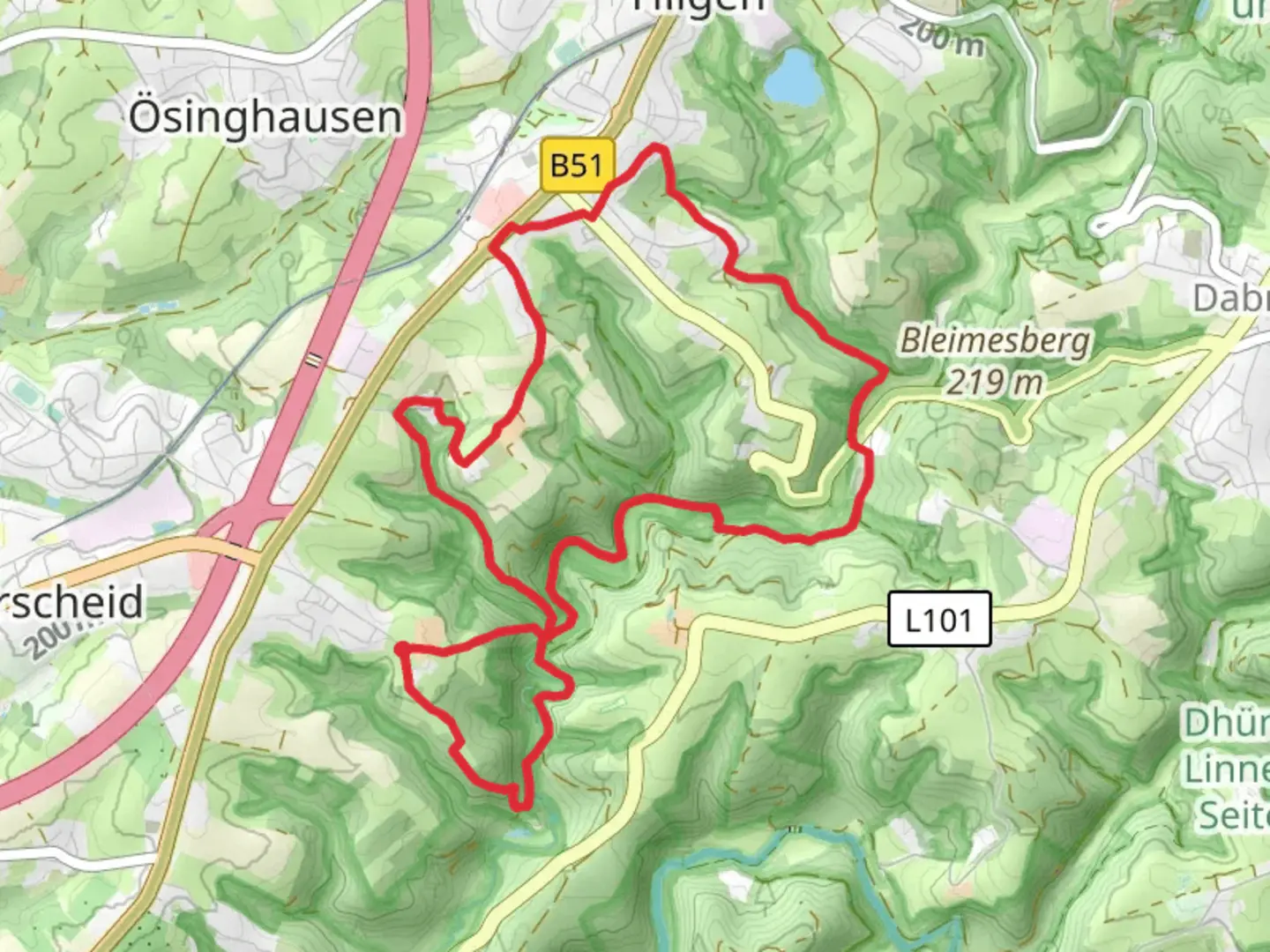
10.1 km
~2 hrs 25 min
243 m
Loop
“"Explore the picturesque Eifgenbach loop trail, offering diverse landscapes, moderate challenge, and rich historical insights."”
Starting near the picturesque Rheinisch-Bergischer Kreis in Germany, this 10 km (approximately 6.2 miles) loop trail offers a delightful mix of natural beauty and moderate challenge, making it an excellent choice for hikers of varying skill levels. With an elevation gain of around 200 meters (656 feet), the trail provides enough ascent to keep things interesting without being overly strenuous.
Getting There
To reach the trailhead, you can either drive or use public transport. If driving, set your GPS to the nearest known address: "Rheinisch-Bergischer Kreis, Germany." There are parking facilities available near the trailhead. For those using public transport, take a train or bus to the nearest major town, Bergisch Gladbach, and then a local bus or taxi to the trailhead.
Trail Navigation
For navigation, it's highly recommended to use HiiKER, which provides detailed maps and real-time updates to ensure you stay on track. The trail is well-marked, but having a reliable navigation tool can enhance your hiking experience.
Trail Highlights
The trail meanders through a variety of landscapes, including dense forests, open meadows, and along the serene Eifgenbach stream. Early in the hike, you'll encounter a charming wooden bridge crossing the stream, a perfect spot for a quick photo or a moment of reflection.
Flora and Fauna
The area is rich in biodiversity. Keep an eye out for native wildlife such as deer, foxes, and a variety of bird species. The forested sections are home to ancient oak and beech trees, providing ample shade and a sense of tranquility. In the spring and summer months, the meadows burst into color with wildflowers, attracting butterflies and bees.
Historical Significance
The region has a deep historical background. As you hike, you'll come across remnants of old mills and farmhouses, some dating back to the medieval period. These structures offer a glimpse into the area's past and its agricultural heritage. Informational plaques along the trail provide context and historical anecdotes, enriching your hiking experience.
Points of Interest
Around the 5 km (3.1 miles) mark, you'll reach a scenic viewpoint offering panoramic views of the surrounding countryside. This is an ideal spot for a rest and a snack. The elevation gain to this point is gradual, making it accessible for most hikers.
Further along, at approximately 7 km (4.3 miles), you'll find a small, secluded picnic area by the stream. This is a great place to take a longer break, enjoy a packed lunch, and soak in the natural beauty.
Final Stretch
The last few kilometers of the trail loop back towards the starting point, taking you through a mix of forest and open fields. The descent is gentle, allowing you to finish your hike on a relaxed note.
Preparation Tips
Given the moderate difficulty rating, it's advisable to wear sturdy hiking boots and bring plenty of water, especially during warmer months. The trail can get muddy after rain, so waterproof gear is recommended. Always check the weather forecast before heading out and let someone know your hiking plans.
By following these guidelines and using HiiKER for navigation, you'll be well-prepared to enjoy the Eifgenbach trail to its fullest.

What to expect?
Activity types
Comments and Reviews
User comments, reviews and discussions about the Eifgenbach, Germany.
4.5
average rating out of 5
2 rating(s)