Download
3D Flyover
Add to list
More
9.8 km
~2 hrs 50 min
531 m
Loop
“Embark on the Hexenbuckel Weg loop for a 10 km journey through lush forests and historical ruins.”
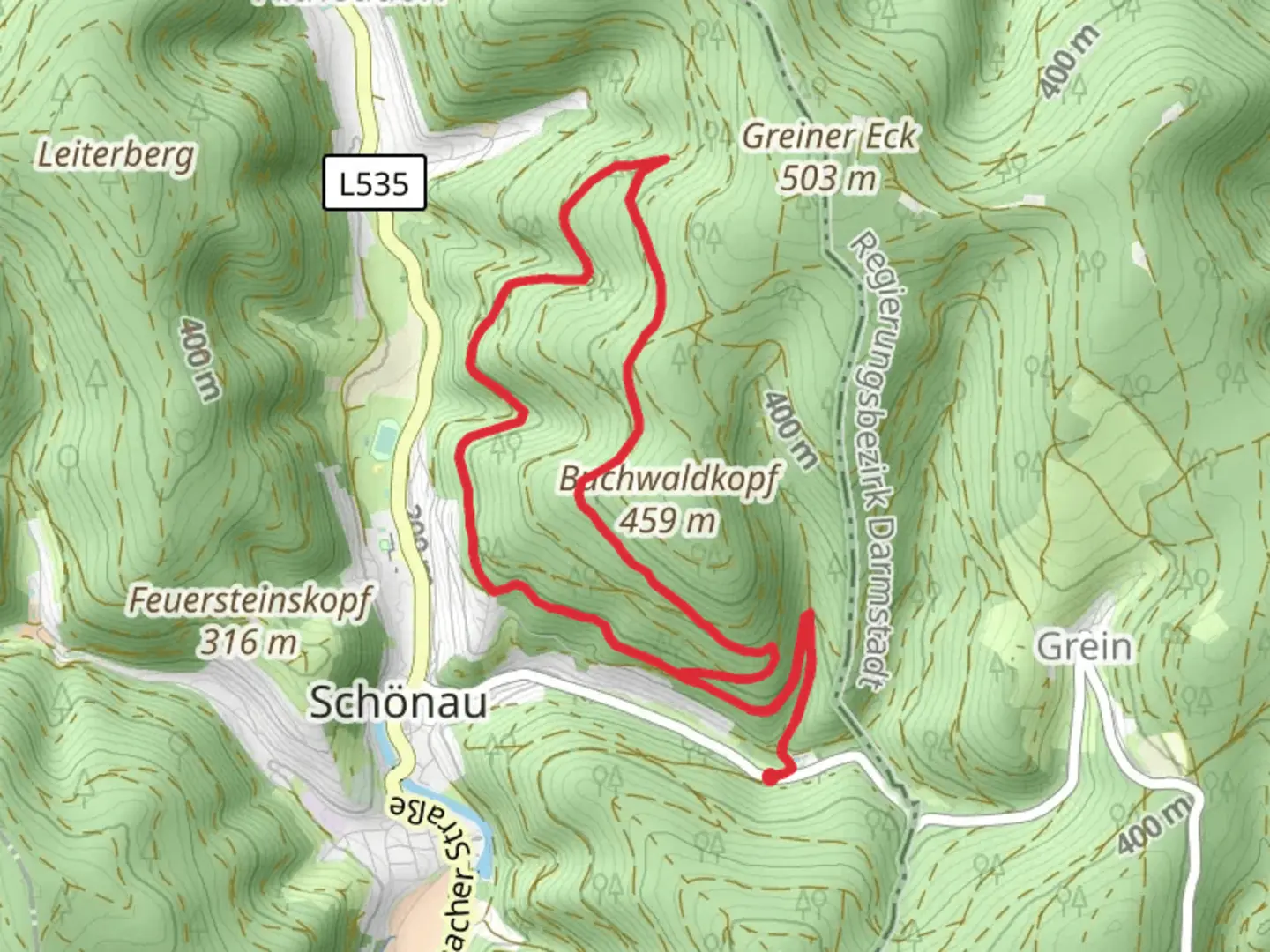
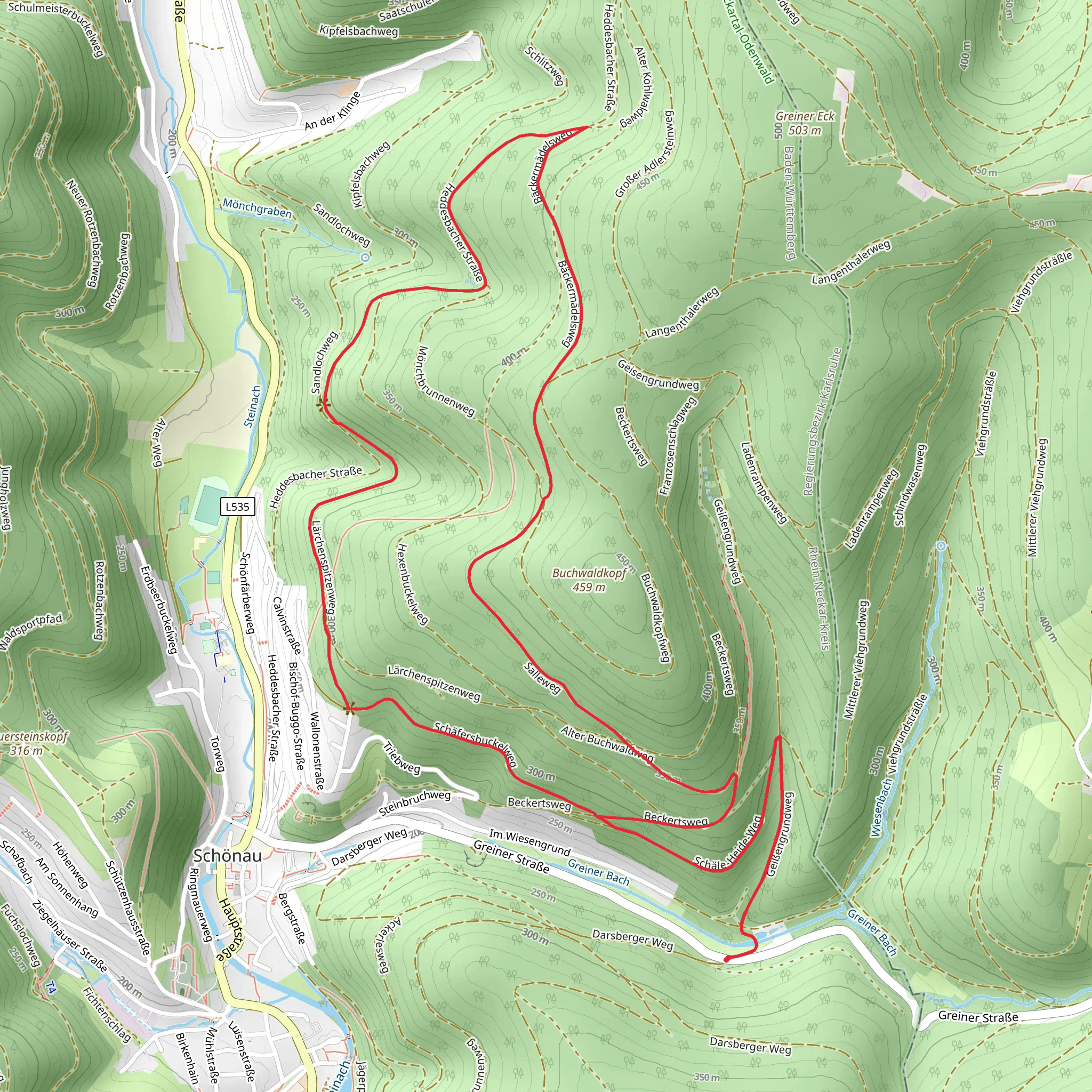
Starting your adventure near Rhein-Neckar-Kreis, Germany, the Hexenbuckel Weg, Baeckermaedel Weg, and Salleweg loop offers a captivating 10 km (6.2 miles) journey with an elevation gain of approximately 500 meters (1,640 feet). This medium-difficulty trail is perfect for those looking to immerse themselves in the natural beauty and historical richness of the region.
Getting There
To reach the trailhead, you can either drive or use public transport. If driving, set your GPS to the nearest known address: Heidelberg, a well-known city in the region. From Heidelberg, follow the signs to Rhein-Neckar-Kreis. For those using public transport, take a train to Heidelberg Hauptbahnhof (main station) and then a local bus towards Rhein-Neckar-Kreis. The trailhead is conveniently located near the town center, making it easily accessible.
Trail Navigation
For navigation, it's highly recommended to use the HiiKER app, which provides detailed maps and real-time updates. The trail is well-marked, but having a reliable navigation tool will ensure you stay on track.
Trail Highlights
Hexenbuckel Weg
Starting with Hexenbuckel Weg, you'll ascend gradually through dense forests. This section is known for its lush greenery and the occasional sighting of local wildlife such as deer and various bird species. After about 2 km (1.2 miles), you'll reach the Hexenbuckel viewpoint, offering panoramic views of the surrounding valleys and hills. The elevation gain here is around 150 meters (492 feet), making it a moderate climb.
Baeckermaedel Weg
Transitioning to Baeckermaedel Weg, the trail becomes a bit steeper, adding another 200 meters (656 feet) of elevation over the next 3 km (1.9 miles). This part of the trail is historically significant, as it passes by ancient ruins dating back to the Roman era. Keep an eye out for informational plaques that provide insights into the region's rich history. The dense forest opens up occasionally, offering glimpses of the picturesque landscape.
Salleweg
The final section, Salleweg, is a gentle descent that takes you back to the starting point. This 5 km (3.1 miles) stretch is relatively easier, with an elevation loss of about 150 meters (492 feet). Along the way, you'll pass through charming meadows and small streams, perfect for a short rest or picnic. The trail also features several wooden benches and rest areas, making it a comfortable end to your hike.
Flora and Fauna
The trail is a haven for nature enthusiasts. The forests are predominantly composed of oak, beech, and pine trees. In spring and summer, the undergrowth is carpeted with wildflowers, adding vibrant colors to your hike. Wildlife is abundant, with frequent sightings of deer, foxes, and a variety of bird species, including woodpeckers and owls.
Historical Significance
The region is steeped in history, with remnants of Roman settlements and medieval structures scattered along the trail. The Baeckermaedel Weg, in particular, offers a glimpse into the past with its ancient ruins and historical markers. These landmarks provide a fascinating backdrop to your hike, enriching the overall experience.
Preparation Tips
Given the medium difficulty rating, it's advisable to wear sturdy hiking boots and bring plenty of water, especially during the warmer months. The trail can be muddy in sections, so waterproof gear is recommended. Always check the weather forecast before heading out and inform someone of your plans.
This loop trail offers a perfect blend of natural beauty, historical intrigue, and moderate physical challenge, making it a rewarding experience for hikers of all levels.
Comments and Reviews
User comments, reviews and discussions about the Hexenbuckel Weg, Baeckermaedel Weg and Salleweg, Germany.
average rating out of 5
0 rating(s)
