Download
Preview
Add to list
More
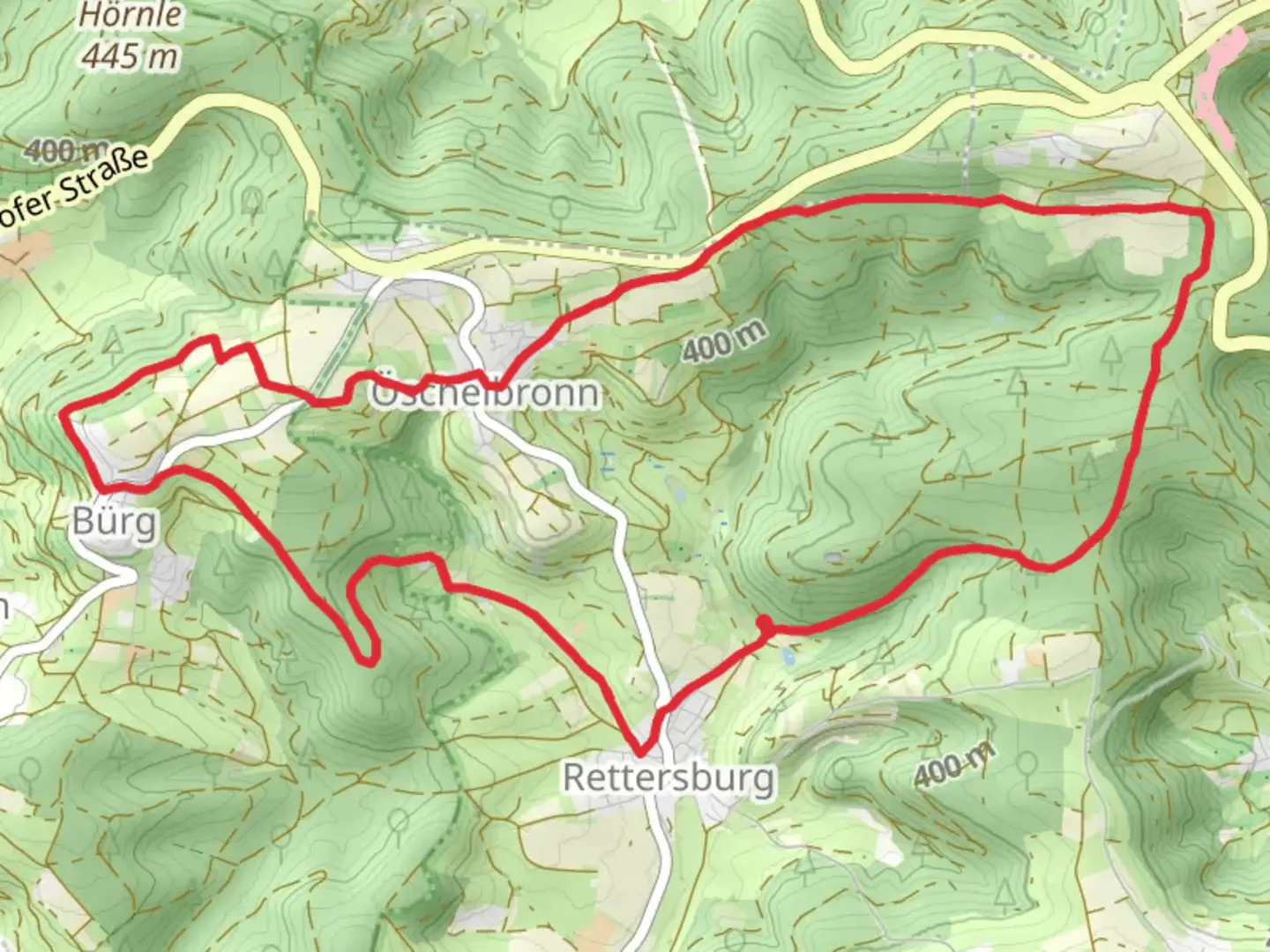
12.7 km
~3 hrs 1 min
290 m
Loop
“The Rems Murr Wanderweg and Oeschelbronn Rundweg Loop offers a scenic, historical 13 km hike for moderate hikers.”
Starting near Rems-Murr-Kreis, Germany, the Rems Murr Wanderweg and Oeschelbronn Rundweg Loop is a delightful 13 km (8 miles) hike with an elevation gain of approximately 200 meters (656 feet). This loop trail is rated as medium difficulty, making it suitable for moderately experienced hikers.
Getting There
To reach the trailhead, you can drive or use public transport. If driving, set your GPS to Rems-Murr-Kreis, and look for parking near the trailhead. For public transport, take a train to the nearest station in Waiblingen, and from there, you can catch a local bus to the trailhead area. The bus routes are well-connected and frequent, making it convenient for hikers.
Trail Overview
The trail begins with a gentle ascent, allowing you to warm up as you make your way through lush forests and open meadows. The first 3 km (1.9 miles) offer a mix of shaded woodland paths and open fields, providing a variety of scenery. Keep an eye out for local wildlife such as deer and various bird species that inhabit the area.
Historical Significance
As you continue, you'll come across several points of historical interest. The region is rich in history, with remnants of ancient settlements and medieval structures. Around the 5 km (3.1 miles) mark, you'll encounter the ruins of an old watchtower, which dates back to the medieval period. This tower once served as a lookout point to protect the local villages from invaders.
Mid-Trail Highlights
At approximately 7 km (4.3 miles), you'll reach a scenic viewpoint offering panoramic views of the Rems Valley. This is an excellent spot to take a break, enjoy a snack, and soak in the breathtaking landscape. The elevation gain here is about 100 meters (328 feet), providing a moderate challenge but rewarding you with stunning vistas.
Flora and Fauna
The trail is abundant with diverse flora, including wildflowers, oak, and beech trees. During spring and summer, the meadows are a riot of colors with blooming flowers. In autumn, the forested sections transform into a tapestry of reds, oranges, and yellows, making it a picturesque hike.
Navigation
Navigating the trail is straightforward, but it's always a good idea to have a reliable navigation tool. HiiKER is an excellent app for this purpose, offering detailed maps and real-time tracking to ensure you stay on course.
Final Stretch
The last 3 km (1.9 miles) of the trail loop back towards the starting point, descending gently through more forested areas and open fields. This section is relatively easy, allowing you to cool down as you complete the loop.
Practical Tips
- Wear sturdy hiking boots, as some sections can be uneven.
- Bring enough water and snacks, especially if you plan to take breaks at the scenic spots.
- Check the weather forecast before heading out, as the trail can become slippery in wet conditions.
- Use HiiKER for navigation to ensure you stay on the correct path.
This trail offers a perfect blend of natural beauty, historical intrigue, and moderate physical challenge, making it a rewarding experience for any hiker.

What to expect?
Activity types
Comments and Reviews
User comments, reviews and discussions about the Rems Murr Wanderweg and Oeschelbronn Rundweg Loop, Germany.
4.67
average rating out of 5
3 rating(s)