Download
3D Flyover
Add to list
More
3.1 km
~49 min
121 m
Loop
“Explore nature and history on the scenic Kohlbachweiher Loop trail, perfect for moderately fit hikers.”
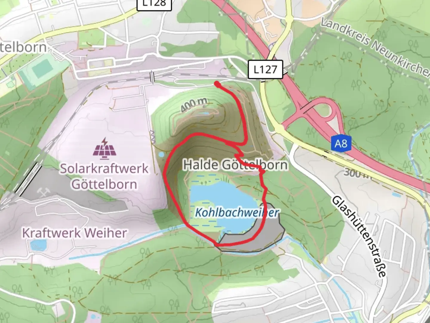
Starting near the Regionalverband Saarbrücken in Germany, the Kohlbachweiher Loop via Haldenrundweg is a delightful 3 km (1.86 miles) loop trail with an elevation gain of approximately 100 meters (328 feet). This trail is rated as medium difficulty, making it suitable for hikers with a moderate level of fitness.
Getting There
To reach the trailhead, you can drive or use public transport. If driving, set your GPS to the Regionalverband Saarbrücken area. For those using public transport, the nearest significant landmark is the Saarbrücken Hauptbahnhof (main train station). From there, you can take a local bus or taxi to the trailhead.
Trail Overview
The trail begins near the Regionalverband Saarbrücken and quickly immerses you in a serene natural environment. The loop is well-marked, but it's always a good idea to have a navigation tool like HiiKER for added assurance.
Key Landmarks and Points of Interest
- Kohlbachweiher Pond: About 1 km (0.62 miles) into the hike, you'll come across the Kohlbachweiher Pond. This is a great spot to take a break, enjoy the scenery, and perhaps spot some local wildlife like ducks and other waterfowl.
- Haldenrundweg: As you continue, you'll join the Haldenrundweg, a path that circles around the area. This section offers a mix of forested paths and open areas, providing a variety of landscapes.
- Historical Significance: The region has a rich history tied to the coal mining industry. The Haldenrundweg itself is named after the "Halden," or spoil heaps, which are remnants of the mining activities that once dominated the area. These heaps have since been reclaimed by nature, offering a unique blend of industrial history and natural beauty.
Flora and Fauna
The trail is home to a diverse range of plant and animal life. In the spring and summer, you'll find wildflowers in bloom, while the forested sections provide a habitat for various bird species. Keep an eye out for deer and other small mammals that are native to the region.
Elevation and Terrain
The trail features a moderate elevation gain of around 100 meters (328 feet), spread out over the 3 km (1.86 miles). The terrain is a mix of dirt paths and gravel, with some sections that can be a bit steep. Good hiking shoes are recommended to navigate these areas comfortably.
Practical Tips
- Weather: Check the weather forecast before you go. The trail can be muddy after rain, making some sections slippery.
- Water and Snacks: Bring enough water and some snacks, especially if you plan to take your time and enjoy the scenery.
- Navigation: While the trail is well-marked, using HiiKER can help you stay on track and provide additional information about the route.
This trail offers a perfect blend of natural beauty and historical significance, making it a rewarding experience for those who venture out to explore it.

What to expect?
Activity types
Comments and Reviews
User comments, reviews and discussions about the Kohlbachweiher Loop via Haldenrundweg, Germany.
4.57
average rating out of 5
7 rating(s)