
Download
3D Flyover
Add to list
More
9.7 km
~2 hrs 37 min
404 m
Loop
“Embark on a 10 km scenic loop from Saarbrücken, featuring lush forests, historical sites, and wildlife.”
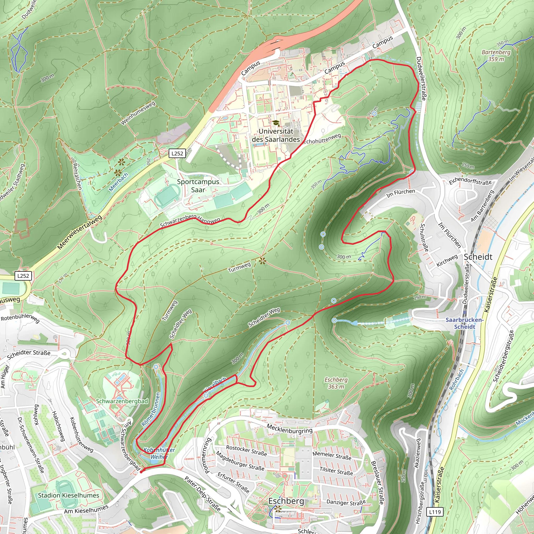
Starting your adventure near the Regionalverband Saarbrücken in Germany, the Kobenhütter Weiher and Schwarzenberg Loop is a captivating 10 km (6.2 miles) trail with an elevation gain of approximately 400 meters (1,312 feet). This loop trail is rated as medium difficulty, making it suitable for moderately experienced hikers.
Getting There
To reach the trailhead, you can drive or use public transport. If driving, set your GPS to the Regionalverband Saarbrücken area. For those using public transport, take a train or bus to Saarbrücken Hauptbahnhof. From there, local buses can take you closer to the trailhead. The nearest significant landmark to the starting point is the Saarbrücken Zoo, which is a short distance away.
Trail Overview
The trail begins with a gentle ascent through lush forests, offering a serene start to your hike. As you progress, the path becomes steeper, leading you to the first significant landmark, the Kobenhütter Weiher, a picturesque pond surrounded by dense woodland. This is an excellent spot for a short break and some nature photography.
Historical Significance
The region around Saarbrücken has a rich history, with roots tracing back to Roman times. As you hike, you'll notice remnants of old structures and possibly even ancient Roman roads. The Schwarzenberg area, in particular, has historical significance, having been a strategic location during various periods of conflict.
Wildlife and Flora
The trail is abundant with diverse flora and fauna. Keep an eye out for deer, wild boar, and various bird species. The forested areas are home to oak, beech, and pine trees, providing a beautiful canopy that changes with the seasons. In spring and summer, wildflowers add vibrant colors to the landscape.
Navigation and Waypoints
Using HiiKER for navigation is highly recommended. The app provides detailed maps and waypoints, ensuring you stay on track. Key waypoints include: - Kobenhütter Weiher (approximately 3 km or 1.86 miles from the start) - Schwarzenberg (around 6 km or 3.73 miles into the hike) - Return to Trailhead (completing the loop at 10 km or 6.2 miles)
Elevation Profile
The trail's elevation gain is gradual but steady. The initial ascent to Kobenhütter Weiher is about 150 meters (492 feet) over 3 km (1.86 miles). The climb to Schwarzenberg adds another 250 meters (820 feet) over the next 3 km (1.86 miles). The descent back to the trailhead is more gradual, allowing for a comfortable end to your hike.
Points of Interest
- Kobenhütter Weiher: A serene pond perfect for a mid-hike break.
- Schwarzenberg: Offers panoramic views of the surrounding region.
- Historical Sites: Look out for ancient Roman road remnants and old structures.
Final Stretch
The final stretch of the trail takes you through a mix of forest and open meadows, gradually descending back to the starting point. This section is less strenuous, allowing you to enjoy the natural beauty and reflect on the hike.
Prepare adequately with water, snacks, and appropriate hiking gear. The trail is well-marked, but having HiiKER for navigation will enhance your experience and ensure you make the most of this beautiful loop trail.
What to expect?
Activity types
Comments and Reviews
User comments, reviews and discussions about the Kobenhütter Weiher and Schwarzenberg Loop, Germany.
4.5
average rating out of 5
2 rating(s)
