Download
Preview
Add to list
More
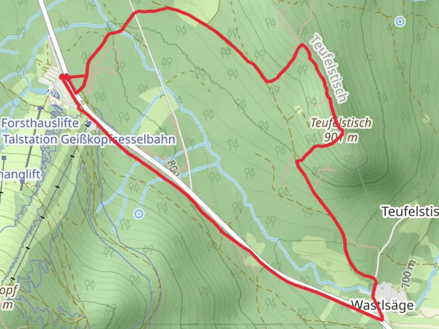
6.7 km
~1 hrs 40 min
210 m
Loop
“Embark on a scenic 7 km hike through Bavaria's historical and enchanting Teufelstisch via Bischofsmais trail.”
Starting your adventure near the charming town of Regen, Germany, the Teufelstisch via Bischofsmais trail offers a delightful 7 km (4.3 miles) loop with an elevation gain of approximately 200 meters (656 feet). This medium-difficulty trail is perfect for those looking to immerse themselves in the natural beauty and historical richness of the Bavarian Forest.
Getting There
To reach the trailhead, you can either drive or use public transport. If driving, set your GPS to Regen, Germany, and follow the signs to the trailhead near the town. For those using public transport, take a train to Regen station. From there, local buses or a short taxi ride will get you to the starting point.
Trail Overview
The trail begins with a gentle ascent through dense, mixed forests, offering a serene atmosphere filled with the sounds of rustling leaves and chirping birds. As you progress, the path becomes steeper, leading you to the first significant landmark, the Teufelstisch, or "Devil's Table." This unique rock formation, resembling a table, is steeped in local folklore and offers a fantastic spot for a break and some photos.
Flora and Fauna
The Bavarian Forest is known for its rich biodiversity. Along the trail, you'll encounter a variety of plant species, including beech, spruce, and fir trees. Keep an eye out for wildlife such as deer, foxes, and a variety of bird species. The forest floor is often carpeted with moss and ferns, adding to the enchanting atmosphere.
Historical Significance
The region around Regen has a deep historical significance. The trail itself passes through areas that were once part of ancient trade routes. The Teufelstisch rock formation has been a subject of local legends for centuries, believed to be a place where the devil himself would rest. This adds a layer of mystique to your hike, making it not just a physical journey but a historical one as well.
Navigation
For navigation, it's highly recommended to use HiiKER. The app provides detailed maps and real-time updates, ensuring you stay on the right path. The trail is well-marked, but having a reliable navigation tool can enhance your hiking experience.
Points of Interest
- Teufelstisch (Devil's Table): Located about 3 km (1.9 miles) into the hike, this rock formation is a must-see.
- Panoramic Views: As you reach higher elevations, you'll be rewarded with stunning views of the Bavarian Forest and the surrounding valleys.
- Bischofsmais: This quaint village is a great place to explore either before or after your hike. It offers traditional Bavarian architecture and local eateries.
Final Stretch
The trail loops back towards Regen, descending gradually through the forest. This part of the hike is less strenuous, allowing you to enjoy the natural beauty at a more relaxed pace. The entire loop takes around 2-3 hours to complete, depending on your pace and how often you stop to take in the sights.
Prepare well, bring enough water, and wear appropriate hiking boots. The Teufelstisch via Bischofsmais trail offers a perfect blend of natural beauty, historical intrigue, and moderate physical challenge, making it a rewarding experience for any hiker.

What to expect?
Activity types
Comments and Reviews
User comments, reviews and discussions about the Teufelstisch via Bischofsmais, Germany.
5.0
average rating out of 5
1 rating(s)