
Download
3D Flyover
Add to list
More
14.4 km
~4 hrs
674 m
Loop
“Embark on a scenic, challenging hike through lush forests, historical landmarks, and breathtaking Bavarian views.”
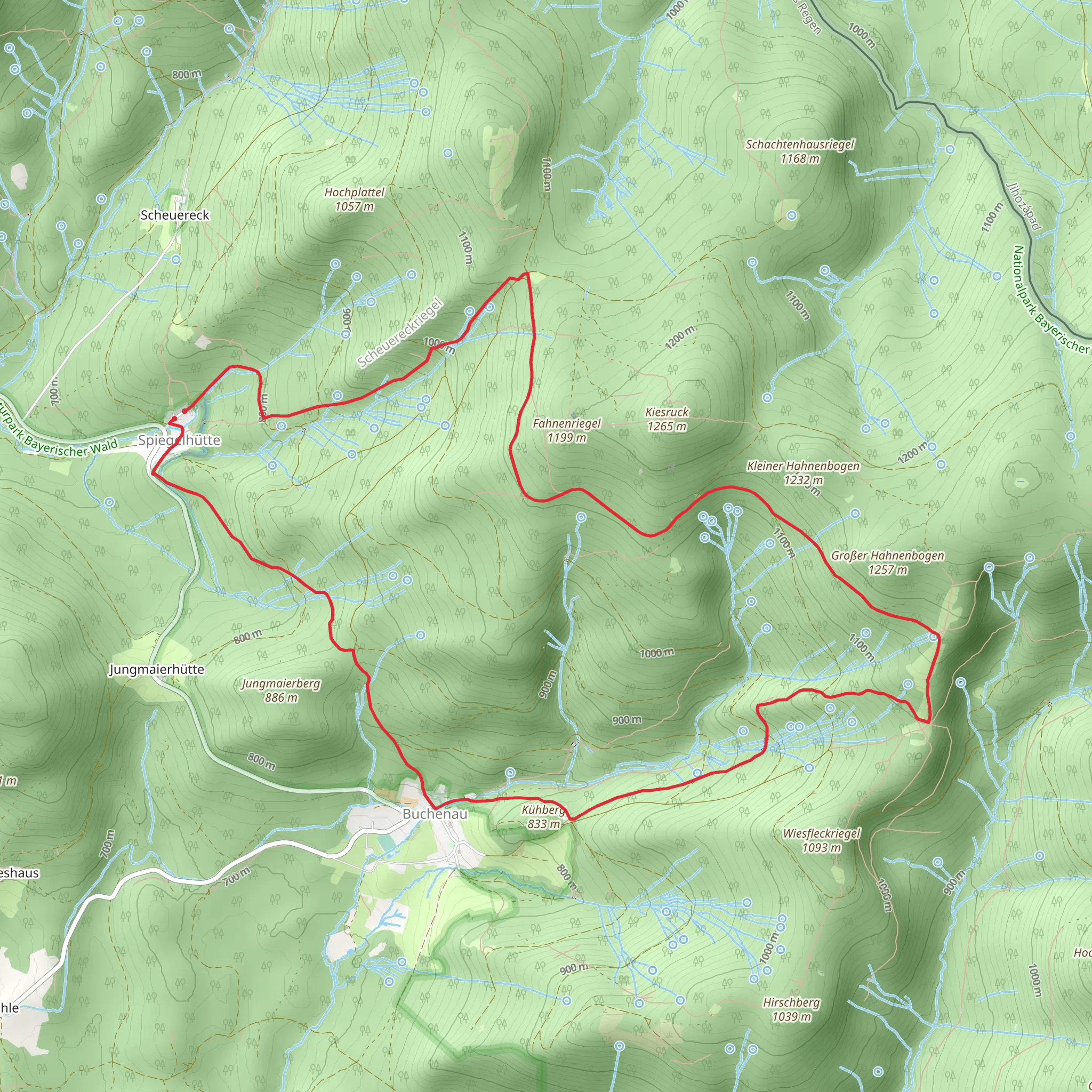
Nestled in the scenic Bavarian Forest, the Sauerklee and Kreuzpinne Loop offers a challenging yet rewarding hiking experience. This 14 km (approximately 8.7 miles) loop trail begins near the charming town of Regen, Germany, and is known for its diverse landscapes and rich history. With an elevation gain of around 600 meters (approximately 1,970 feet), hikers should be prepared for a demanding trek that promises breathtaking views and encounters with nature.
Getting There
To reach the trailhead, travelers can opt for public transport or drive. If you're using public transport, Regen is accessible via regional trains from major cities like Munich. From the Regen train station, local buses or taxis can take you closer to the trailhead. For those driving, Regen is well-connected by road, and parking is available near the trail's starting point.
Trail Highlights
Diverse Landscapes
The trail meanders through a variety of terrains, including dense forests, open meadows, and rocky outcrops. As you ascend, the lush greenery of the Bavarian Forest envelops you, offering a serene escape from urban life. The trail's elevation gain provides opportunities to witness panoramic views of the surrounding valleys and distant mountain ranges.
Flora and Fauna
The Bavarian Forest is home to a rich array of wildlife. Keep an eye out for deer, foxes, and a variety of bird species that inhabit the area. The forest floor is often carpeted with wildflowers, including the trail's namesake, the Sauerklee (wood sorrel), which adds a splash of color to the verdant landscape.
Historical Significance
The region around Regen has a storied past, with roots tracing back to medieval times. As you hike, you'll pass by remnants of ancient settlements and historical landmarks that tell the tale of the area's cultural heritage. The Kreuzpinne, a notable point on the trail, is steeped in local folklore and offers a glimpse into the region's past.
Navigation and Safety
Given the trail's difficulty rating, it's crucial to be well-prepared. The path can be steep and uneven in places, so sturdy hiking boots are recommended. Weather conditions can change rapidly, so pack layers and rain gear. For navigation, the HiiKER app is an invaluable tool, providing detailed maps and real-time updates to ensure you stay on track.
Points of Interest
Kreuzpinne Summit: Approximately halfway through the loop, this summit offers a rewarding vantage point with sweeping views of the Bavarian landscape. It's an ideal spot for a rest and a picnic.
Forest Streams: Along the trail, you'll encounter several babbling brooks and streams. These natural water features provide a refreshing backdrop and are perfect for a quick break to enjoy the tranquility of the forest.
Embarking on the Sauerklee and Kreuzpinne Loop is a journey through nature and history, offering a challenging yet fulfilling adventure for seasoned hikers.
Comments and Reviews
User comments, reviews and discussions about the Sauerklee and Kreuzpinne Loop, Germany.
average rating out of 5
0 rating(s)
