Download
Preview
Add to list
More
7.3 km
~2 hrs 11 min
442 m
Loop
“The Bodenmais Loop, a 7 km scenic trail in Germany, offers moderate hiking with waterfalls and panoramic views.”
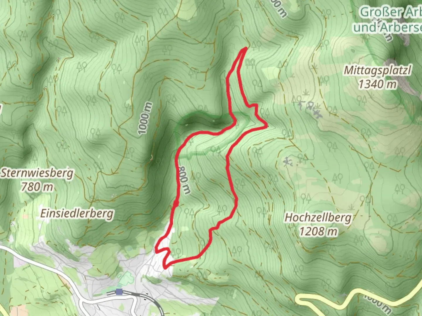
Starting near the charming town of Regen in Germany, the Bodenmais Loop is a delightful 7 km (4.35 miles) trail with an elevation gain of approximately 400 meters (1,312 feet). This loop trail is rated as medium difficulty, making it suitable for moderately experienced hikers looking for a rewarding day hike.
Getting There
To reach the trailhead, you can either drive or use public transport. If driving, head towards Bodenmais, a well-known town in the Bavarian Forest. There are several parking options available near the trailhead. For those using public transport, take a train to the Regen station. From there, local buses or taxis can take you to Bodenmais, where the trail begins.
Trail Overview
The Bodenmais Loop offers a mix of dense forests, open meadows, and panoramic views of the Bavarian Forest. The trail is well-marked, but it's always a good idea to have a reliable navigation tool like HiiKER to ensure you stay on track.
Key Landmarks and Sections
Start to Rißloch Waterfalls
The first section of the trail takes you through a lush forest, gradually ascending towards the Rißloch Waterfalls. This part of the hike is about 2 km (1.24 miles) with an elevation gain of around 150 meters (492 feet). The waterfalls are a significant highlight, cascading down rocky cliffs and creating a serene atmosphere. Take a moment to enjoy the sight and sound of the water before continuing your hike.
Rißloch Waterfalls to Hochzellberg
From the waterfalls, the trail continues to climb towards Hochzellberg, the highest point of the loop. This section is approximately 3 km (1.86 miles) with an elevation gain of 200 meters (656 feet). As you ascend, the forest opens up to offer stunning views of the surrounding landscape. On clear days, you can see as far as the Czech border. This is a great spot for a break and some photos.
Hochzellberg to Bodenmais
The final section of the trail descends back towards Bodenmais. This 2 km (1.24 miles) stretch is relatively easier, with a gentle descent of about 50 meters (164 feet). The path winds through picturesque meadows and small streams, offering a peaceful end to your hike.
Nature and Wildlife
The Bodenmais Loop is rich in biodiversity. Keep an eye out for various bird species, deer, and even the occasional fox. The flora is equally impressive, with a mix of deciduous and coniferous trees, wildflowers, and moss-covered rocks adding to the trail's natural beauty.
Historical Significance
The region around Bodenmais has a rich history, particularly in glassmaking. The town itself is known for its glassblowing workshops, which have been a part of the local culture for centuries. As you hike, you might come across old glassworks or remnants of historical buildings, adding an extra layer of interest to your journey.
Preparation Tips
Given the medium difficulty rating, it's advisable to wear sturdy hiking boots and bring plenty of water. The trail can be muddy in places, especially after rain, so be prepared for varying trail conditions. A light snack or packed lunch is also recommended, especially if you plan to take breaks at the waterfalls or the summit.
Whether you're a seasoned hiker or someone looking to explore the Bavarian Forest, the Bodenmais Loop offers a perfect blend of natural beauty, moderate challenge, and historical intrigue.

What to expect?
Activity types
Comments and Reviews
User comments, reviews and discussions about the NSG Rießloch Loop, Germany.
4.45
average rating out of 5
11 rating(s)