
Download
3D Flyover
Add to list
More
8.1 km
~2 hrs 24 min
464 m
Point to Point
“Embark on a scenic, moderately challenging 8-kilometer hike through Bavaria's lush forests and historic high-altitude pastures.”
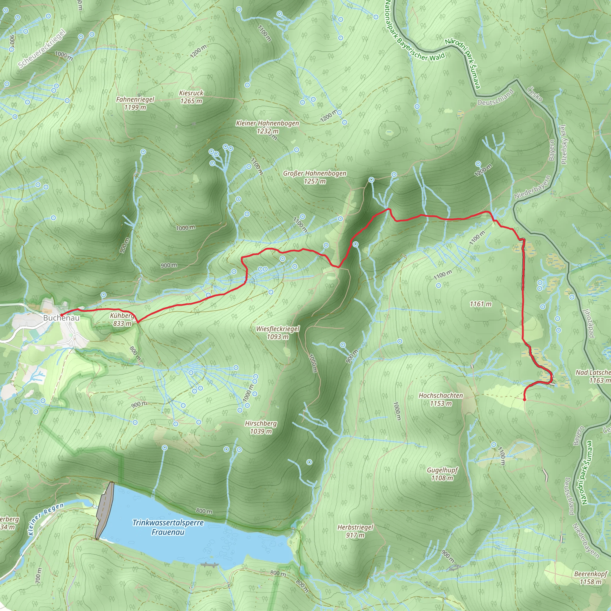
Starting near the charming town of Regen in Germany, the Buchenau to Hochschachten via Pestwurz trail offers an invigorating hike through the Bavarian Forest. This point-to-point trail spans approximately 8 kilometers (around 5 miles) with an elevation gain of about 400 meters (1,312 feet), making it a moderately challenging route suitable for hikers with some experience.
Getting There
To reach the trailhead, you can either drive or use public transportation. If you're driving, head towards Regen and look for parking options near the Buchenau area. For those relying on public transport, take a train to Regen station. From there, local buses or taxis can take you to the trailhead near Buchenau.
Trail Overview
The trail begins in the picturesque village of Buchenau, nestled in the Bavarian Forest. As you set off, you'll find yourself surrounded by dense woodlands, a hallmark of this region. The initial part of the trail is relatively gentle, allowing you to ease into the hike while enjoying the serene forest atmosphere.
Flora and Fauna
As you progress, the trail becomes steeper, and the forest canopy thickens. This area is rich in biodiversity, so keep an eye out for various species of birds, deer, and perhaps even the elusive lynx. The forest floor is often carpeted with ferns and wildflowers, including the trail's namesake, Pestwurz (Butterbur), which blooms in early spring.
Significant Landmarks
Around the 4-kilometer (2.5-mile) mark, you'll come across a small clearing known as Pestwurz Meadow. This is a great spot to take a break and soak in the natural beauty. The meadow is named after the Butterbur plant, which was historically used for medicinal purposes.
Continuing on, the trail ascends more steeply as you approach Hochschachten. This area is known for its "Schachten," or high-altitude pastures, which were historically used for summer grazing. These open spaces offer stunning panoramic views of the surrounding forest and distant mountains.
Historical Significance
The region has a rich history, particularly related to its use for grazing and forestry. The "Schachten" pastures are a testament to the traditional agricultural practices of the Bavarian Forest. These high-altitude meadows were essential for local farmers, who would bring their cattle here during the summer months.
Navigation and Safety
Given the moderate difficulty of the trail, it's advisable to use a reliable navigation tool like HiiKER to keep track of your progress and ensure you stay on the right path. The trail is well-marked, but having a digital map can provide extra peace of mind.
Final Stretch
As you near the end of the trail, the descent into Hochschachten offers a gentle relief from the earlier climbs. The trail concludes in the high-altitude pastures, where you can take a moment to appreciate the expansive views and reflect on the journey.
This hike through the Bavarian Forest is a rewarding experience, offering a mix of natural beauty, historical significance, and moderate physical challenge. Whether you're a seasoned hiker or looking to step up your hiking game, this trail provides a memorable adventure.
What to expect?
Activity types
Comments and Reviews
User comments, reviews and discussions about the Buchenau to Hochschachten via Pestwurz, Germany.
4.67
average rating out of 5
3 rating(s)
