Download
3D Flyover
Add to list
More
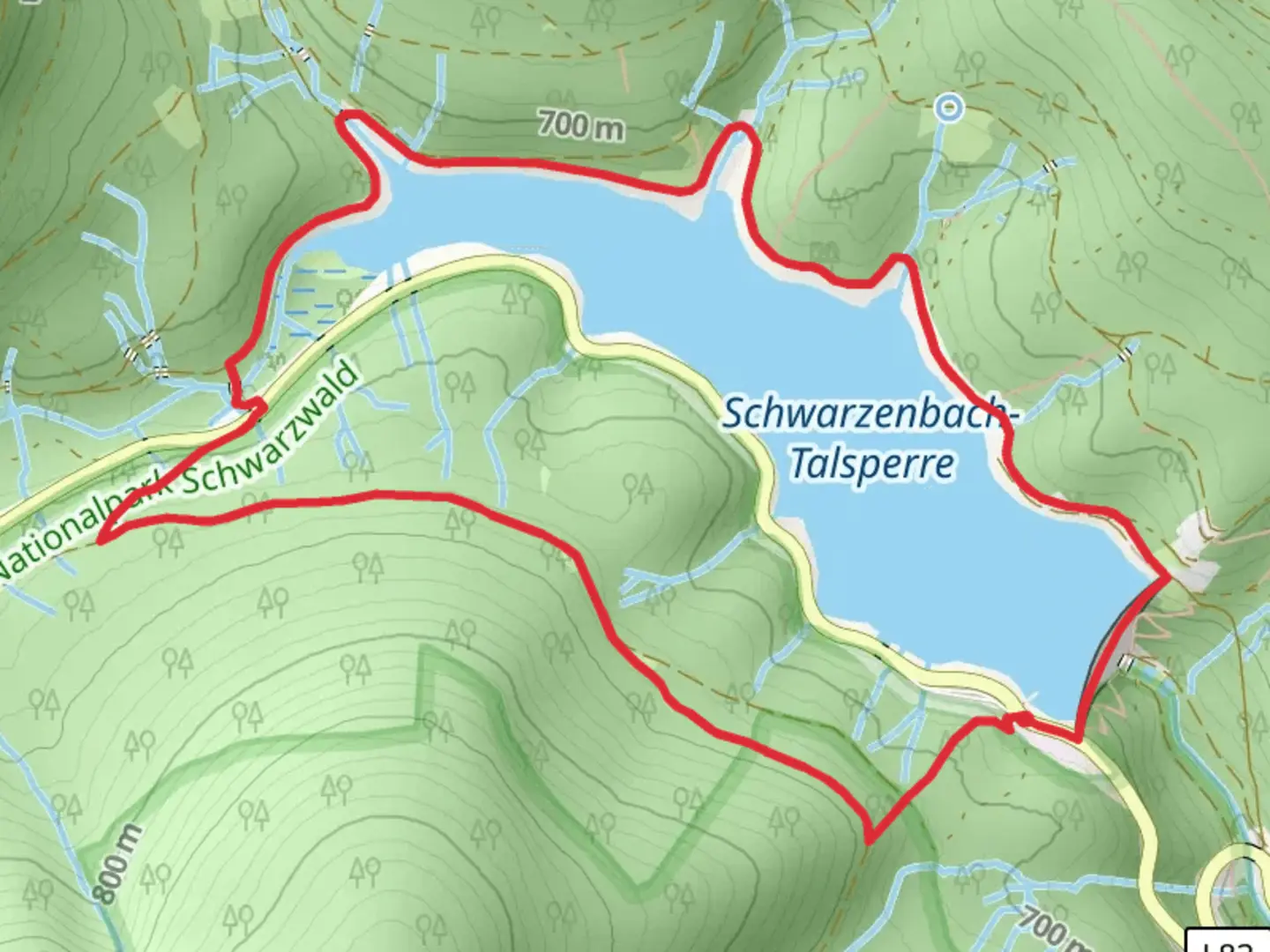
6.5 km
~1 hrs 39 min
217 m
Loop
“Explore the scenic Schwarzenbach-Talsperre Loop: a 6 km hike of natural beauty, moderate challenge, and history.”
Starting near the town of Rastatt, Germany, the Schwarzenbach - Talsperre Loop is a captivating 6 km (approximately 3.7 miles) trail with an elevation gain of around 200 meters (656 feet). This loop trail is rated as medium difficulty, making it suitable for moderately experienced hikers.
Getting There
To reach the trailhead, you can either drive or use public transport. If you're driving, set your GPS to the Schwarzenbach Dam, which is a well-known landmark in the area. For those using public transport, take a train to Rastatt and then a local bus towards the Schwarzenbach Dam. The nearest bus stop is conveniently located just a short walk from the trailhead.
Trail Overview
The trail begins near the Schwarzenbach Dam, a significant landmark that dates back to the early 20th century. The dam itself is an engineering marvel and provides a picturesque starting point for your hike. As you set off, you'll be greeted by the serene waters of the Schwarzenbach Reservoir, which offers stunning reflections of the surrounding Black Forest.
Key Landmarks and Nature
At approximately 1 km (0.6 miles) into the hike, you'll encounter the first significant viewpoint. Here, you can take a moment to enjoy panoramic views of the reservoir and the dense forest that envelops it. The trail continues to wind through a mix of coniferous and deciduous trees, offering a rich tapestry of flora and fauna. Keep an eye out for local wildlife such as deer, foxes, and a variety of bird species.
Elevation and Terrain
As you progress, the trail begins to ascend gradually. By the time you reach the 3 km (1.8 miles) mark, you'll have gained a significant portion of the 200 meters (656 feet) in elevation. The terrain varies from well-trodden paths to rocky sections, so sturdy hiking boots are recommended. The ascent is steady but manageable, providing ample opportunities to pause and take in the natural beauty around you.
Historical Significance
Around the halfway point, you'll come across remnants of historical significance. The area around the Schwarzenbach Dam has a rich history, particularly related to its construction during the early 20th century. Informational plaques along the trail provide insights into the dam's construction and its role in the region's development.
Navigation
For navigation, it's advisable to use the HiiKER app, which offers detailed maps and real-time updates. The trail is well-marked, but having a reliable navigation tool can enhance your hiking experience and ensure you stay on the right path.
Final Stretch
As you near the end of the loop, the trail descends gently back towards the reservoir. The final 1 km (0.6 miles) offers a leisurely walk along the water's edge, providing a peaceful conclusion to your hike. The loop brings you back to the starting point near the Schwarzenbach Dam, where you can relax and perhaps enjoy a picnic by the water.
This trail offers a perfect blend of natural beauty, moderate physical challenge, and historical intrigue, making it a rewarding experience for any hiker.

What to expect?
Activity types
Comments and Reviews
User comments, reviews and discussions about the Schwarzenbach - Talsperre Loop, Germany.
4.4
average rating out of 5
5 rating(s)