Download
3D Flyover
Add to list
More
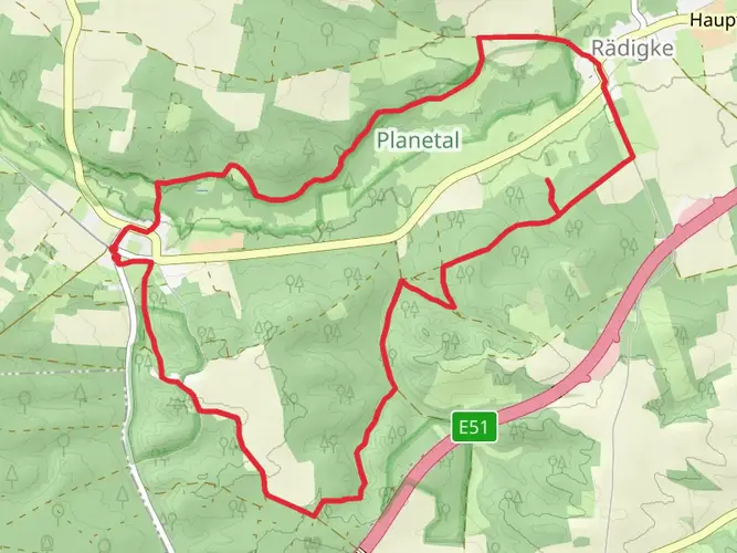
136.3 km
~5 days
1007 m
Multi-Day
“Traverse the historic and scenic Burgenwanderweg loop for a moderate trek through Germany's castles and countryside.”
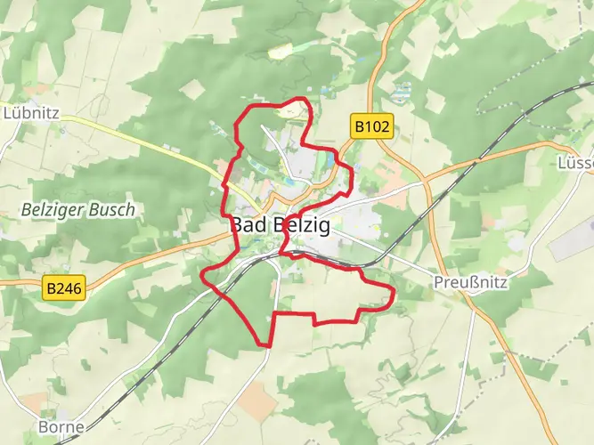
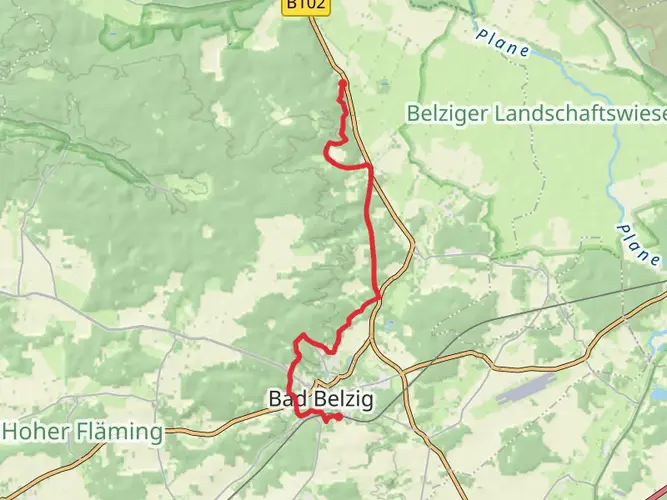
Embarking on the Burgenwanderweg, hikers will traverse approximately 136 kilometers (about 85 miles) of diverse landscapes, with an elevation gain of around 1000 meters (approximately 3280 feet). This loop trail, nestled near Potsdam-Mittelmark in Germany, offers a medium difficulty rating, making it accessible to hikers with a reasonable level of fitness.
Getting to the Trailhead
The starting point of the Burgenwanderweg is conveniently accessible from Berlin by public transport. Hikers can take a regional train to the town of Bad Belzig, which is the nearest significant landmark to the trailhead. From there, local buses or a short taxi ride can bring adventurers to the starting point. For those driving, parking is available in the area, and since the trail is a loop, your journey will conclude where it began, simplifying the return to your vehicle.
Navigating the Trail
Hikers can rely on HiiKER for detailed maps and navigation tools to guide them along the Burgenwanderweg. The trail is well-marked, but having a digital tool can provide additional peace of mind and ensure you stay on the correct path.
Historical Significance and Landmarks
The Burgenwanderweg, or Castle Hiking Trail, is steeped in history, winding through the scenic landscapes of Brandenburg. As the name suggests, the trail offers numerous encounters with historical fortresses, castles, and ruins. One of the highlights is the Eisenhardt Castle in Bad Belzig, a well-preserved medieval fortress that provides a glimpse into the region's past.
Natural Beauty and Wildlife
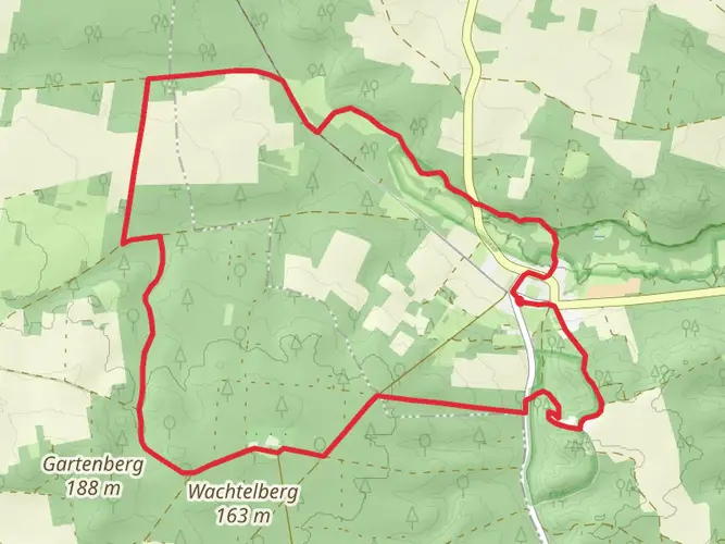
The trail meanders through a variety of terrains, including dense forests, open fields, and rolling hills, offering hikers a chance to experience the natural beauty of the region. The flora and fauna are typical of the Brandenburg area, with the possibility of spotting deer, various bird species, and a plethora of plant life, especially during the spring and summer months when the landscape is in full bloom.
What to Expect on the Trail
The Burgenwanderweg is a journey of moderate difficulty, with some sections requiring a bit more exertion due to elevation changes. The trail can be completed in sections for those who prefer shorter hikes or tackled in its entirety over several days for a more immersive experience. There are designated rest areas and shelters along the route, allowing for breaks and overnight stays.
Preparation and Planning
Before setting out, hikers should ensure they have adequate supplies, including water, food, and appropriate clothing for changing weather conditions. It's also wise to check the forecast and plan for any necessary gear, such as rain protection or additional layers for cooler temperatures. Given the trail's length, it's recommended to carry a first aid kit and a means of communication in case of emergencies.
Conclusion
With its rich history, natural beauty, and well-marked paths, the Burgenwanderweg offers an enriching hiking experience for those looking to explore the heart of Germany's countryside. Whether you're a history buff, nature lover, or simply seeking a long-distance hiking challenge, this trail promises a rewarding adventure through the landscapes of Brandenburg.

Frequently asked questions
How long does the Burgenwanderweg in Brandenburg take to hike?
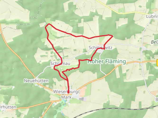
The Burgenwanderweg is 136.29 km long in HiiKER and is best treated as a multi-day route. A common planning pace for a trail of this length is about 5 to 8 days, depending on daily mileage, lodging stops, and how much time is spent at places like Burg Eisenhardt in Bad Belzig, Burg Rabenstein, Schloss Wiesenburg, and Ziesar.
Where does the Burgenwanderweg start and finish in Hoher Fläming?
The Burgenwanderweg is a loop in Potsdam-Mittelmark, so it finishes back near where it begins. Bad Belzig is the usual gateway and one of the best-known starting points, with the route circling through the Hoher Fläming region before returning to the Bad Belzig area.
What castles and landmarks are on the Burgenwanderweg in Brandenburg?
The signature sights on the Burgenwanderweg are the four Fläming castle sites: Burg Eisenhardt in Bad Belzig, Burg Rabenstein near Raben, Schloss Wiesenburg, and the former bishop’s residence at Ziesar. The route also passes through the Naturpark Hoher Fläming, with stretches of pine forest, dry valleys, boulder fields, and villages such as Görzke and Raben.
Can the Burgenwanderweg be hiked in stages in Hoher Fläming?
Yes. The Burgenwanderweg is a multi-day trail and is commonly broken into stages between towns and castle stops in Hoher Fläming. Natural stage hubs include Bad Belzig, Raben or Burg Rabenstein, Wiesenburg, Görzke, and Ziesar, which helps divide the full 136.29 km into manageable daily sections.
Is the Burgenwanderweg a difficult hike?
The Burgenwanderweg is rated medium difficulty, with 1007 m of total elevation gain spread across 136.29 km. That usually means the challenge comes more from the route’s length and multi-day commitment than from steep mountain terrain, although repeated rolling climbs in the Hoher Fläming still require solid day-hiking fitness.
How do you get to the Burgenwanderweg from Berlin by public transport?
Bad Belzig is the most practical rail access point from Berlin and is regularly used as the main trail gateway. Regional trains on the RE7 line connect Berlin with Bad Belzig, and Wiesenburg/Mark is also a recognized access station for the wider Burgenwanderweg area in Hoher Fläming.
Is there accommodation along the Burgenwanderweg in Fläming?
Yes. Because the Burgenwanderweg passes through established towns and villages rather than remote alpine terrain, overnight stops are usually planned in places such as Bad Belzig, Wiesenburg/Mark, Rabenstein/Fläming, Görzke, and Ziesar. That makes it realistic to organize the route as a hut-free inn-to-inn or guesthouse-style multi-day hike.
Comments and Reviews
User comments, reviews and discussions about the Burgenwanderweg, Germany.
4.4
average rating out of 5
5 rating(s)