Download
Preview
Add to list
More
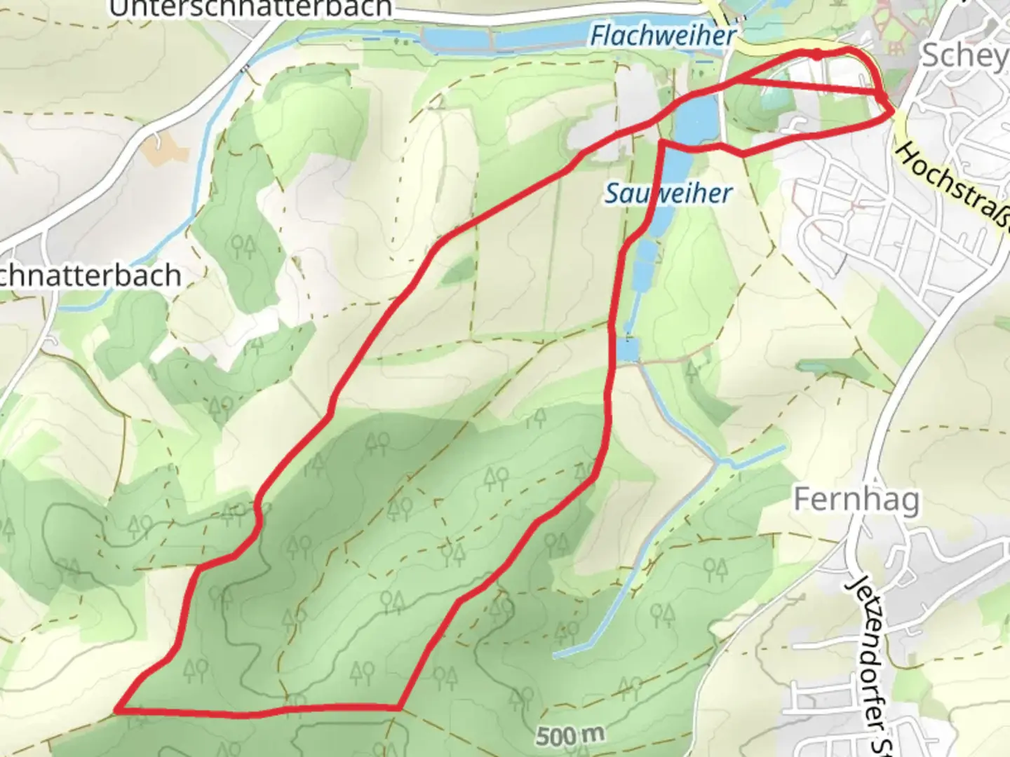
6.0 km
~1 hrs 25 min
134 m
Point-to-Point
“Discover the enchanting Bavarian trail, weaving through lush landscapes, serene ponds, and historic wonders.”
Nestled in the picturesque Bavarian countryside, the Ledererweiher and Sauweiher via Benediktenweg trail offers a delightful journey through lush landscapes and serene water bodies. This 6 km (approximately 3.7 miles) point-to-point trail begins near the charming town of Pfaffenhofen an der Ilm, Germany, and is rated as medium difficulty, making it suitable for hikers with some experience.
Getting There
To reach the trailhead, you can drive to Pfaffenhofen an der Ilm, which is conveniently located about 50 km (31 miles) north of Munich. If you prefer public transport, take a train from Munich to Pfaffenhofen an der Ilm station. From there, local buses or a short taxi ride will bring you to the starting point of the trail.
Trail Highlights
As you embark on this journey, you'll traverse a landscape rich in natural beauty and historical significance. The trail meanders through dense forests and open meadows, offering a peaceful escape from urban life. The elevation gain is around 100 meters (approximately 328 feet), providing a gentle challenge as you ascend and descend through the rolling terrain.
Ledererweiher and Sauweiher
The trail's namesake, Ledererweiher and Sauweiher, are two tranquil ponds that serve as focal points along the route. These serene water bodies are perfect spots for a short rest or a picnic, where you can enjoy the reflections of the surrounding trees on the water's surface. Keep an eye out for local wildlife, including various bird species and small mammals that inhabit the area.
Historical Significance
The region around Pfaffenhofen an der Ilm is steeped in history, with roots tracing back to medieval times. As you hike, you'll pass through areas that have been shaped by centuries of human activity, from ancient agricultural practices to more recent developments. The Benediktenweg itself is named after the Benedictine monks who once played a significant role in the region's cultural and spiritual life.
Navigation and Safety
For navigation, it's recommended to use the HiiKER app, which provides detailed maps and real-time updates to ensure you stay on track. The trail is well-marked, but having a reliable navigation tool can enhance your hiking experience and provide peace of mind.
Flora and Fauna
The trail is a haven for nature enthusiasts, with a diverse array of flora and fauna. Depending on the season, you might encounter wildflowers, mushrooms, and a variety of tree species, including oak and beech. The forested sections offer a cool respite during warmer months, while the open meadows provide expansive views of the Bavarian landscape.
Final Preparations
Before setting out, ensure you have adequate water, snacks, and appropriate footwear for the terrain. Weather conditions can change rapidly, so it's wise to check the forecast and dress in layers. With its blend of natural beauty and historical intrigue, the Ledererweiher and Sauweiher via Benediktenweg trail promises a rewarding adventure for those who venture along its path.

What to expect?
Activity types
Comments and Reviews
User comments, reviews and discussions about the Ledererweiher and Sauweiher via Benediktenweg, Germany.
average rating out of 5
0 rating(s)