Download
3D Flyover
Add to list
More
8.0 km
~2 hrs 7 min
307 m
Loop
“Explore the Trauchgau Loop for stunning alpine views, historic sites, and diverse wildlife in Ostallgäu.”
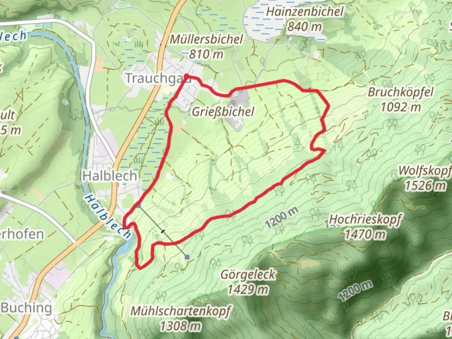
Starting near the picturesque village of Ostallgäu in Germany, the Trauchgau Loop is an 8 km (approximately 5 miles) trail with an elevation gain of around 300 meters (about 984 feet). This loop trail is rated as medium difficulty, making it suitable for moderately experienced hikers.
Getting There
To reach the trailhead, you can drive or use public transport. If driving, set your GPS to Ostallgäu, Germany, and look for parking near the village center. For those using public transport, take a train to Füssen, which is the nearest major town. From Füssen, you can catch a local bus to Trauchgau. The bus stop is conveniently located near the trailhead.
Trail Navigation
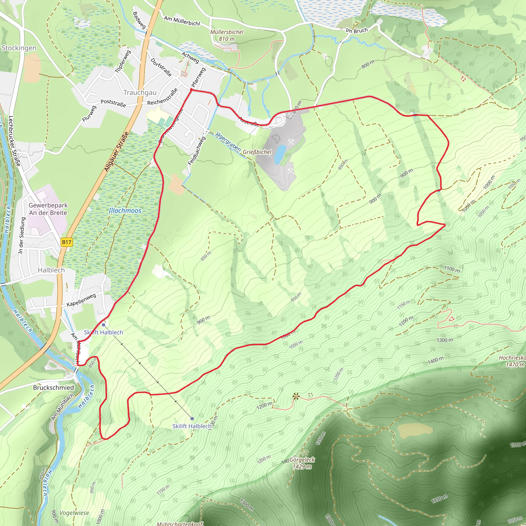
For navigation, it is highly recommended to use HiiKER, which provides detailed maps and real-time updates. The trail is well-marked, but having a reliable navigation tool will enhance your hiking experience.
Trail Description
The trail begins with a gentle ascent through lush meadows and fields, offering panoramic views of the surrounding Bavarian Alps. After about 1 km (0.6 miles), you will enter a dense forest. The forest section is serene, with the sounds of birds and rustling leaves accompanying you. This part of the trail is relatively flat, making it a good warm-up for the more challenging sections ahead.
Significant Landmarks
At around the 3 km (1.9 miles) mark, you will come across the historic Trauchgau Chapel. This quaint chapel dates back to the 18th century and is a perfect spot for a short break and some photographs. The chapel is surrounded by ancient oak trees, adding to its charm.
Continuing on, the trail begins to climb more steeply. The next 2 km (1.2 miles) will take you through a series of switchbacks, gaining most of the trail's elevation. As you ascend, keep an eye out for the diverse flora, including wildflowers in the spring and summer months. You might also spot some local wildlife, such as deer or foxes.
Scenic Views
Upon reaching the highest point of the trail, approximately 5 km (3.1 miles) in, you will be rewarded with stunning views of the Allgäu Alps and the surrounding valleys. This is an excellent spot to rest, have a snack, and take in the breathtaking scenery.
Descent and Return
The descent begins gradually, winding through more forested areas. Around the 6.5 km (4 miles) mark, you will pass by a small, crystal-clear stream. This is another great spot to pause and enjoy the natural beauty of the area. The final stretch of the trail takes you back through open meadows, eventually leading you back to the trailhead near Ostallgäu.
Historical Significance
The region around Ostallgäu is steeped in history. The nearby Neuschwanstein Castle, built by King Ludwig II, is one of the most famous landmarks in Germany and is just a short drive from the trailhead. The area has a rich cultural heritage, with many traditional Bavarian villages and historic sites to explore.
Wildlife and Nature
The Trauchgau Loop offers a diverse range of natural habitats. From alpine meadows to dense forests, the trail is home to a variety of wildlife. Birdwatchers will enjoy spotting species such as the European robin and the black woodpecker. The flora is equally diverse, with seasonal wildflowers adding bursts of color to the landscape.
This trail provides a perfect blend of natural beauty, historical landmarks, and moderate physical challenge, making it a must-visit for hikers in the region.
What to expect?
Activity types
Comments and Reviews
User comments, reviews and discussions about the Trauchgau Loop, Germany.
4.5
average rating out of 5
2 rating(s)
