Download
Preview
Add to list
More
2.7 km
~1 hrs 1 min
292 m
Out and Back
“Climbing Tegelberg’s rugged heights, breathtaking vistas and royal echoes reward every step on this dramatic trail.”
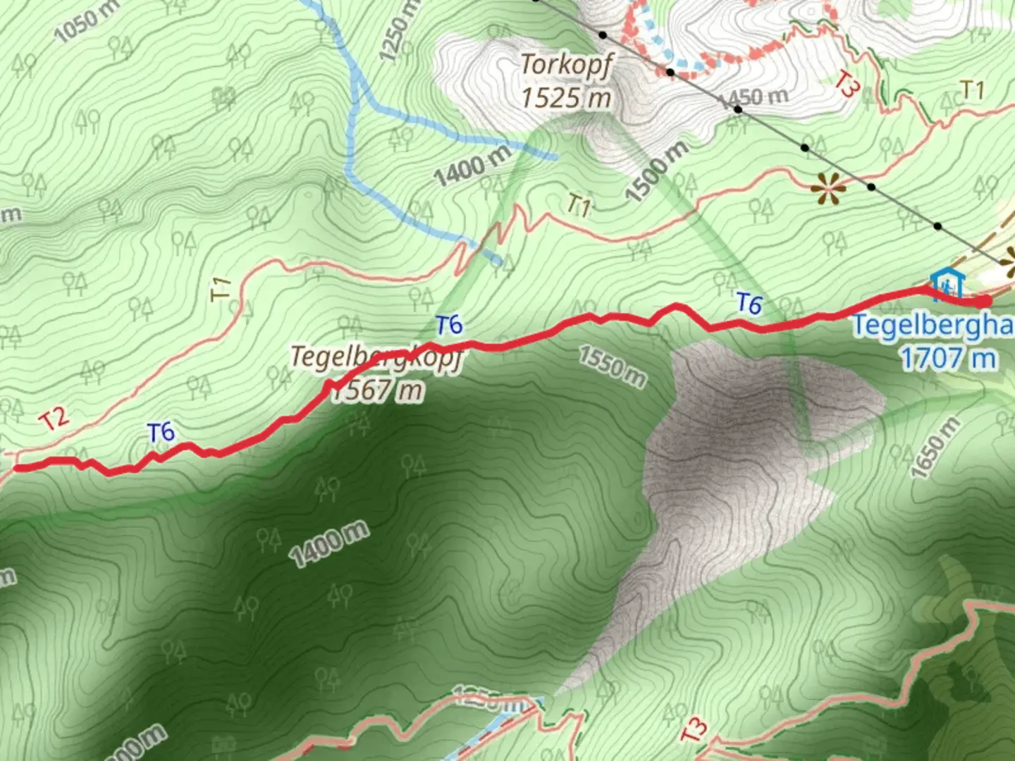
Starting from the vicinity of the Tegelbergbahn Talstation near Schwangau in Ostallgäu, Germany, this out-and-back route covers approximately 3 km (1.9 miles) with a challenging ascent of about 300 meters (984 feet). The trailhead is easily accessible by car, with ample parking available at the Tegelbergbahn cable car station. For those using public transport, regional buses from Füssen train station stop directly at Tegelbergbahn, making it a convenient option for travelers.
Initial Ascent and Terrain
The route begins at the base of the Tegelberg, a mountain renowned for its dramatic limestone cliffs and panoramic views over the Allgäu Alps. The first section quickly introduces hikers to steep, rocky paths interspersed with exposed roots and occasional loose scree. The gradient intensifies within the first 0.5 km (0.3 miles), demanding careful footing and a steady pace. This trail is rated Extra Difficult, so expect sections that require both hands for balance and occasional scrambling, especially after rainfall when rocks can become slick.
Landmarks and Natural Features
At around 1 km (0.6 miles), the trail skirts beneath the imposing Tegelberg cliffs, offering glimpses of the famous Neuschwanstein Castle in the valley below—a highlight for many hikers. The area is rich in alpine flora, with wildflowers such as gentians and alpine roses blooming in late spring and summer. Marmots and chamois are sometimes spotted on the higher slopes, while golden eagles occasionally soar overhead.
Historical and Cultural Significance
The region is steeped in history, with the nearby Tegelberg Roman Road, an ancient trade route, and the royal castles of Neuschwanstein and Hohenschwangau just a short distance away. The Tegelberg itself was a favored destination of King Ludwig II, whose architectural legacy dominates the landscape. Interpretive signs near the trailhead provide insight into the area's Roman and royal past.
Final Push to the Summit
The last 0.5 km (0.3 miles) is the most demanding, with a series of switchbacks and exposed sections that may require a head for heights. The summit of Tegelbergkopf rewards hikers with sweeping views across the Ammergebirge and the Forggensee lake. On clear days, the panorama stretches deep into the Tyrolean Alps.
Navigation and Safety
Given the technical nature of the trail and the potential for rapidly changing mountain weather, reliable navigation is essential. HiiKER provides detailed maps and GPS tracks for this route, which are highly recommended for staying on course. Sturdy hiking boots, weather-appropriate clothing, and sufficient water are crucial, as there are no facilities along the trail. The descent follows the same path, requiring careful attention to footing, especially on the steeper sections.
This trail is best suited for experienced hikers with a good level of fitness and confidence on exposed, rocky terrain.

Comments and Reviews
User comments, reviews and discussions about the Tegelbergkopf, Germany.
average rating out of 5
0 rating(s)