
Download
3D Flyover
Add to list
More
8.0 km
~2 hrs 11 min
352 m
Loop
“Embark on the Haintal Weg for stunning vistas, medieval ruins, and vibrant wildlife in Odenwaldkreis.”
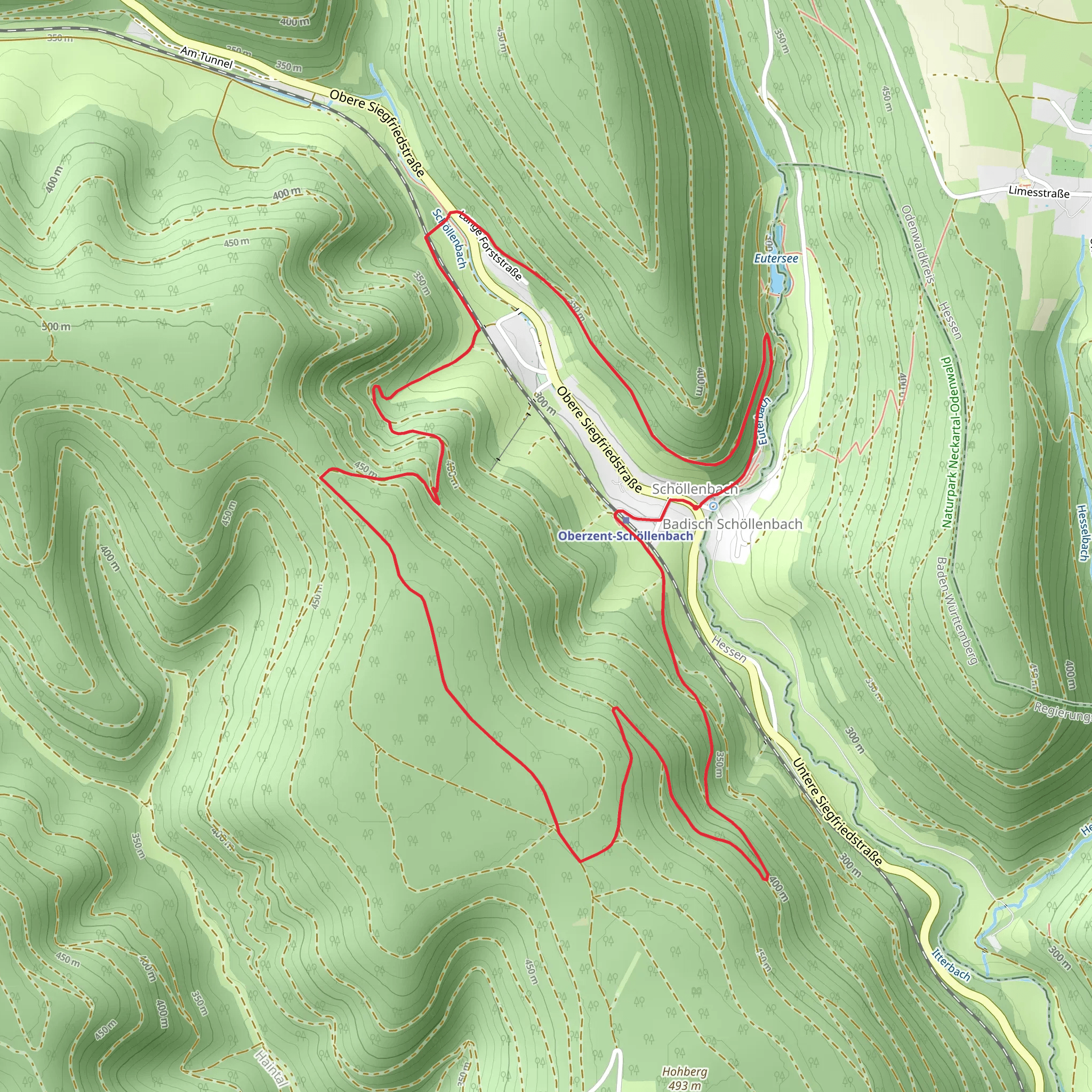
Starting near Odenwaldkreis, Germany, the Haintal Weg is an 8 km (approximately 5 miles) loop trail with an elevation gain of around 300 meters (about 984 feet). This medium-difficulty trail offers a delightful mix of natural beauty, historical landmarks, and opportunities for wildlife spotting.
Getting There
To reach the trailhead, you can either drive or use public transport. If driving, set your GPS to the nearest known address: Odenwaldkreis, Germany. For those using public transport, take a train to the Erbach (Odenw) station, which is the closest major station. From there, you can catch a local bus or taxi to the trailhead.
Trail Overview
The Haintal Weg begins with a gentle ascent through a dense forest, where the air is filled with the scent of pine and the sounds of chirping birds. The initial 2 km (1.2 miles) of the trail are relatively easy, making it a good warm-up for the more challenging sections ahead. As you continue, the trail becomes steeper, gaining about 150 meters (492 feet) in elevation over the next 3 km (1.8 miles).
Historical Significance
Around the 4 km (2.5 miles) mark, you'll come across the ruins of an old watchtower, a remnant from the medieval period when the region was a strategic point for monitoring trade routes. This spot offers a fantastic view of the surrounding Odenwald region, making it a perfect place for a short break and some photos.
Nature and Wildlife
The trail then meanders through a mixed forest of oak, beech, and spruce trees. Keep an eye out for local wildlife such as deer, foxes, and a variety of bird species. In the spring and summer months, the forest floor is carpeted with wildflowers, adding a splash of color to your hike.
Navigation
Navigating the Haintal Weg is straightforward, but it's always a good idea to have a reliable navigation tool. I recommend using HiiKER for detailed maps and real-time updates on the trail conditions. The app will also help you stay on track, especially in areas where the trail markers might be less visible.
Final Stretch
The last 2 km (1.2 miles) of the trail are a gentle descent back to the trailhead. This section takes you through open meadows, offering panoramic views of the Odenwald region. It's a relaxing end to a moderately challenging hike, allowing you to cool down and reflect on the natural beauty and historical richness you've just experienced.
Whether you're a seasoned hiker or someone looking to explore the natural and historical wonders of the Odenwald region, the Haintal Weg offers a rewarding experience.
Comments and Reviews
User comments, reviews and discussions about the Haintal Weg, Germany.
4.5
average rating out of 5
2 rating(s)
