Download
3D Flyover
Add to list
More
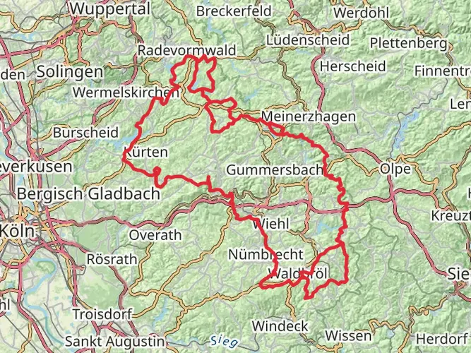
126.0 km
~5 days
1715 m
Multi-Day
“Embark on the scenic Wupperweg to discover the Bergisches Land's historical tapestry amid enchanting natural splendor.”
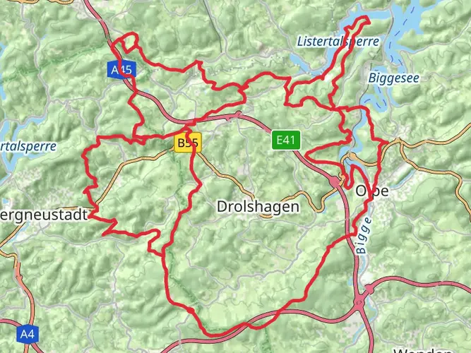
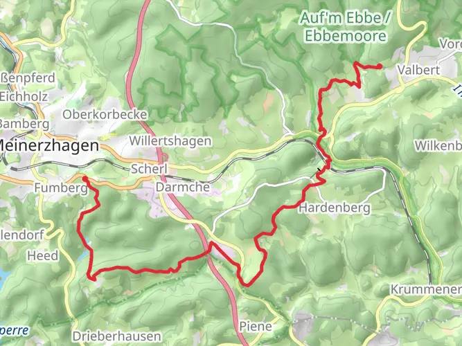
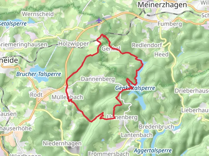
The Wupperweg trail offers a remarkable journey through the heart of the Bergisches Land, a region steeped in history and natural beauty. Spanning approximately 126 kilometers (about 78 miles) with an elevation gain of around 1700 meters (approximately 5577 feet), this point-to-point trail begins near the Oberbergischer Kreis in Germany and winds its way through a landscape characterized by rolling hills, dense forests, and the meandering Wupper River.
Getting to the Trailhead To reach the starting point of the Wupperweg, hikers can either drive or use public transportation. The trailhead is accessible by taking a bus or train to the nearest station in the Oberbergischer Kreis area, from where you can catch a local bus or taxi to the exact starting location. For those driving, parking is available near the trailhead. Hikers can use the HiiKER app to navigate to the start of the trail, ensuring a smooth beginning to their adventure.
Navigating the Trail The Wupperweg is well-marked with signage, making it easy to follow. Hikers can also rely on the HiiKER app for detailed maps and GPS navigation, ensuring they stay on the right path throughout their journey.
Landmarks and Scenery As you embark on the Wupperweg, you'll be greeted by the lush greenery of the Oberbergischer Kreis. The trail meanders alongside the Wupper River, offering serene views and the soothing sounds of flowing water. Hikers will pass through charming villages and towns, each with its own unique character and history.
Historical Significance The Bergisches Land region has a rich industrial heritage, and along the Wupperweg, hikers will encounter remnants of this past. The trail passes by historic mills, factories, and other industrial sites that once thrived on the power of the Wupper River. These landmarks provide a glimpse into the region's transformation from agricultural to industrial significance during the 19th century.
Flora and Fauna The trail is a haven for nature enthusiasts, with a diverse range of flora and fauna. The dense forests are home to a variety of tree species, including beeches, oaks, and pines. Wildlife sightings may include deer, foxes, and a plethora of bird species, making it a delightful experience for birdwatchers.
Preparation and Planning Given the trail's moderate difficulty rating, it's suitable for hikers with some experience. It's important to prepare adequately, packing enough water, food, and appropriate clothing for the weather conditions. The elevation gain is gradual, but there are sections that can be challenging, so a good level of fitness is recommended.
Accommodation and Resupply Points Along the Wupperweg, there are opportunities to rest and resupply in the towns and villages. Hikers can find accommodation ranging from campgrounds to guesthouses, allowing for a comfortable rest before continuing the journey. It's advisable to book accommodations in advance, especially during peak hiking seasons.
Safety and Etiquette Always remember to respect the natural environment by staying on the marked trails and disposing of waste properly. It's also important to be considerate of wildlife and other hikers. In case of emergency, keep a charged mobile phone with you and be aware of the nearest exit points along the trail.
By preparing well and respecting the trail's guidelines, hikers can look forward to an enriching experience on the Wupperweg, filled with natural beauty, historical insights, and the tranquility of the great outdoors.

Frequently asked questions
How many stages does the Wupperweg have and how long is each section?
The Wupperweg is a 125.97 km multi-day route, so it is usually walked in several stages rather than in one push. A published breakdown includes sections such as Teilstück 1 from Börlinghausen to Wipperfürth at 20.6 km, Teilstück 2 from Wipperfürth to Hückeswagen at 12.6 km, Teilstück 3 from Hückeswagen to Krebsöge at 10.9 km, and Teilstück 7 from Kohlfurth to Müngsten at 8.1 km.
Where does the Wupperweg start and finish?
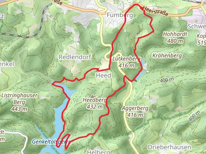
The Wupperweg starts in the Wupper source area at Marienheide-Börlinghausen and follows the river system westward to the Wupper’s mouth on the Rhine at Leverkusen-Rheindorf. The full route covers about 126 km across the Bergisches Land, linking places including Wipperfürth, Hückeswagen, the Wupper-Talsperre area, Solingen, and Leverkusen.
What is the first stage of the Wupperweg like?
The first stage of the Wupperweg runs 20.6 km from Börlinghausen to Wipperfürth. It begins near the roughly 37 springs of the Wupper in the Börlinghauser Quellmoor, then passes landmarks including the Brucher-Talsperre and Lingese-Talsperre before finishing in Wipperfürth, the oldest town in the Bergisches Land.
What happens on Stage 3 of the Wupperweg?
Stage 3 of the Wupperweg is a 10.9 km section from Hückeswagen to Krebsöge. This stretch follows the shore of the Wupper-Vorsperre and Wupper-Talsperre, climbs near the hamlet of Berg, passes the old Wuppertal–Radevormwald railway line, and reaches the dam area near the Niedernfeld hiking parking area.
What is Stage 7 of the Wupperweg and does it include Müngsten Bridge?
Stage 7 of the Wupperweg is an 8.1 km section from Kohlfurth to Müngsten. It passes the Kläranlage Kohlfurth and heads into Brückenpark Müngsten, directly beneath the 107 m high Müngstener Bridge, which is described as Germany’s highest railway bridge. This stage also includes access toward Schaberg station and the river crossing by the park’s suspension ferry.
How hard is the Wupperweg and how much climbing does it have?
The Wupperweg is rated medium difficulty. Over its 125.97 km point-to-point line it gains about 1,715 m of elevation, so the challenge comes more from repeated rolling climbs over several days than from any single alpine ascent. Forest tracks, reservoir edges, riverbank paths, and town approaches all contribute to the effort.
How is the Wupperweg waymarked and easy to follow?
The Wupperweg is a signed long-distance trail and is marked with a diamond symbol carrying the number 6. That route marking is used along the 125 km corridor developed along the Wupper, which helps distinguish it from local circular walks and reservoir-side paths in the same region.
Comments and Reviews
User comments, reviews and discussions about the Wupperweg, Germany.
5.0
average rating out of 5
3 rating(s)