Download
Preview
Add to list
More
5.6 km
~1 hrs 15 min
82 m
Point-to-Point
“Explore a scenic, medium-difficulty hike through lush countryside, historic sites, and vibrant wildlife in Germany.”
Starting your journey near the picturesque Oberbergischer Kreis in Germany, this trail offers a delightful 6 km (approximately 3.7 miles) point-to-point hike with no significant elevation gain, making it accessible for most hikers. The trail is estimated to have a medium difficulty rating, primarily due to its length and the varied terrain you will encounter along the way.
Getting There
To reach the trailhead, you can drive to the vicinity of Oberbergischer Kreis, where parking is generally available. For those relying on public transport, the nearest major city is Wuppertal. From Wuppertal, you can take a regional train to Radevormwald, followed by a local bus service that will bring you close to the starting point. Be sure to check the latest schedules and routes for any changes.
Trail Highlights
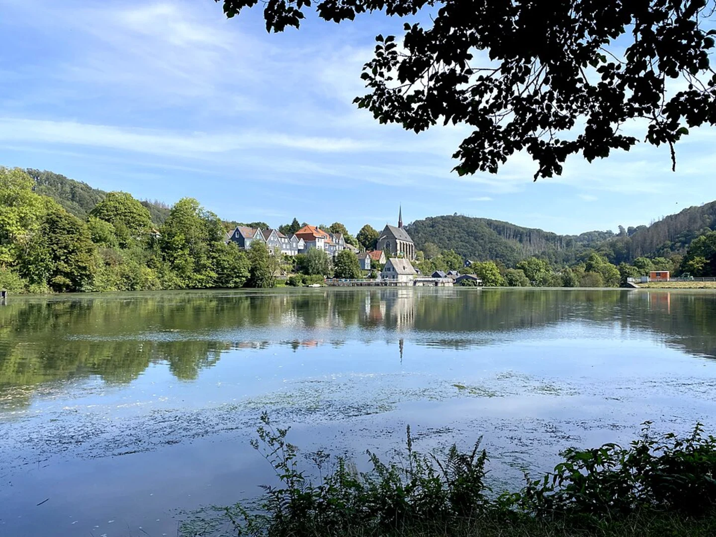
As you embark on this scenic hike, you'll traverse through lush German countryside, characterized by rolling hills and dense forests. The trail meanders alongside the Beyenburger Stausee, a serene reservoir that offers stunning reflections of the surrounding landscape. This area is a haven for birdwatchers, with a variety of waterfowl and woodland birds frequently spotted along the shores.
Historical Significance
The region around Beyenburg is steeped in history. Beyenburg itself is a quaint village with roots dating back to the Middle Ages. As you approach Beyenburg, you'll notice the remnants of its historical architecture, including the Beyenburg Monastery, which dates back to the 13th century. This monastery once played a significant role in the religious and cultural life of the region.
Navigation and Safety
While the trail is well-marked, it's always wise to have a reliable navigation tool. The HiiKER app is an excellent choice for this trail, providing detailed maps and real-time updates. The path is generally well-maintained, but be prepared for occasional muddy patches, especially after rain. Wearing sturdy hiking boots is recommended.
Flora and Fauna
The trail is rich in biodiversity. As you hike, you'll pass through mixed woodlands where oak, beech, and pine trees dominate the landscape. In spring and summer, the forest floor is carpeted with wildflowers, adding vibrant splashes of color to your journey. Keep an eye out for deer and foxes, which are common in this area.
Final Stretch
As you near the end of your hike in Beyenburg, take a moment to enjoy the tranquil atmosphere of this charming village. The trail concludes near the Beyenburg Dam, where you can relax and reflect on the natural beauty and historical richness of the area. Whether you're a seasoned hiker or a casual walker, this trail offers a rewarding experience that combines nature, history, and culture.

Comments and Reviews
User comments, reviews and discussions about the Niederdahl to Beyenburg via Beyenburger Stausee, Germany.
5.0
average rating out of 5
1 rating(s)