
Download
3D Flyover
Add to list
More
14.1 km
~3 hrs 49 min
598 m
Loop
“Explore the scenic Oberallgäu on the captivating 14 km Wandergebiet Oberstaufen Loop, ideal for moderately experienced hikers.”
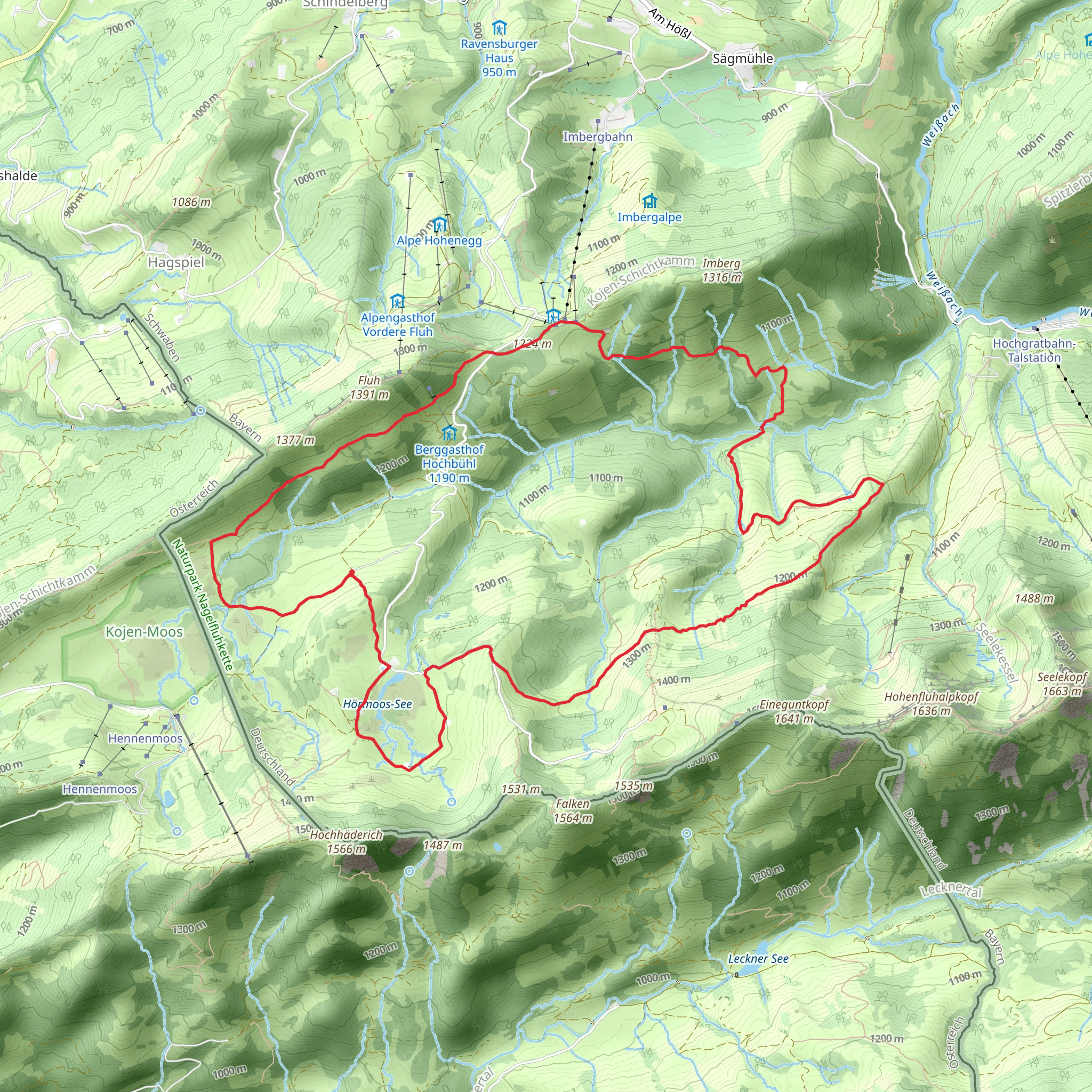
Starting your hike near Oberallgäu, Germany, the Wandergebiet Oberstaufen Loop is a captivating 14 km (8.7 miles) journey with an elevation gain of approximately 500 meters (1,640 feet). This loop trail is rated as medium difficulty, making it suitable for moderately experienced hikers.
Getting There
To reach the trailhead, you can drive or use public transport. If driving, set your GPS to Oberallgäu, Germany, and look for parking near the town center. For public transport, take a train to Oberstaufen station, which is well-connected to major cities like Munich and Stuttgart. From the station, it's a short walk to the trailhead.
Trail Overview
The trail begins near the picturesque town of Oberstaufen, a region known for its lush meadows and rolling hills. As you start your hike, you'll be greeted by a gentle ascent through dense forests. The first 3 km (1.9 miles) offer a gradual climb, gaining about 150 meters (492 feet) in elevation. This section is shaded and cool, perfect for a morning start.
Key Landmarks and Nature
Around the 4 km (2.5 miles) mark, you'll reach a clearing that offers panoramic views of the Allgäu Alps. This is an excellent spot for a short break and some photography. Continuing on, the trail meanders through alpine meadows filled with wildflowers during the spring and summer months. Keep an eye out for local wildlife such as deer, foxes, and a variety of bird species.
Historical Significance
At approximately 7 km (4.3 miles), you'll come across the historic St. Peter and Paul Church, a beautiful example of Baroque architecture dating back to the 18th century. This church is a significant landmark and offers a glimpse into the region's rich history. Take a moment to explore the church grounds and enjoy the serene atmosphere.
Midpoint and Elevation Gain
By the time you reach the midpoint of the trail, you'll have gained around 300 meters (984 feet) in elevation. The trail then descends slightly before another ascent, making the total elevation gain around 500 meters (1,640 feet). This section can be a bit challenging, so ensure you have adequate water and snacks.
Navigation and Safety
For navigation, it's highly recommended to use the HiiKER app, which provides detailed maps and real-time updates. The trail is well-marked, but having a reliable navigation tool will enhance your hiking experience and ensure you stay on track.
Final Stretch
The last 4 km (2.5 miles) of the trail take you through more open meadows and past small, charming farms. The descent is gradual, allowing you to enjoy the scenic views without too much strain. As you approach the end of the loop, you'll re-enter the forested area, leading you back to the trailhead near Oberallgäu.
This trail offers a perfect blend of natural beauty, historical landmarks, and moderate physical challenge, making it a rewarding experience for any hiker.
Comments and Reviews
User comments, reviews and discussions about the Wandergebiet Oberstaufen Loop, Germany.
5.0
average rating out of 5
3 rating(s)
