
Download
3D Flyover
Add to list
More
4.8 km
~1 hrs 31 min
339 m
Point to Point
“Explore lush meadows, historic huts, and alpine wildlife on the moderately challenging Untere Schwarzenbergalpe trail.”
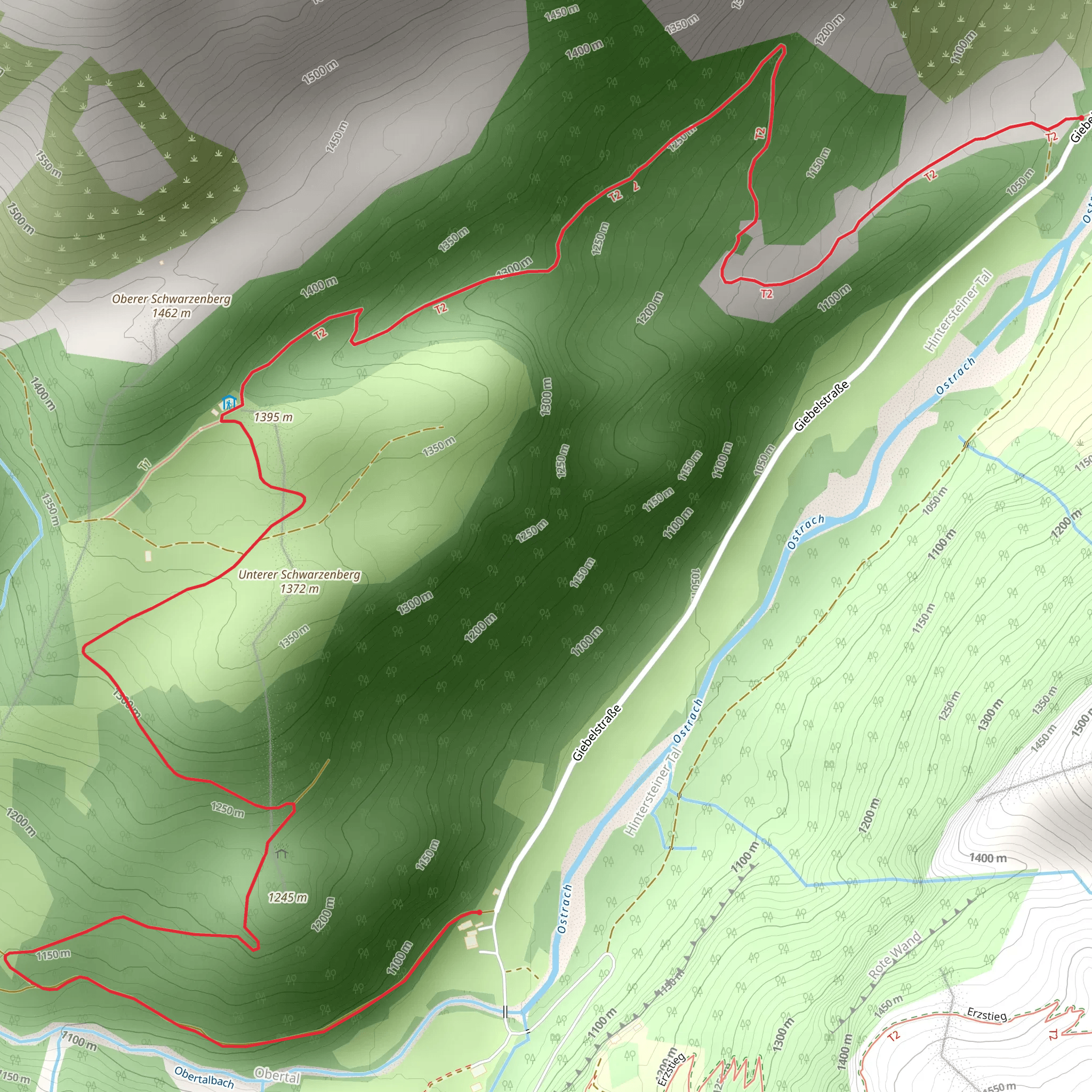
Starting near Oberallgäu, Germany, the Untere Schwarzenbergalpe trail offers a delightful 5 km (3.1 miles) hike with an elevation gain of approximately 300 meters (984 feet). This point-to-point trail is rated as medium difficulty, making it suitable for moderately experienced hikers.
Getting There
To reach the trailhead, you can either drive or use public transport. If driving, head towards Oberallgäu and look for parking options near the trail's starting point. For those using public transport, the nearest significant landmark is the Oberstdorf train station. From there, you can take a local bus or taxi to the trailhead.
Trail Overview
The trail begins with a gentle ascent through lush meadows and dense forests, offering a serene start to your hike. As you progress, the path becomes steeper, leading you through a series of switchbacks. The initial 1.5 km (0.9 miles) will see you gaining about 100 meters (328 feet) in elevation.
Flora and Fauna
The Untere Schwarzenbergalpe trail is rich in biodiversity. Keep an eye out for native wildflowers such as Alpine Aster and Edelweiss, especially during the spring and summer months. Birdwatchers will be delighted to spot species like the Alpine Chough and Golden Eagle. Small mammals like marmots and chamois are also commonly seen along the trail.
Significant Landmarks
Around the 3 km (1.9 miles) mark, you'll come across the picturesque Schwarzenbergalpe, a traditional Alpine hut. This spot offers a perfect opportunity to take a break and enjoy some local Bavarian snacks. The hut is also a great place to learn about the region's history, as it has been a resting point for shepherds and hikers for centuries.
Historical Significance
The Oberallgäu region has a rich history dating back to the Roman era. The trail itself has been used for centuries, initially serving as a route for shepherds moving their flocks between pastures. The area was also a strategic point during various historical conflicts, adding a layer of historical intrigue to your hike.
Navigation and Safety
Given the trail's moderate difficulty, it's advisable to use a reliable navigation tool like HiiKER to ensure you stay on course. The trail is well-marked, but weather conditions can change rapidly, so always be prepared with appropriate gear.
Final Stretch
The last 2 km (1.2 miles) of the trail involve a descent through a scenic valley, offering stunning views of the surrounding mountains. This section is less strenuous, allowing you to enjoy the natural beauty at a more relaxed pace.
Wildlife and Nature
As you near the end of the trail, you'll pass through a mixed forest where you might spot deer and other woodland creatures. The trail concludes near a small, serene lake, perfect for a moment of reflection before heading back.
This hike offers a balanced mix of natural beauty, historical significance, and moderate physical challenge, making it a rewarding experience for any hiker.
What to expect?
Activity types
Comments and Reviews
User comments, reviews and discussions about the Untere Schwarzenbergalpe, Germany.
4.75
average rating out of 5
4 rating(s)
