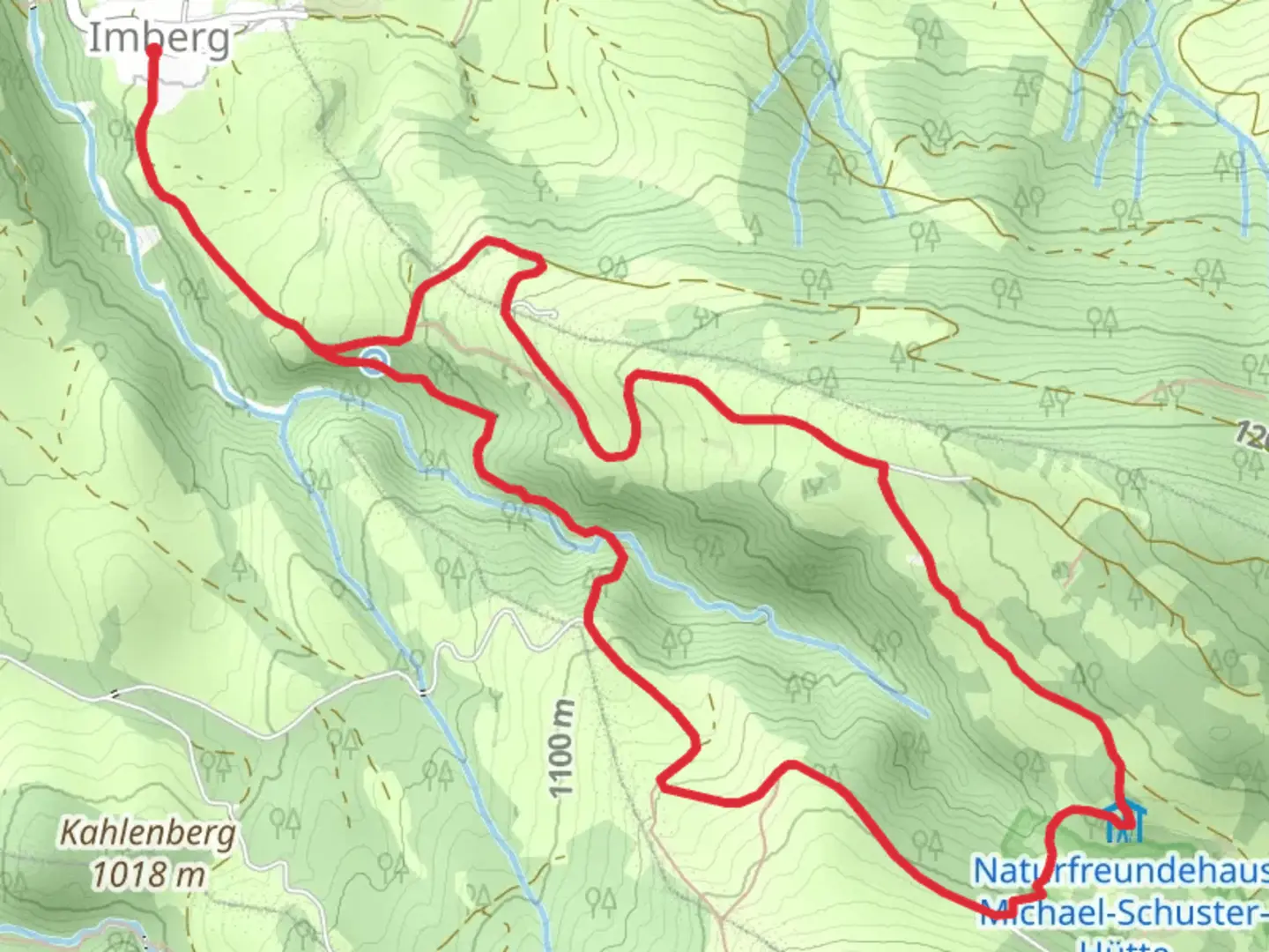
Strausberghütte and Michael Schuster Naturfreundehaus Loop via Wanderwegenetz Sonthofen
Download
3D Flyover
Add to list
More
7.2 km
~2 hrs 3 min
370 m
Loop
“Embark on a 7 km scenic loop in Oberallgäu, Germany, blending alpine beauty and historical charm.”
Starting your hike near Oberallgäu, Germany, the Strausberghütte and Michael Schuster Naturfreundehaus Loop via Wanderwegenetz Sonthofen offers a delightful 7 km (4.3 miles) journey with an elevation gain of approximately 300 meters (984 feet). This loop trail is rated medium in difficulty, making it suitable for moderately experienced hikers.
Getting There
To reach the trailhead, you can either drive or use public transport. If you're driving, set your GPS to Oberallgäu, Germany, and look for parking near the Wanderwegenetz Sonthofen. For those using public transport, take a train to Sonthofen station. From there, local buses or a short taxi ride will get you to the trailhead.
Trail Overview
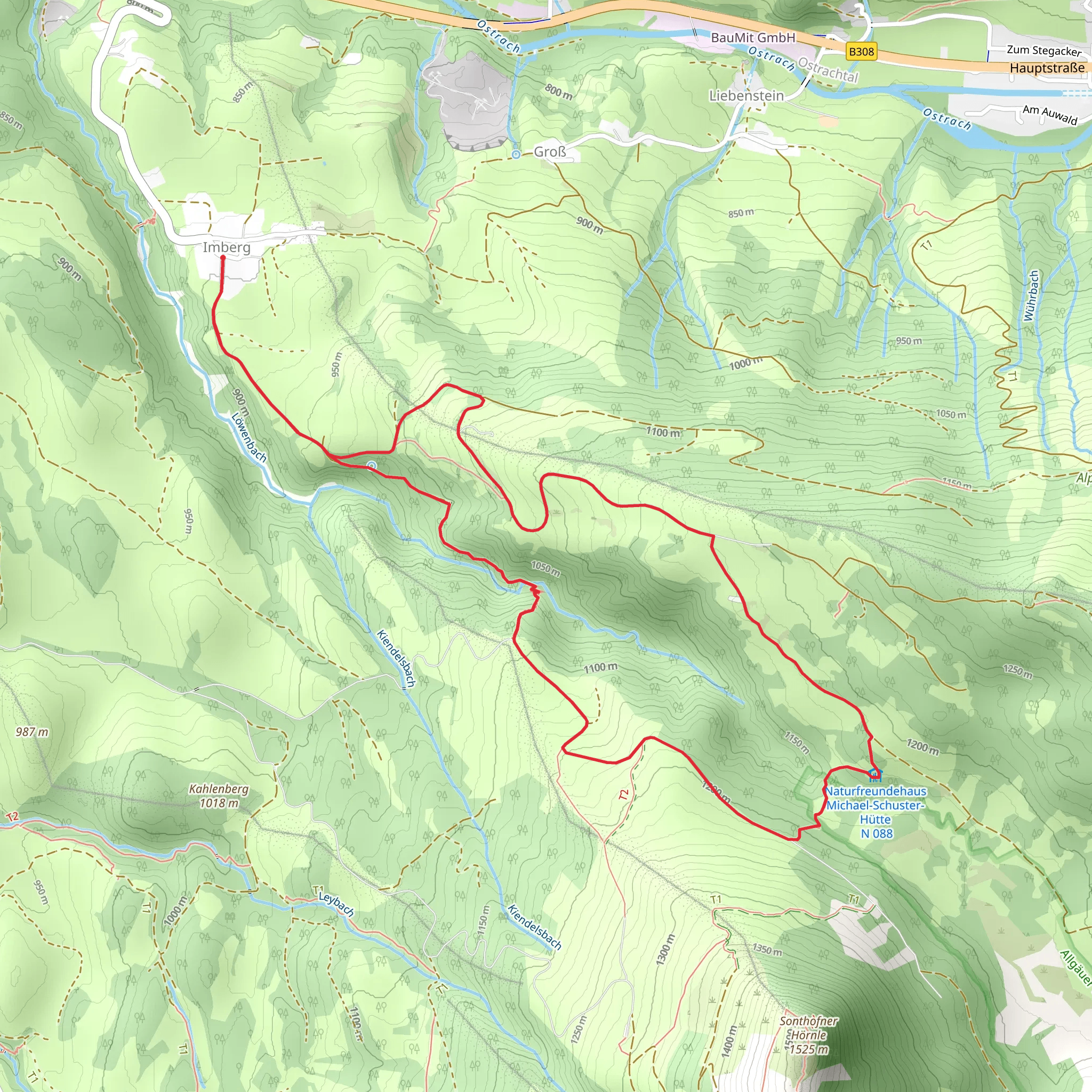
The trail begins with a gentle ascent through lush meadows and mixed forests. Early on, you'll encounter the Strausberghütte, a charming alpine hut that offers a perfect spot for a quick rest or a snack. The hut is located approximately 2 km (1.2 miles) from the start, with an elevation gain of about 100 meters (328 feet).
Key Landmarks and Natural Features
Continuing on, the trail meanders through dense forest areas, where you might spot local wildlife such as deer, foxes, and a variety of bird species. The flora is equally captivating, with wildflowers dotting the landscape, especially in spring and summer.
Around the 4 km (2.5 miles) mark, you'll reach the Michael Schuster Naturfreundehaus. This historic building serves as a mountain refuge and offers panoramic views of the surrounding Allgäu Alps. The elevation gain to this point is roughly 200 meters (656 feet). The Naturfreundehaus is a great place to pause and take in the scenery, perhaps even enjoying a meal if the facility is open.
Historical Significance
The region around Oberallgäu has a rich history, with roots tracing back to ancient Roman times. The trail itself passes through areas that were historically used for transhumance, the seasonal movement of livestock between fixed summer and winter pastures. This practice has shaped the landscape and cultural heritage of the area.
Navigation and Safety
The trail is well-marked, but it's always a good idea to have a reliable navigation tool. HiiKER is an excellent app for this purpose, providing detailed maps and real-time updates. Make sure to wear sturdy hiking boots, carry sufficient water, and be prepared for changing weather conditions, as the alpine climate can be unpredictable.
Final Stretch
The final leg of the loop takes you back through serene meadows and forested paths, gradually descending to the starting point. The total elevation gain for the entire loop is around 300 meters (984 feet), making the descent relatively gentle and enjoyable.
This trail offers a perfect blend of natural beauty, historical significance, and moderate physical challenge, making it a rewarding experience for any hiker.
What to expect?
Activity types
Comments and Reviews
User comments, reviews and discussions about the Strausberghütte and Michael Schuster Naturfreundehaus Loop via Wanderwegenetz Sonthofen, Germany.
5.0
average rating out of 5
2 rating(s)
