
Söllereckbahn Bergstation to Söllereck Mittelstation Walk via Freibergsee
Download
3D Flyover
Add to list
More
8.8 km
~2 hrs 15 min
290 m
Point to Point
“Embark on a scenic 9 km hike through the Bavarian Alps, featuring lakes, wildlife, and historical landmarks.”
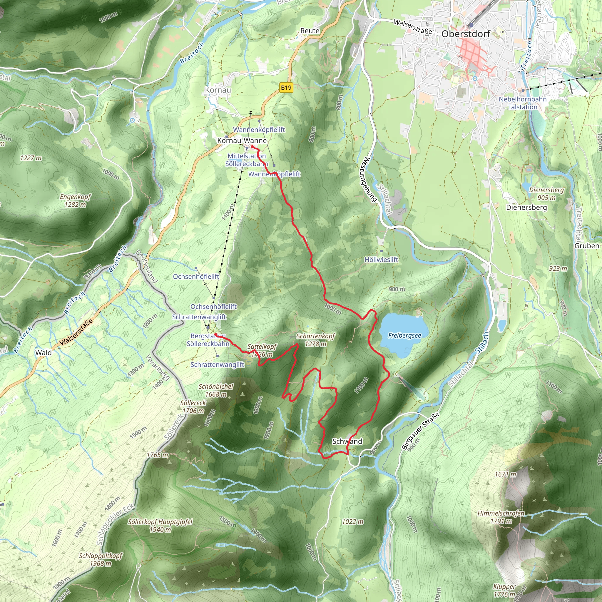
Starting your hike near Oberallgäu, Germany, the trail from Söllereckbahn Bergstation to Söllereck Mittelstation via Freibergsee offers a delightful journey through the Bavarian Alps. This point-to-point trail spans approximately 9 km (5.6 miles) with an elevation gain of around 200 meters (656 feet), making it a moderately challenging hike suitable for those with a reasonable level of fitness.
Getting There
To reach the trailhead, you can either drive or use public transport. If you're driving, head towards the Söllereckbahn cable car station near Oberstdorf, which is well-signposted and has ample parking facilities. For those using public transport, take a train to Oberstdorf station. From there, you can catch a bus or a taxi to the Söllereckbahn Bergstation.
Trail Overview
The hike begins at the Söllereckbahn Bergstation, where you can take a moment to enjoy the panoramic views of the surrounding mountains. The trail initially descends gently through lush alpine meadows and dense forests, offering a serene start to your journey.
Key Landmarks and Nature
As you proceed, you'll come across the Freibergsee, a picturesque alpine lake located about 4 km (2.5 miles) into the hike. This is an excellent spot to take a break, have a picnic, or even take a refreshing dip in the summer months. The lake is surrounded by dense forest and offers stunning reflections of the surrounding peaks.
Continuing on, the trail meanders through a mix of forested areas and open meadows, providing a diverse range of flora and fauna. Keep an eye out for local wildlife such as deer, marmots, and a variety of bird species. The trail also offers several vantage points where you can enjoy breathtaking views of the Allgäu Alps.
Historical Significance
The region around Oberallgäu has a rich history dating back to medieval times. The area was historically significant for its strategic location and its role in alpine agriculture. As you hike, you may notice traditional Bavarian farmhouses and alpine huts, some of which date back several centuries. These structures offer a glimpse into the traditional way of life in the Bavarian Alps.
Navigation and Safety
Given the moderate difficulty of the trail, it's advisable to use a reliable navigation tool like HiiKER to ensure you stay on the correct path. The trail is well-marked, but having a digital map can provide additional peace of mind. Make sure to wear sturdy hiking boots and bring plenty of water, especially during the warmer months.
Final Stretch
The final section of the hike involves a gentle ascent towards the Söllereck Mittelstation. As you approach the end of the trail, you'll be rewarded with expansive views of the surrounding valleys and peaks. The Söllereck Mittelstation offers facilities such as restrooms and a small café where you can relax and reflect on your hike.
This trail offers a perfect blend of natural beauty, historical significance, and moderate physical challenge, making it a rewarding experience for any hiker.
What to expect?
Activity types
Comments and Reviews
User comments, reviews and discussions about the Söllereckbahn Bergstation to Söllereck Mittelstation Walk via Freibergsee, Germany.
4.57
average rating out of 5
7 rating(s)


.jpg)