Download
3D Flyover
Add to list
More
13.5 km
~4 hrs 8 min
864 m
Loop
“Explore the enchanting 13 km Siplingerkopf-Girenkopf-Alpe Spicherhalde Loop, blending natural beauty, moderate challenge, and rich history.”
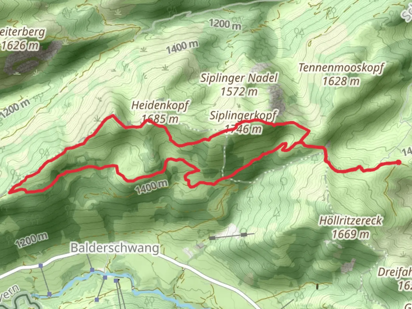
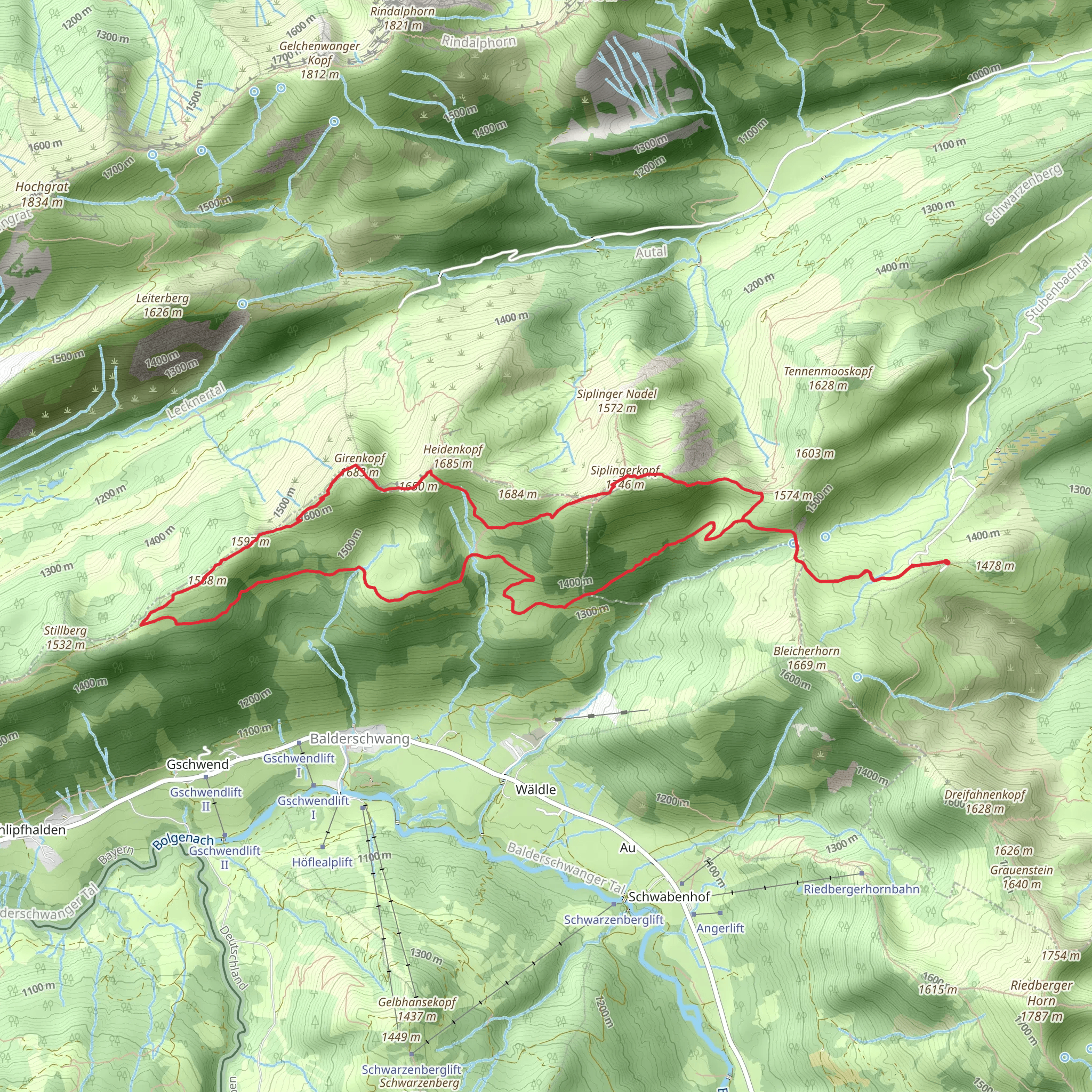
Starting your adventure near Oberallgäu, Germany, the Siplingerkopf, Girenkopf, and Alpe Spicherhalde Loop is a captivating 13 km (8 miles) trail with an elevation gain of approximately 800 meters (2,625 feet). This loop trail is rated as medium difficulty, making it suitable for moderately experienced hikers.
Getting There
To reach the trailhead, you can drive or use public transport. If driving, head towards the town of Oberallgäu and look for parking near the trailhead, which is conveniently located close to the town center. For those using public transport, take a train to the nearest station in Oberallgäu and then a local bus or taxi to the trailhead.
Trail Overview
The trail begins with a gentle ascent through lush meadows and dense forests, offering a serene start to your hike. As you progress, the path becomes steeper, leading you towards the first significant landmark, the Siplingerkopf. At around 4 km (2.5 miles) into the hike, you'll reach the summit of Siplingerkopf, standing at an elevation of 1,746 meters (5,728 feet). From here, you can enjoy panoramic views of the Allgäu Alps and the surrounding valleys.
Girenkopf and Alpe Spicherhalde
Continuing along the ridge, the trail takes you to Girenkopf, another notable peak at an elevation of 1,689 meters (5,541 feet). This section of the trail is particularly scenic, with breathtaking views and diverse flora. Keep an eye out for alpine flowers and, if you're lucky, you might spot some local wildlife such as chamois or marmots.
After descending from Girenkopf, the trail leads you to Alpe Spicherhalde, a traditional alpine hut where you can take a well-deserved break. This is a great spot to enjoy a snack and soak in the tranquil surroundings. The hut is typically open during the summer months and offers local delicacies and refreshments.
Historical Significance
The region around Oberallgäu has a rich history, with evidence of human settlement dating back to the Bronze Age. The trails you hike today were once used by shepherds and traders, and remnants of old trade routes can still be seen. The alpine huts, like Alpe Spicherhalde, have been part of the local culture for centuries, serving as shelters and meeting points for the mountain communities.
Navigation and Safety
Given the varying terrain and elevation changes, it's advisable to use a reliable navigation tool like HiiKER to stay on track. The trail is well-marked, but weather conditions can change rapidly in the mountains, so always be prepared with appropriate gear, including a map, compass, and GPS device.
Flora and Fauna
The trail offers a rich tapestry of natural beauty. In the lower elevations, you'll walk through mixed forests of beech and spruce, while higher up, the landscape transitions to alpine meadows dotted with wildflowers. Birdwatchers will enjoy spotting species like the golden eagle and the alpine chough.
Final Descent
The final leg of the loop takes you through more forested areas and meadows as you descend back towards Oberallgäu. This section is less strenuous, allowing you to relax and reflect on the stunning landscapes and historical paths you've traversed.
This loop trail is a perfect blend of natural beauty, moderate challenge, and historical intrigue, making it a must-do for any hiking enthusiast visiting the Allgäu region.
What to expect?
Activity types
Comments and Reviews
User comments, reviews and discussions about the Siplingerkopf, Girenkopf and Alpe Spicherhalde Loop, Germany.
average rating out of 5
0 rating(s)
