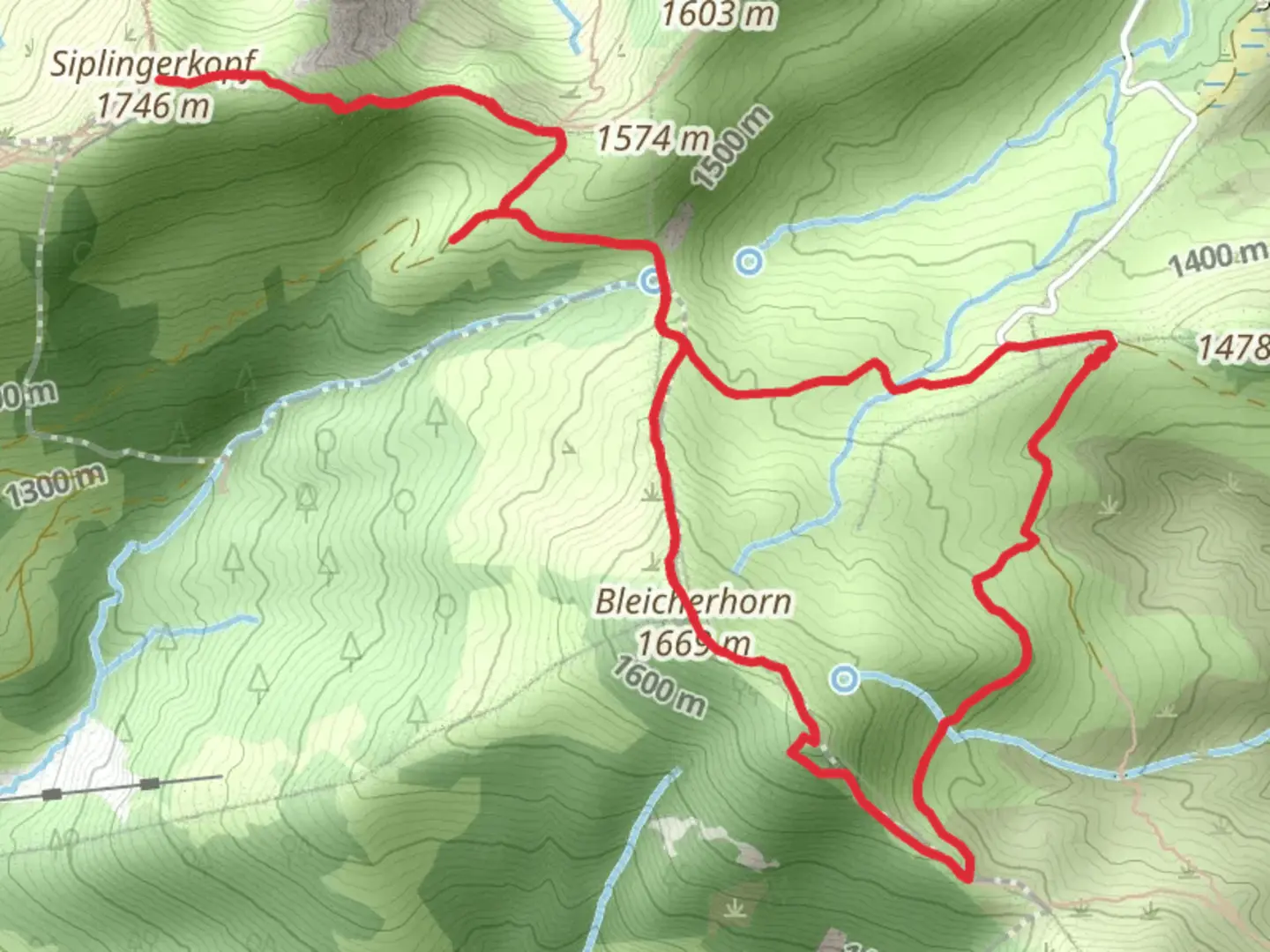
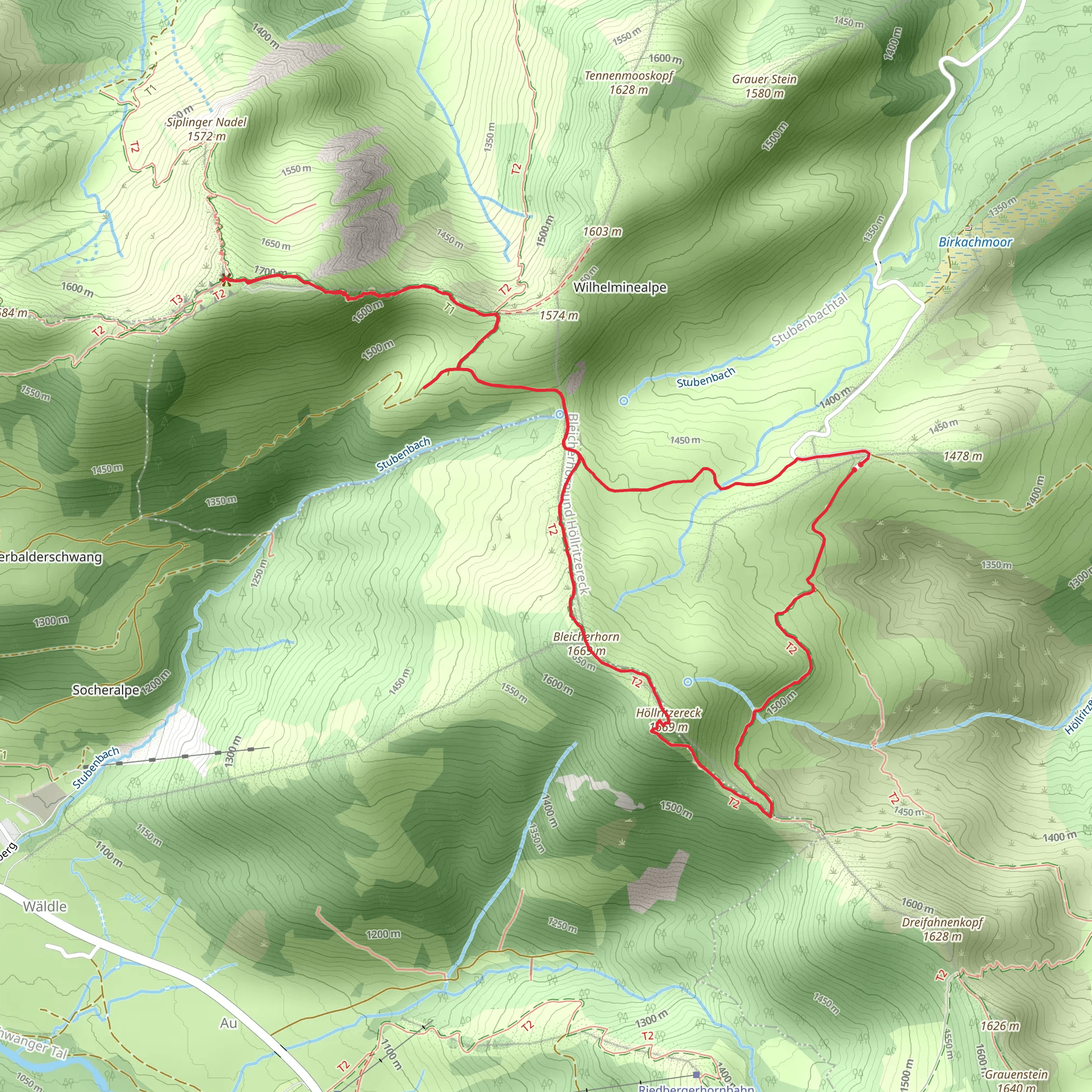
Siplingerkopf, Bleicherhorn and Höllritzereck Loop via Oberallgaeuer Rundwandweweg
Download
3D Flyover
Add to list
More
7.8 km
~2 hrs 28 min
542 m
Loop
“Explore the captivating 8 km Siplingerkopf Loop in Oberallgäu, blending stunning views, diverse wildlife, and rich history.”
Starting your hike near Oberallgäu, Germany, the Siplingerkopf, Bleicherhorn, and Höllritzereck Loop via Oberallgäuer Rundwandweweg is a captivating 8 km (5 miles) loop with an elevation gain of approximately 500 meters (1,640 feet). This medium-difficulty trail offers a blend of natural beauty, historical significance, and diverse wildlife, making it a rewarding experience for hikers.
Getting There
To reach the trailhead, you can either drive or use public transport. If driving, set your GPS to Oberallgäu, Germany, and look for parking options near the trailhead. For those using public transport, take a train to the nearest station in Oberstdorf, and from there, a local bus can take you closer to the starting point. The nearest significant landmark is the Oberstdorf train station, which is well-connected to major cities.
Trail Overview
The loop begins with a gentle ascent through lush forests, where you’ll be greeted by the sounds of chirping birds and rustling leaves. As you progress, the trail becomes steeper, leading you to the first significant landmark, the Siplingerkopf. This peak offers panoramic views of the Allgäu Alps, making it a perfect spot for a short break and some photography.
Siplingerkopf to Bleicherhorn
From Siplingerkopf, the trail continues towards Bleicherhorn. This section is relatively moderate, with a mix of ascents and descents. Keep an eye out for alpine flowers and occasional sightings of marmots. The Bleicherhorn peak provides another excellent vantage point, offering views of the surrounding valleys and peaks.
Bleicherhorn to Höllritzereck
The path from Bleicherhorn to Höllritzereck is where the trail becomes more challenging. The terrain is rocky and requires careful footing. This part of the hike is particularly rewarding for those interested in geology, as you’ll pass by fascinating rock formations. Höllritzereck is the highest point of the loop, and from here, you can enjoy sweeping views of the Allgäu region.
Descent and Return
The descent from Höllritzereck is gradual, taking you through alpine meadows and past small streams. This section is less strenuous, allowing you to relax and enjoy the serene environment. As you make your way back to the starting point, you’ll pass through more forested areas, where you might spot deer or other wildlife.
Historical Significance
The Allgäu region has a rich history, with evidence of human settlement dating back to the Bronze Age. The trail itself passes near several historical landmarks, including ancient farmhouses and remnants of old trade routes. These historical elements add an extra layer of interest to your hike, making it not just a physical challenge but also a journey through time.
Navigation and Safety
For navigation, it’s highly recommended to use the HiiKER app, which provides detailed maps and real-time updates. Ensure you have adequate water, snacks, and appropriate clothing, as weather conditions can change rapidly in the mountains. Always inform someone of your hiking plans and estimated return time.
This trail offers a perfect blend of natural beauty, physical challenge, and historical intrigue, making it a must-visit for any hiking enthusiast.
What to expect?
Activity types
Comments and Reviews
User comments, reviews and discussions about the Siplingerkopf, Bleicherhorn and Höllritzereck Loop via Oberallgaeuer Rundwandweweg, Germany.
4.75
average rating out of 5
4 rating(s)
