Download
Preview
Add to list
More
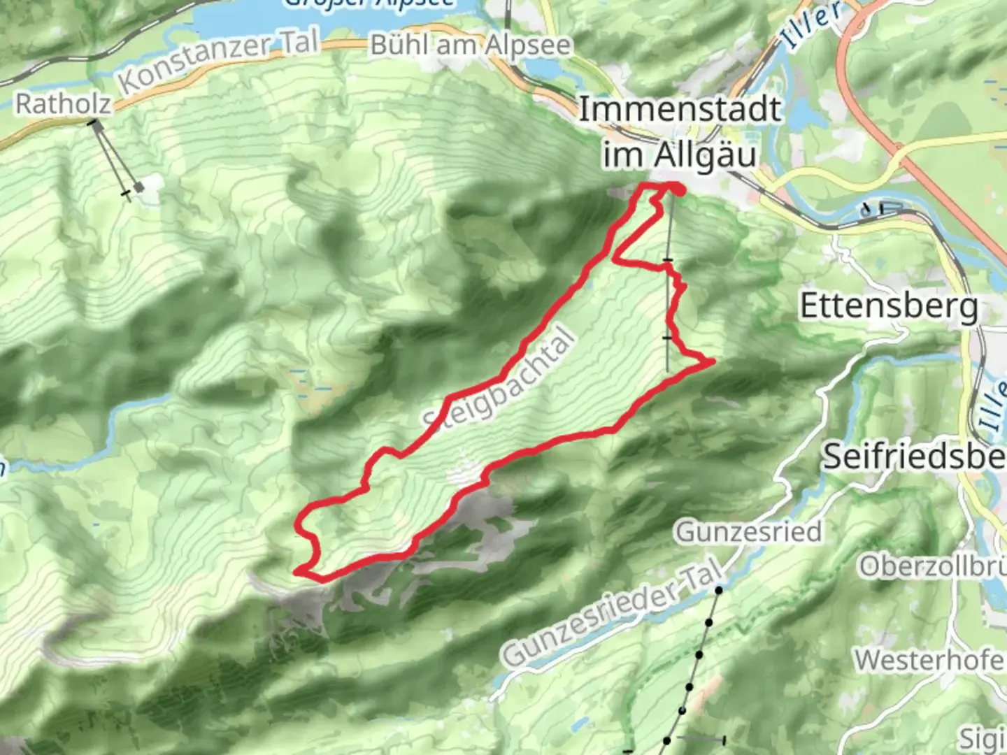
16.1 km
~5 hrs 1 min
1077 m
Loop
“Embark on a breathtaking alpine adventure through picturesque peaks and rich historical landscapes in Oberallgäu.”
Nestled in the picturesque region of Oberallgäu, Germany, the Mittagberg, Steineberg, and Leckereck Loop offers a challenging yet rewarding hiking experience. This 16 km (approximately 10 miles) loop trail boasts an elevation gain of around 1000 meters (3280 feet), making it a demanding trek suitable for experienced hikers. The trailhead is conveniently located near the town of Immenstadt, which is accessible by both car and public transport.
Getting There
For those traveling by car, Immenstadt is well-connected via the A7 and B19 highways. Parking is available near the trailhead, which is situated close to the Mittagbahn cable car station. If you prefer public transport, Immenstadt is accessible by train, with regular services from major cities like Munich. From the Immenstadt train station, local buses or a short taxi ride can take you to the trailhead.
Trail Overview
The loop begins with a steady ascent towards Mittagberg, the first peak on the route. As you climb, you'll be treated to panoramic views of the Allgäu Alps and the lush valleys below. The initial section of the trail is well-marked and follows a combination of forest paths and open ridges. Keep an eye out for the diverse flora, including alpine flowers and dense coniferous forests that characterize this region.
Key Landmarks and Sections
Mittagberg
Reaching Mittagberg, at an elevation of approximately 1451 meters (4760 feet), you'll find a small hut offering refreshments and a chance to rest. The summit provides breathtaking views of the surrounding peaks and Lake Alpsee. This is a perfect spot to pause and soak in the natural beauty before continuing your journey.
Steineberg
The trail then leads you towards Steineberg, a peak known for its distinctive rock formations. This section involves some scrambling, so be prepared for a more technical climb. The summit of Steineberg, at about 1683 meters (5522 feet), offers another opportunity to marvel at the expansive vistas. The rugged terrain here is home to various bird species, so birdwatchers should keep their binoculars handy.
Leckereck
Continuing on, the path descends slightly before ascending again to Leckereck. This part of the trail is less frequented, providing a sense of solitude amidst the alpine landscape. The elevation here is around 1720 meters (5643 feet), and the area is known for its serene atmosphere and the occasional sighting of mountain goats.
Historical Significance
The Allgäu region is steeped in history, with evidence of human settlement dating back to the Bronze Age. The trail itself traverses areas that have been used for centuries by shepherds and traders. The cultural heritage of the region is reflected in the traditional Bavarian architecture and local customs you might encounter in nearby villages.
Navigation and Safety
Given the trail's difficulty, it's essential to be well-prepared. Use HiiKER for accurate navigation and to stay updated on trail conditions. Weather in the Alps can change rapidly, so pack accordingly with layers, rain gear, and sufficient water and snacks. Proper hiking boots are a must due to the rocky and uneven terrain.
This loop trail offers a challenging yet unforgettable adventure through one of Germany's most stunning alpine regions. Whether you're drawn by the natural beauty, the physical challenge, or the rich history, the Mittagberg, Steineberg, and Leckereck Loop promises an experience that will linger in your memory long after the hike is over.

Comments and Reviews
User comments, reviews and discussions about the Mittagberg, Steineberg and Leckereck Loop - Immenstadt, Germany.
average rating out of 5
0 rating(s)