Download
3D Flyover
Add to list
More
7.6 km
~2 hrs 38 min
675 m
Loop
“Embark on a scenic 8 km loop in the Allgäu Alps, blending natural beauty and historical intrigue.”
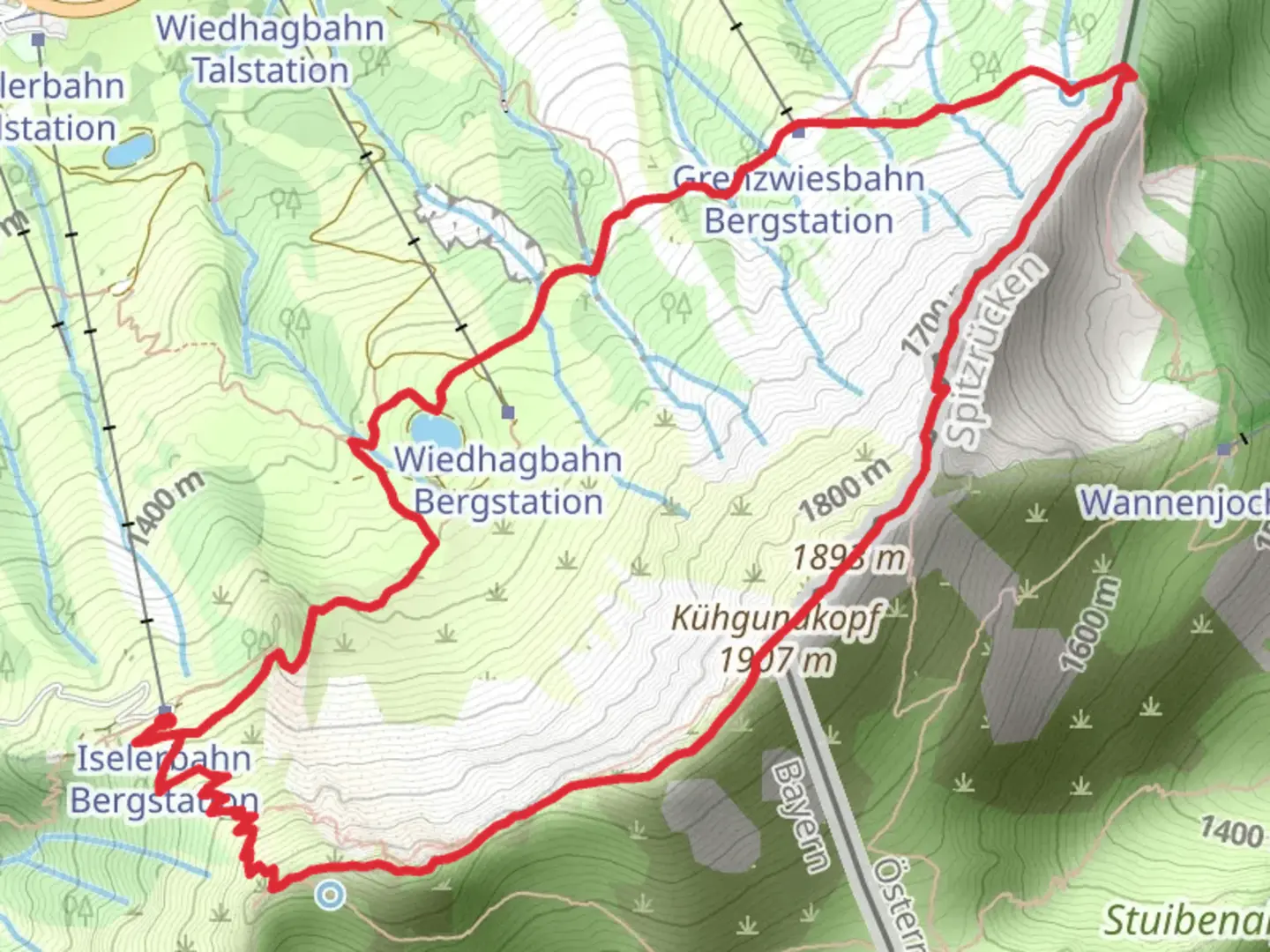
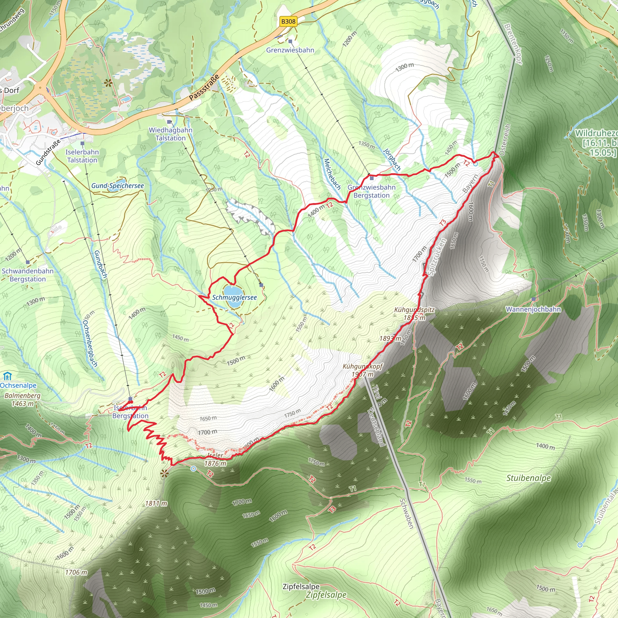
Starting your adventure near Oberallgäu, Germany, the Iseler, Kuehgundkopf via Iselergrat and Schmugglerweg trail offers a captivating 8 km (5 miles) loop with an elevation gain of approximately 600 meters (1,970 feet). This medium-difficulty trail is perfect for those looking to experience the beauty of the Allgäu Alps while enjoying a mix of natural and historical elements.
Getting There
To reach the trailhead, you can either drive or use public transport. If driving, head towards Oberjoch, a small village in the Oberallgäu district. There are parking facilities available near the Iselerbahn cable car station. For those using public transport, take a train to Sonthofen and then a bus to Oberjoch. The nearest significant landmark is the Iselerbahn cable car station, which is a convenient starting point for your hike.
Trail Overview
The trail begins with a steady ascent towards the Iseler summit. The initial part of the hike takes you through lush alpine meadows, where you can spot a variety of wildflowers and possibly some local wildlife like chamois or marmots. After about 2 km (1.2 miles), you will reach the Iseler summit at an elevation of 1,876 meters (6,155 feet). Here, you can enjoy panoramic views of the surrounding peaks and valleys.
Iselergrat Ridge
From the Iseler summit, the trail continues along the Iselergrat ridge. This section is particularly scenic, offering breathtaking views of the Tannheimer Valley and the distant Zugspitze, Germany's highest peak. The ridge walk is about 1.5 km (0.9 miles) long and involves some mild scrambling, so be prepared for a bit of a challenge. The elevation gain here is moderate, but the rocky terrain requires careful footing.
Kuehgundkopf Summit
After navigating the Iselergrat, you will reach the Kuehgundkopf summit, standing at 1,907 meters (6,257 feet). This is the highest point of the trail and offers a perfect spot for a break. Take in the stunning vistas and perhaps enjoy a snack while soaking up the alpine atmosphere.
Schmugglerweg (Smuggler's Path)
The descent begins along the Schmugglerweg, a historic path once used by smugglers to transport goods between Germany and Austria. This part of the trail is rich in history and folklore, adding an intriguing layer to your hike. The path is well-marked and gradually descends through dense forests and open meadows. Keep an eye out for interpretive signs that provide insights into the smuggling activities that once took place here.
Flora and Fauna
Throughout the hike, you'll encounter a diverse range of flora and fauna. The alpine meadows are home to edelweiss, gentians, and various orchids. Birdwatchers might spot golden eagles, alpine choughs, and other mountain birds. The forested sections are inhabited by deer, foxes, and occasionally, wild boar.
Navigation and Safety
Given the varied terrain and historical significance of the trail, it's advisable to use a reliable navigation tool like HiiKER to stay on track. The trail is well-marked, but having a digital map can be very helpful, especially along the more challenging sections of the Iselergrat ridge.
Final Stretch
As you make your way back to the trailhead, the path becomes easier, allowing you to relax and enjoy the final leg of your journey. The loop concludes back at the Iselerbahn cable car station, where you can either take the cable car down or continue hiking to explore more of the Oberallgäu region.
This trail offers a perfect blend of natural beauty, historical intrigue, and moderate physical challenge, making it a must-do for any hiking enthusiast visiting the Allgäu Alps.
What to expect?
Activity types
Comments and Reviews
User comments, reviews and discussions about the Iseler, Kuehgundkopf via Iselergrat and Schmugglerweg, Germany.
4.2
average rating out of 5
5 rating(s)
