
Download
3D Flyover
Add to list
More
8.6 km
~2 hrs 55 min
724 m
Loop
“Explore Oberallgäu's diverse landscapes, historical landmarks, and panoramic views on this captivating 9 km loop trail.”
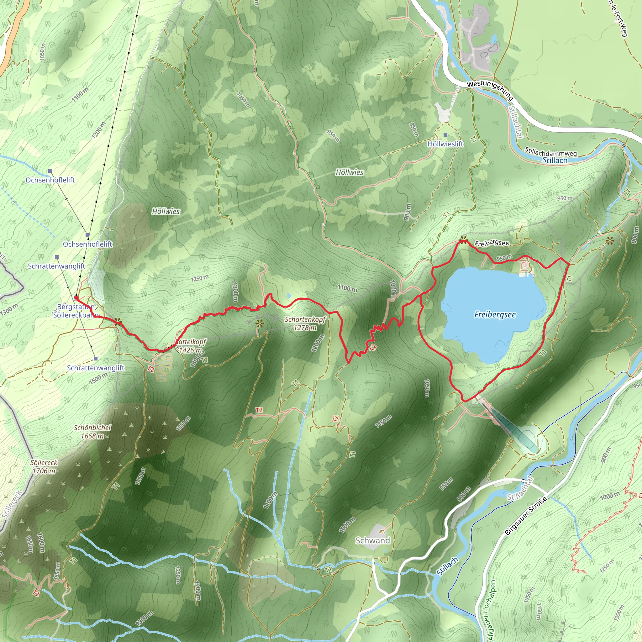
Starting your hike near Oberallgäu, Germany, the Freibergsee via Oberallgäuer Rundwanderweg is a captivating loop trail that spans approximately 9 km (5.6 miles) with an elevation gain of around 700 meters (2,297 feet). This medium-difficulty trail offers a blend of natural beauty, historical significance, and a variety of landscapes that will keep you engaged throughout your journey.
Getting There
To reach the trailhead, you can either drive or use public transport. If you're driving, set your GPS to Oberallgäu, Germany, and look for parking near the starting point. For those using public transport, take a train to Oberstdorf station, which is the nearest major station. From there, you can catch a local bus or taxi to the trailhead.
Trail Overview
The trail begins with a gentle ascent through lush forests, where you'll be surrounded by towering trees and the soothing sounds of nature. As you progress, the path becomes steeper, offering a moderate challenge that rewards you with stunning views of the surrounding Allgäu Alps.
Key Landmarks and Points of Interest
- Freibergsee: About 3 km (1.9 miles) into the hike, you'll reach Freibergsee, a picturesque lake nestled among the mountains. This is an excellent spot for a break, where you can enjoy the serene waters and perhaps even take a refreshing dip if the weather permits.
- Heini-Klopfer-Skiflugschanze: Near the lake, you'll find the Heini-Klopfer-Skiflugschanze, one of the world's largest ski jumps. This landmark is not only impressive in its scale but also holds historical significance in the world of ski jumping.
- Panoramic Views: As you continue, the trail offers several vantage points where you can take in panoramic views of the Allgäu Alps. These spots are perfect for photography and provide a great opportunity to appreciate the natural beauty of the region.
Flora and Fauna
The trail is rich in biodiversity. Keep an eye out for local wildlife such as deer, foxes, and a variety of bird species. The flora is equally diverse, with wildflowers, ferns, and alpine plants adding splashes of color to the landscape.
Navigation and Safety
Given the elevation gain and varying terrain, it's advisable to use a reliable navigation tool like HiiKER to stay on track. The trail is well-marked, but having a digital map can provide extra assurance. Wear sturdy hiking boots and bring trekking poles if you have them, as some sections can be quite steep and rocky.
Historical Significance
The region around Oberallgäu has a rich history, with evidence of human settlement dating back to the Bronze Age. The Allgäu Alps have long been a site of cultural and economic importance, from ancient trade routes to modern tourism. The Heini-Klopfer-Skiflugschanze itself is a testament to the area's long-standing association with winter sports.
Final Stretch
As you loop back towards the starting point, the trail descends through more forested areas, offering a peaceful end to your hike. The final kilometers are relatively easy, allowing you to cool down and reflect on the diverse experiences the trail has offered.
This hike is a perfect blend of natural beauty, moderate physical challenge, and historical intrigue, making it a must-do for anyone visiting the Oberallgäu region.
What to expect?
Activity types
Comments and Reviews
User comments, reviews and discussions about the Freibergsee via Oberallgaeuer Rundwanderweg, Germany.
4.25
average rating out of 5
4 rating(s)
