
Download
3D Flyover
Add to list
More
6.4 km
~2 hrs 1 min
442 m
Out and Back
“Explore the Falkenstein Walk: a 6 km journey of natural beauty and historic intrigue in Oberallgäu.”
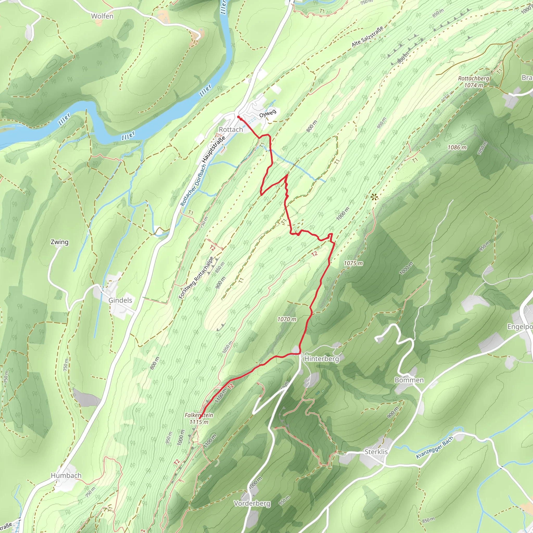
Starting near Oberallgäu, Germany, the Falkenstein Walk from Rottach is an invigorating out-and-back trail that spans approximately 6 km (3.7 miles) with an elevation gain of around 400 meters (1,312 feet). This medium-difficulty hike offers a blend of natural beauty and historical intrigue, making it a rewarding experience for both novice and seasoned hikers.
Getting There
To reach the trailhead, you can either drive or use public transportation. If you're driving, set your GPS to Rottach, Oberallgäu, Germany. There is ample parking available near the starting point. For those relying on public transport, take a train to Oberstdorf and then a local bus to Rottach. The bus stop is conveniently located near the trailhead, making it easy to start your hike.
Trail Overview
The trail begins with a gentle ascent through lush forests, where you’ll be greeted by the sounds of chirping birds and rustling leaves. As you progress, the path becomes steeper, offering a moderate challenge that rewards you with stunning views of the surrounding Allgäu Alps.
Significant Landmarks
At approximately 2 km (1.2 miles) into the hike, you’ll come across the ruins of Falkenstein Castle. Perched on a rocky outcrop, this medieval fortress offers panoramic views of the valley below. The castle dates back to the 13th century and was once a strategic stronghold. Take a moment to explore the ruins and imagine the historical events that unfolded here.
Continuing on, the trail winds through alpine meadows dotted with wildflowers, especially vibrant in the spring and summer months. Keep an eye out for local wildlife such as deer, marmots, and a variety of bird species. The flora and fauna in this region are diverse, making it a paradise for nature enthusiasts.
Elevation and Terrain
The trail’s elevation gain of 400 meters (1,312 feet) is spread out over the 6 km (3.7 miles), making it a manageable climb for most hikers. The terrain varies from well-trodden paths to rocky sections, so sturdy hiking boots are recommended. Trekking poles can also be helpful, especially on the steeper sections.
Navigation
For navigation, it’s advisable to use the HiiKER app, which provides detailed maps and real-time updates. The trail is well-marked, but having a reliable navigation tool ensures you stay on track and can fully enjoy the hike without any worries.
Final Stretch
As you approach the 3 km (1.85 miles) mark, the trail reaches its highest point, offering breathtaking views of the Allgäu Alps and the surrounding valleys. This is a perfect spot to take a break, enjoy a snack, and soak in the natural beauty. The return journey follows the same path, allowing you to revisit the scenic spots and perhaps notice details you missed on the way up.
This hike is a perfect blend of natural beauty, historical landmarks, and moderate physical challenge, making it a must-do for anyone visiting the Oberallgäu region.
What to expect?
Activity types
Comments and Reviews
User comments, reviews and discussions about the Falkenstein Walk from Rottach, Germany.
4.5
average rating out of 5
2 rating(s)
