Download
Preview
Add to list
More
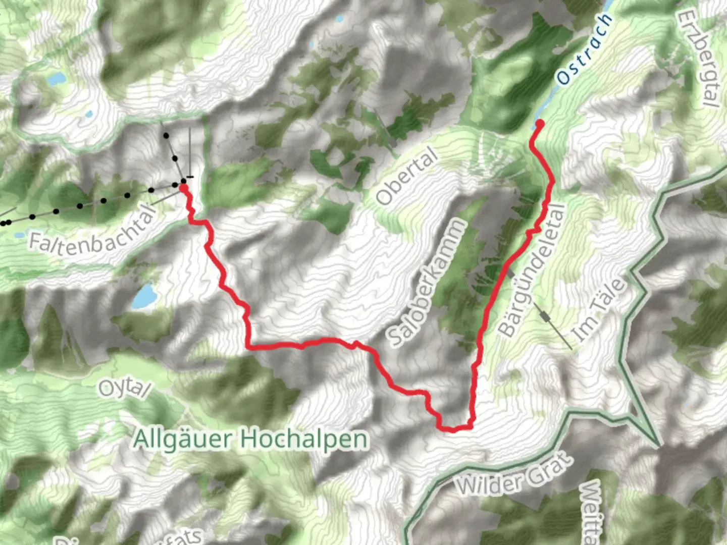
13.4 km
~3 hrs 57 min
764 m
Point-to-Point
“Embark on a breathtaking alpine adventure through vibrant meadows, dense forests, and historical trails in Oberallgäu.”
Nestled in the picturesque region of Oberallgäu, Germany, the Edmund to Giebel Via Alpina Purple Trail offers a challenging yet rewarding hiking experience. Spanning approximately 13 kilometers (about 8 miles) with an elevation gain of around 700 meters (approximately 2,300 feet), this point-to-point trail is best suited for experienced hikers seeking a demanding adventure.
Getting There
To reach the trailhead near Oberallgäu, you can opt for public transport or drive. If you're using public transport, the nearest major town is Oberstdorf, which is well-connected by train. From Oberstdorf, local buses can take you closer to the trailhead. If driving, you can park near the starting point, which is accessible via local roads leading from Oberstdorf.
Trail Overview
The trail begins with a steady ascent through lush alpine meadows, where you'll be greeted by the vibrant colors of wildflowers during the warmer months. As you gain elevation, the landscape transitions into dense forests, offering a serene environment with the gentle rustling of leaves and the occasional chirping of birds.
Significant Landmarks
As you progress, you'll encounter several notable landmarks. One of the highlights is the panoramic view from the Giebel summit, which provides breathtaking vistas of the surrounding Allgäu Alps. This spot is perfect for a brief rest and photo opportunity, allowing you to soak in the majestic beauty of the region.
Nature and Wildlife
The trail is home to a diverse range of flora and fauna. Keep an eye out for the elusive chamois and marmots, which are often spotted along the rocky sections of the trail. Bird enthusiasts might also catch sight of golden eagles soaring above the alpine ridges.
Historical Significance
The Oberallgäu region is steeped in history, with its roots tracing back to ancient times. The trail itself is part of the larger Via Alpina network, which has been used for centuries as a trade and pilgrimage route. This historical significance adds a layer of depth to your hiking experience, as you traverse paths once walked by traders and travelers of old.
Navigation and Safety
Given the trail's difficulty rating, it's crucial to be well-prepared. Ensure you have a reliable navigation tool like HiiKER to guide you through the more challenging sections. Weather conditions can change rapidly in the mountains, so pack appropriate gear, including layers, rain protection, and sturdy hiking boots.
Final Stretch
The descent towards Giebel offers a mix of rocky paths and gentle slopes, leading you through more open landscapes. As you near the end of the trail, the terrain becomes less demanding, allowing you to reflect on the journey and the natural wonders you've encountered along the way.

Comments and Reviews
User comments, reviews and discussions about the Edmund to Giebel Via Alpina Purple Trail, Germany.
4.0
average rating out of 5
2 rating(s)