Download
3D Flyover
Add to list
More
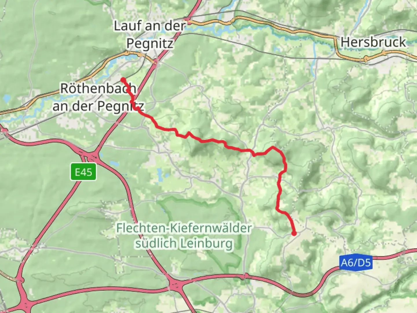
15.7 km
~3 hrs 53 min
446 m
Point-to-Point
“Explore enchanting landscapes and history on the Weibenbrunn to Rothenbach trail, ideal for all adventurers.”
Nestled in the picturesque region of Nürnberger Land, Germany, the Weibenbrunn to Rothenbach Walk offers a delightful journey through serene landscapes and charming villages. This point-to-point trail stretches approximately 16 kilometers (about 10 miles) with an elevation gain of around 400 meters (approximately 1,312 feet), making it an accessible adventure for hikers of all skill levels.
Getting There
To reach the trailhead near Nürnberger Land, travelers can opt for public transport or drive. If you're using public transport, the nearest major city is Nuremberg, which is well-connected by train and bus services. From Nuremberg, take a regional train to the nearest station, such as Hersbruck, and then a local bus or taxi to the trailhead. For those driving, the trailhead is accessible via the A9 motorway, with parking available near the starting point.
Trail Highlights
As you embark on this journey, you'll traverse a landscape rich in natural beauty and cultural history. The trail begins in the quaint village of Weibenbrunn, where you can admire traditional Bavarian architecture and perhaps enjoy a local pastry before setting off.
Nature and Wildlife
The trail meanders through lush forests and open meadows, offering a chance to spot local wildlife such as deer, foxes, and a variety of bird species. In spring and summer, the meadows burst into color with wildflowers, creating a vibrant tapestry against the backdrop of verdant hills.
Historical Significance
This region is steeped in history, with remnants of medieval settlements and ancient trade routes. As you hike, you'll pass by several historical landmarks, including the ruins of old fortifications and charming stone bridges that have stood the test of time. These sites offer a glimpse into the area's past, where trade and travel flourished along these paths.
Navigational Tips
The trail is well-marked, but it's always wise to have a reliable navigation tool. HiiKER is an excellent choice for this trail, providing detailed maps and real-time updates to ensure you stay on course. The app can also alert you to any changes in trail conditions or weather, helping you plan your hike more effectively.
Points of Interest
Midway through the hike, you'll encounter a scenic viewpoint offering panoramic vistas of the surrounding countryside. This is an ideal spot for a rest and a picnic, allowing you to soak in the tranquil beauty of the region. As you continue towards Rothenbach, the trail gently descends, leading you through more forested areas and past small streams that add a soothing soundtrack to your journey.
Arrival in Rothenbach
The trail concludes in the village of Rothenbach, where you can explore local shops and cafes. This charming village is a perfect place to unwind after your hike, offering a taste of local culture and hospitality. Whether you're savoring a traditional Bavarian meal or simply enjoying the peaceful ambiance, Rothenbach provides a fitting end to this delightful hiking experience.

Comments and Reviews
User comments, reviews and discussions about the Weibenbrunn to Rothenbach Walk, Germany.
average rating out of 5
0 rating(s)