Download
3D Flyover
Add to list
More
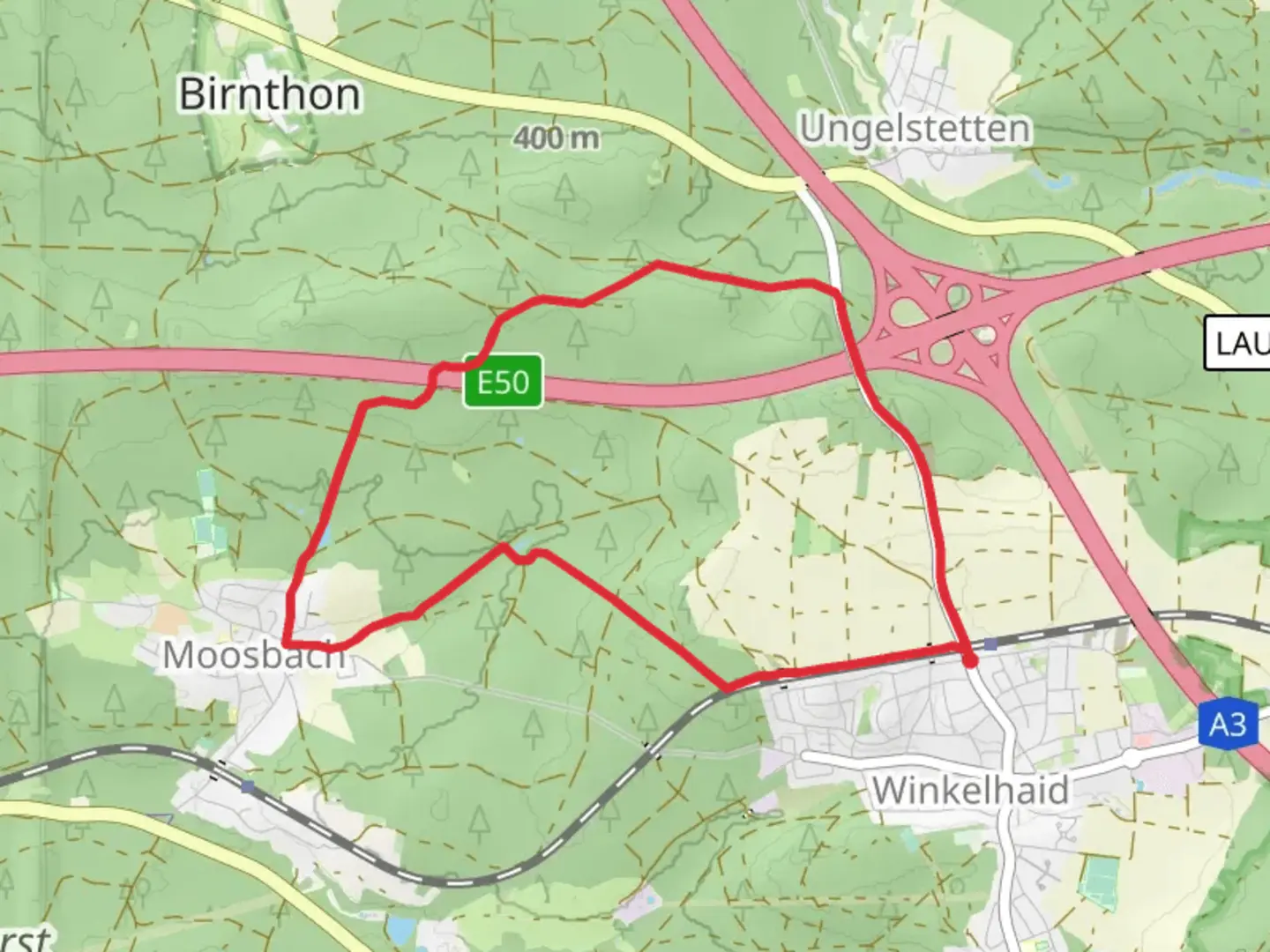
7.8 km
~1 hrs 43 min
100 m
Loop
“The Rundweg um Winkelhaid trail blends scenic beauty, historical landmarks, and moderate challenges for a rewarding hike.”
Starting near Nürnberger Land in Germany, the Rundweg um Winkelhaid is an 8 km (approximately 5 miles) loop trail with an elevation gain of around 100 meters (328 feet). This trail offers a medium difficulty rating, making it suitable for moderately experienced hikers.
Getting There
To reach the trailhead, you can take public transport or drive. If you're using public transport, the nearest significant landmark is Winkelhaid Bahnhof (Winkelhaid Train Station). From there, it's a short walk to the trailhead. For those driving, you can park near the train station or in designated parking areas around Winkelhaid.
Trail Overview
The trail begins with a gentle ascent, allowing you to ease into the hike. As you progress, you'll encounter a mix of forested areas and open fields, providing a diverse range of scenery. The initial 2 km (1.2 miles) will take you through dense woodlands, where you might spot local wildlife such as deer and various bird species.
Historical Significance
Around the 3 km (1.8 miles) mark, you'll come across remnants of historical significance. This region has a rich history dating back to medieval times, and you may notice old stone markers and ruins that hint at its past. These landmarks offer a glimpse into the area's historical context, making your hike not just a physical journey but also a walk through history.
Mid-Trail Highlights
At approximately 4 km (2.5 miles), you'll reach a scenic viewpoint that offers panoramic views of the surrounding countryside. This is an excellent spot to take a break, enjoy a snack, and capture some photos. The elevation gain here is about 50 meters (164 feet), providing a moderate challenge but rewarding you with stunning vistas.
Flora and Fauna
As you continue, the trail meanders through a mix of deciduous and coniferous forests. Depending on the season, you might see wildflowers in bloom or autumn leaves creating a colorful canopy. Keep an eye out for local flora such as oak, beech, and pine trees. The diverse ecosystem supports a variety of wildlife, including foxes, hares, and numerous bird species.
Navigation and Safety
The trail is well-marked, but it's always a good idea to have a reliable navigation tool. HiiKER is recommended for accurate trail maps and real-time updates. Ensure you have adequate water and snacks, as there are no facilities along the trail. Wear sturdy hiking boots, especially during wetter months when the trail can become muddy.
Final Stretch
The last 2 km (1.2 miles) of the trail will take you through more open fields and meadows, gradually descending back towards the starting point. This section is relatively easy, allowing you to cool down and reflect on the hike. As you approach the end, you'll pass through a small village area, where you can explore local shops or cafes if you wish.
This loop trail offers a balanced mix of natural beauty, historical landmarks, and moderate physical challenge, making it a rewarding experience for hikers.

What to expect?
Activity types
Comments and Reviews
User comments, reviews and discussions about the Rundweg um Winkelhaid, Germany.
4.44
average rating out of 5
9 rating(s)