Download
Preview
Add to list
More
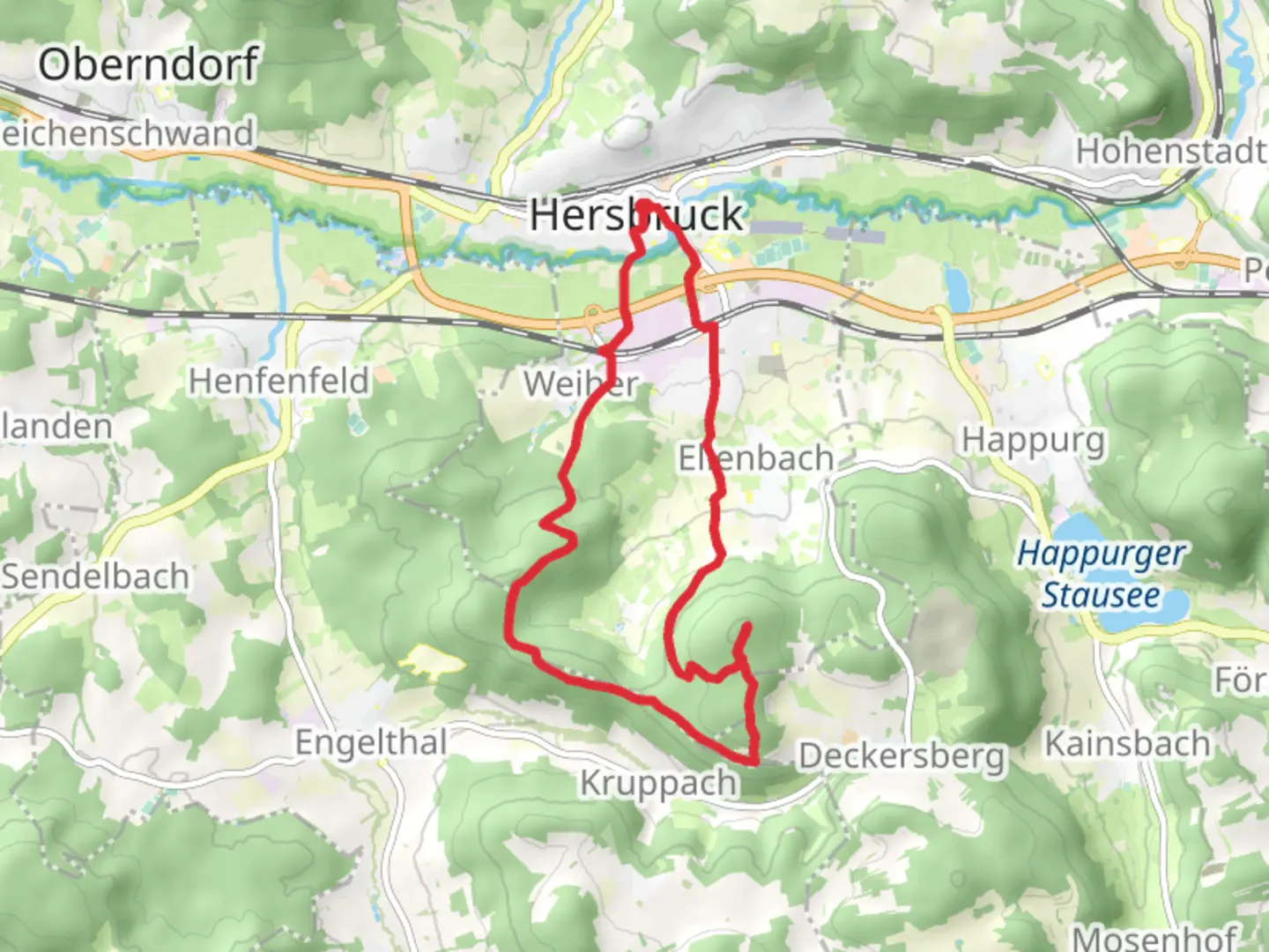
13.8 km
~3 hrs 18 min
336 m
Loop
“This 14 km loop near Nürnberger Land blends natural beauty, historical intrigue, and moderate hiking challenges.”
Starting near Nürnberger Land, Germany, this 14 km (approximately 8.7 miles) loop trail offers a delightful mix of natural beauty and historical intrigue. With an elevation gain of around 300 meters (approximately 984 feet), the trail is rated as medium difficulty, making it suitable for moderately experienced hikers.
Getting There
To reach the trailhead, you can either drive or use public transport. If driving, set your GPS to the vicinity of Nürnberger Land. For those using public transport, take a train to Hersbruck, which is well-connected to major cities like Nuremberg. From Hersbruck, local buses can take you closer to the trailhead.
Trail Navigation
For navigation, the HiiKER app is highly recommended. It provides detailed maps and real-time updates to ensure you stay on track.
Trail Highlights
The trail begins with a gentle ascent through lush forests, offering a serene start to your hike. As you progress, you'll encounter the Hersbrucker Rundweg, a scenic route that circles the charming town of Hersbruck. This section is particularly rich in flora, with a variety of native plants and trees that change with the seasons.
Historical Significance
Hersbruck itself is steeped in history. The town dates back to the Middle Ages and features well-preserved architecture, including the Hersbruck Castle. As you hike, you'll pass by several historical markers and plaques that provide insights into the region's past.
Nature and Wildlife
The trail is a haven for birdwatchers. Keep an eye out for species like the European robin and the great spotted woodpecker. The diverse habitats along the trail, from dense forests to open meadows, support a wide range of wildlife.
Key Landmarks
Around the 5 km (3.1 miles) mark, you'll reach a viewpoint that offers panoramic views of the Franconian landscape. This is an excellent spot for a break and some photography. Continuing on, you'll join the Frankenweg Teil, another historic route that traverses the Franconian region.
Elevation and Terrain
The trail features a mix of ascents and descents, with the most significant climb occurring around the 8 km (5 miles) point. Here, you'll gain approximately 150 meters (492 feet) in elevation over a relatively short distance, so be prepared for a bit of a workout.
Final Stretch
The last few kilometers take you through more open terrain, offering expansive views and a chance to reflect on the journey. As you loop back towards the starting point, the trail descends gently, making for a pleasant and relaxing end to your hike.
Practical Tips
- Wear sturdy hiking boots, as the terrain can be uneven in places.
- Bring enough water and snacks, especially if you plan to take your time exploring the historical sites.
- Check the weather forecast before you go; the trail can be slippery after rain.
This trail offers a perfect blend of natural beauty, historical landmarks, and moderate physical challenge, making it a rewarding experience for any hiker.

What to expect?
Activity types
Comments and Reviews
User comments, reviews and discussions about the Arzberg via Hersbrucker Rundweg and Frankenweg Teil, Germany.
5.0
average rating out of 5
2 rating(s)