Download
3D Flyover
Add to list
More
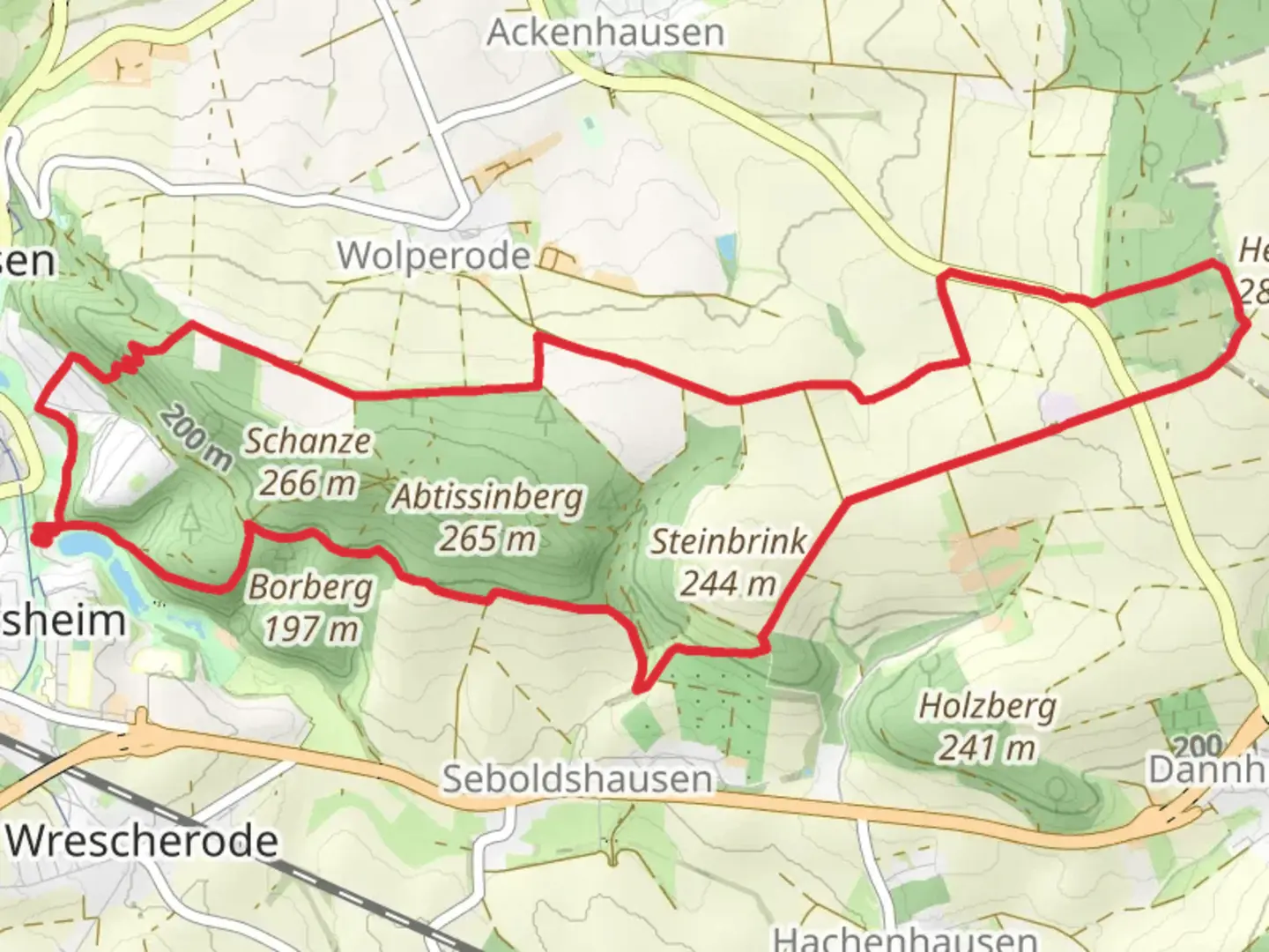
12.7 km
~3 hrs 2 min
295 m
Loop
“Explore Northeim’s scenic 13 km loop with panoramic views, historical landmarks, and diverse wildlife.”
Starting near the charming town of Northeim, Germany, the Grosser Osterberg via Heberweg and Hochbehaetter trail offers a delightful 13 km (8 miles) loop with an elevation gain of approximately 200 meters (656 feet). This medium-difficulty hike is perfect for those looking to explore the natural beauty and historical richness of the region.
Getting There
To reach the trailhead, you can drive to Northeim, which is well-connected by major roads. If you prefer public transport, Northeim has a train station with regular services from Göttingen and Hannover. From the station, you can take a local bus or taxi to the trailhead, located near the outskirts of the town.
Trail Overview
The trail begins with a gentle ascent through mixed forests, offering a serene start to your hike. As you progress, you'll encounter the Heberweg section, which is known for its well-maintained paths and occasional clearings that provide stunning views of the surrounding countryside. Keep an eye out for local wildlife, including deer and various bird species that inhabit the area.
Significant Landmarks
Around the 4 km (2.5 miles) mark, you'll reach the Hochbehaetter section, where the trail becomes slightly steeper. This part of the hike is particularly scenic, with dense forests giving way to open meadows. Here, you can enjoy panoramic views of the Harz Mountains in the distance. The elevation gain in this section is about 100 meters (328 feet), making it the most challenging part of the hike.
Historical Significance
The region around Northeim has a rich history dating back to medieval times. As you hike, you'll come across remnants of old stone walls and possibly even ancient boundary markers. These historical artifacts offer a glimpse into the area's past, where it served as a strategic location for trade and defense.
Flora and Fauna
The trail is abundant with diverse flora, including oak, beech, and pine trees. In spring and summer, the forest floor is carpeted with wildflowers, adding a splash of color to your hike. The area is also home to various wildlife, such as foxes, badgers, and numerous bird species, making it a haven for nature enthusiasts.
Navigation and Safety
For navigation, it's highly recommended to use the HiiKER app, which provides detailed maps and real-time updates. The trail is well-marked, but having a reliable navigation tool ensures you stay on track and can fully enjoy your hike without any worries.
Final Stretch
As you near the end of the loop, the trail descends gently back towards Northeim. This section is less strenuous, allowing you to relax and take in the final views of the picturesque landscape. The last few kilometers wind through peaceful woodlands, eventually leading you back to the trailhead.
This hike offers a perfect blend of natural beauty, historical intrigue, and moderate physical challenge, making it a rewarding experience for hikers of all levels.

What to expect?
Activity types
Comments and Reviews
User comments, reviews and discussions about the Grosser Osterberg via Heberweg and Hochbehaetter, Germany.
4.0
average rating out of 5
3 rating(s)