Download
3D Flyover
Add to list
More
9.8 km
~2 hrs 10 min
124 m
Loop
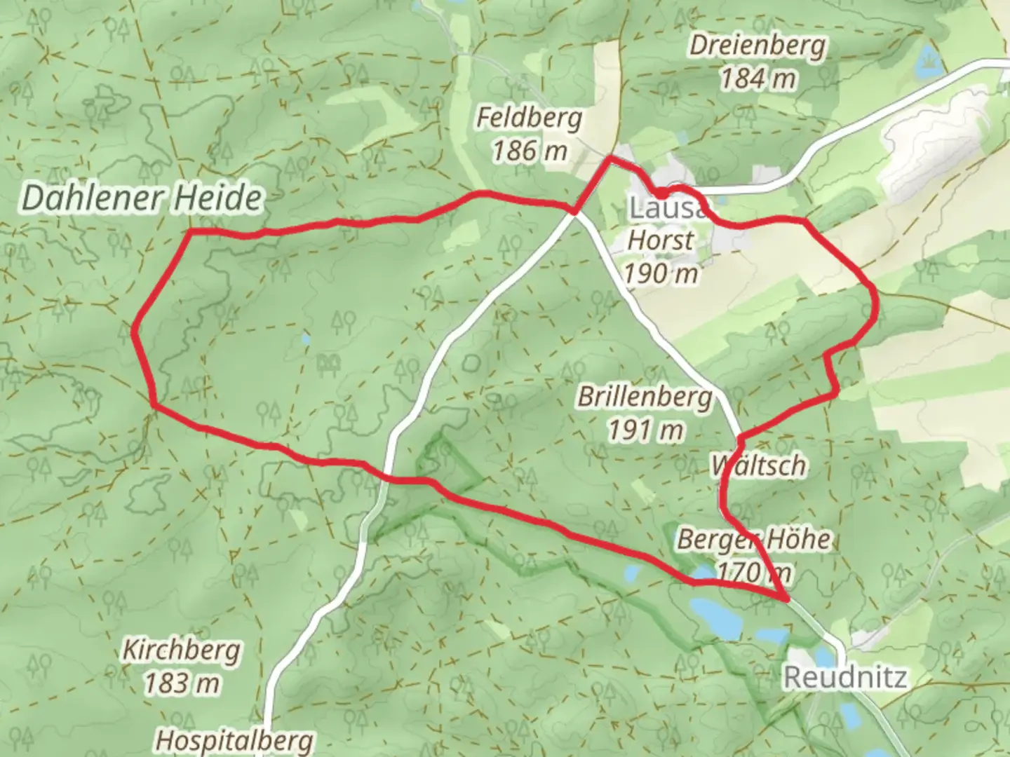
“Embark on the Berger Hoehe via G Weg for a scenic, historical, and wildlife-filled 10-kilometer adventure.”
Starting near Nordsachsen, Germany, the Berger Hoehe via G Weg trail is a captivating loop trail that spans approximately 10 kilometers (6.2 miles) with an elevation gain of around 100 meters (328 feet). This medium-difficulty trail offers a delightful mix of natural beauty, historical landmarks, and wildlife sightings, making it a rewarding experience for hikers.
Getting There
To reach the trailhead, you can either drive or use public transport. If driving, set your GPS to the vicinity of Nordsachsen, Germany. For those using public transport, the nearest significant landmark is the town of Eilenburg. From Eilenburg, you can take a local bus or taxi to the trailhead.
Trail Navigation
For navigation, it is highly recommended to use the HiiKER app, which provides detailed maps and real-time updates to ensure you stay on the right path.
Trail Highlights
Initial Ascent
The trail begins with a gentle ascent through a mixed forest, where you will encounter a variety of native trees such as oak, beech, and pine. The initial 2 kilometers (1.2 miles) are relatively easy, with a gradual elevation gain of about 30 meters (98 feet). Keep an eye out for local wildlife, including deer and various bird species.
Historical Significance
Around the 3-kilometer (1.9-mile) mark, you will come across remnants of old stone structures. These ruins date back to the medieval period and offer a glimpse into the region's rich history. Take a moment to explore and imagine the lives of those who once inhabited this area.
Scenic Overlook
At approximately 5 kilometers (3.1 miles), you will reach the highest point of the trail, Berger Hoehe. This vantage point offers stunning panoramic views of the surrounding countryside. On a clear day, you can see for miles, making it an ideal spot for a rest and some photography.
Flora and Fauna
As you descend from Berger Hoehe, the trail meanders through meadows and small patches of woodland. During spring and summer, these meadows are adorned with wildflowers, attracting butterflies and bees. You might also spot small mammals like hares and foxes.
Final Stretch
The last 2 kilometers (1.2 miles) of the trail loop back towards the starting point. This section is relatively flat and easy, allowing you to cool down and reflect on the hike. The path here is well-marked and wide, making it accessible for hikers of all skill levels.
Practical Tips
- Footwear: Sturdy hiking boots are recommended due to uneven terrain.
- Water: Carry at least 1-2 liters of water, especially during warmer months.
- Weather: Check the weather forecast before heading out, as conditions can change rapidly.
- Wildlife: Be respectful of wildlife and maintain a safe distance.
This trail offers a perfect blend of natural beauty, historical intrigue, and moderate physical challenge, making it a must-visit for any hiking enthusiast.
What to expect?
Activity types
Comments and Reviews
User comments, reviews and discussions about the Berger Hoehe via G Weg, Germany.
4.67
average rating out of 5
3 rating(s)
