Download
Preview
Add to list
More
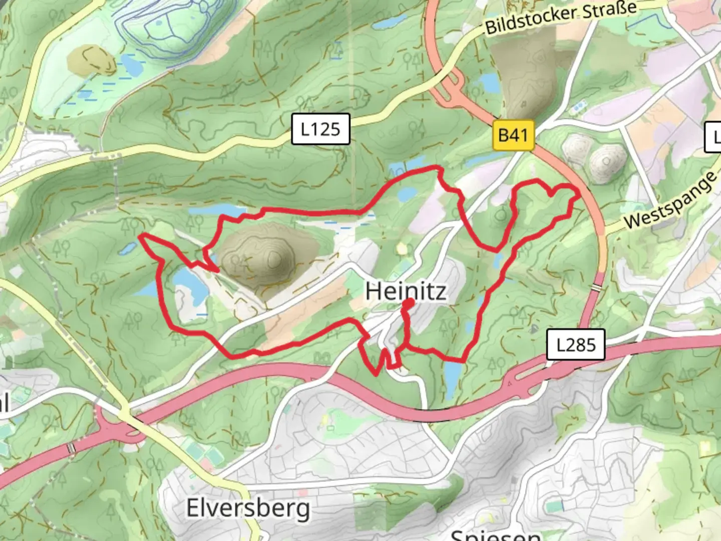
10.6 km
~2 hrs 28 min
215 m
Loop
“The 12 Weiher Weg loop near Neunkirchen, Germany, offers 11 km of stunning ponds, diverse wildlife, and historical landmarks.”
Starting near Neunkirchen, Germany, the Heinitzer Weiher via 12 Weiher Weg is a picturesque loop trail that spans approximately 11 kilometers (6.8 miles) with an elevation gain of around 200 meters (656 feet). This medium-difficulty trail offers a delightful mix of natural beauty, historical landmarks, and serene water bodies.
Getting There
To reach the trailhead, you can drive to Neunkirchen, where ample parking is available near the starting point. If you prefer public transport, Neunkirchen is well-connected by train and bus services. The nearest train station is Neunkirchen (Saar) Hauptbahnhof, from where you can take a local bus or taxi to the trailhead.
Trail Highlights
Heinitzer Weiher
One of the first significant landmarks you'll encounter is the Heinitzer Weiher, a tranquil pond surrounded by lush greenery. This spot is perfect for a short break and offers excellent opportunities for bird-watching and photography.
12 Weiher Weg
As the name suggests, the trail takes you past 12 different ponds, each with its unique charm. These water bodies are home to various species of fish, amphibians, and birds, making it a haven for nature enthusiasts. The ponds are well-distributed along the trail, providing frequent scenic spots to rest and enjoy the surroundings.
Flora and Fauna
The trail meanders through dense forests and open meadows, offering a diverse range of flora and fauna. Depending on the season, you might encounter wildflowers, mushrooms, and a variety of trees such as oak, beech, and pine. Wildlife sightings could include deer, foxes, and numerous bird species.
Historical Significance
The region around Neunkirchen has a rich history, particularly related to its industrial past. While the trail itself is primarily focused on natural beauty, you may come across remnants of old mining operations and historical markers that provide insight into the area's industrial heritage.
Navigation and Safety
Given the trail's moderate difficulty, it's advisable to use a reliable navigation tool like HiiKER to ensure you stay on the correct path. The trail is well-marked, but having a digital map can be very helpful, especially in densely wooded areas where the path might be less obvious.
Elevation and Terrain
The trail features a mix of flat sections and gentle inclines, with the total elevation gain being around 200 meters (656 feet). The terrain varies from well-maintained paths to more rugged, natural trails. Good hiking boots are recommended to navigate the occasional rocky or muddy sections.
Points of Interest
- Neunkircher Zoo: Located near the trailhead, this zoo is home to a variety of animals and can be a great addition to your day.
- Bliestal Valley: As you hike, you'll get glimpses of the beautiful Bliestal Valley, known for its scenic landscapes and historical sites.
Practical Tips
- Water and Snacks: While the trail is not overly long, carrying sufficient water and some snacks is advisable.
- Weather: Check the weather forecast before heading out, as the trail can become slippery in wet conditions.
- Wildlife: Be respectful of the wildlife and maintain a safe distance from any animals you encounter.
This trail offers a perfect blend of natural beauty, historical intrigue, and moderate physical challenge, making it a rewarding experience for hikers of all levels.

Comments and Reviews
User comments, reviews and discussions about the Heinitzer Weiher via 12 Weiher Weg, Germany.
4.5
average rating out of 5
2 rating(s)