Schleusenkanal and Ruhr via Muelheim Wasserbf Rundweg and U Styrum Mintard Wasserbf
Download
3D Flyover
Add to list
More
7.6 km
~1 hrs 35 min
39 m
Loop
“An 8 km loop blending natural beauty and historical landmarks near Mülheim an der Ruhr, Germany.”
Starting near Mülheim an der Ruhr, Germany, this 8 km (approximately 5 miles) loop trail offers a delightful mix of natural beauty and historical significance. With no significant elevation gain, this trail is accessible to a wide range of hikers, making it an excellent choice for a medium-difficulty day hike.
Getting There
To reach the trailhead, you can either drive or use public transport. If driving, you can park near the Mülheim Wasserbahnhof, a well-known landmark in the area. For those using public transport, take the train to Mülheim (Ruhr) Hauptbahnhof and then transfer to a local bus or tram that stops near the Wasserbahnhof. The trailhead is conveniently located, making it easy to start your adventure.
Trail Navigation
The trail is well-marked, but it's always a good idea to have a reliable navigation tool like HiiKER to ensure you stay on track. The loop takes you through a variety of landscapes, including riverside paths, wooded areas, and urban sections, providing a diverse hiking experience.
Key Landmarks and Sections
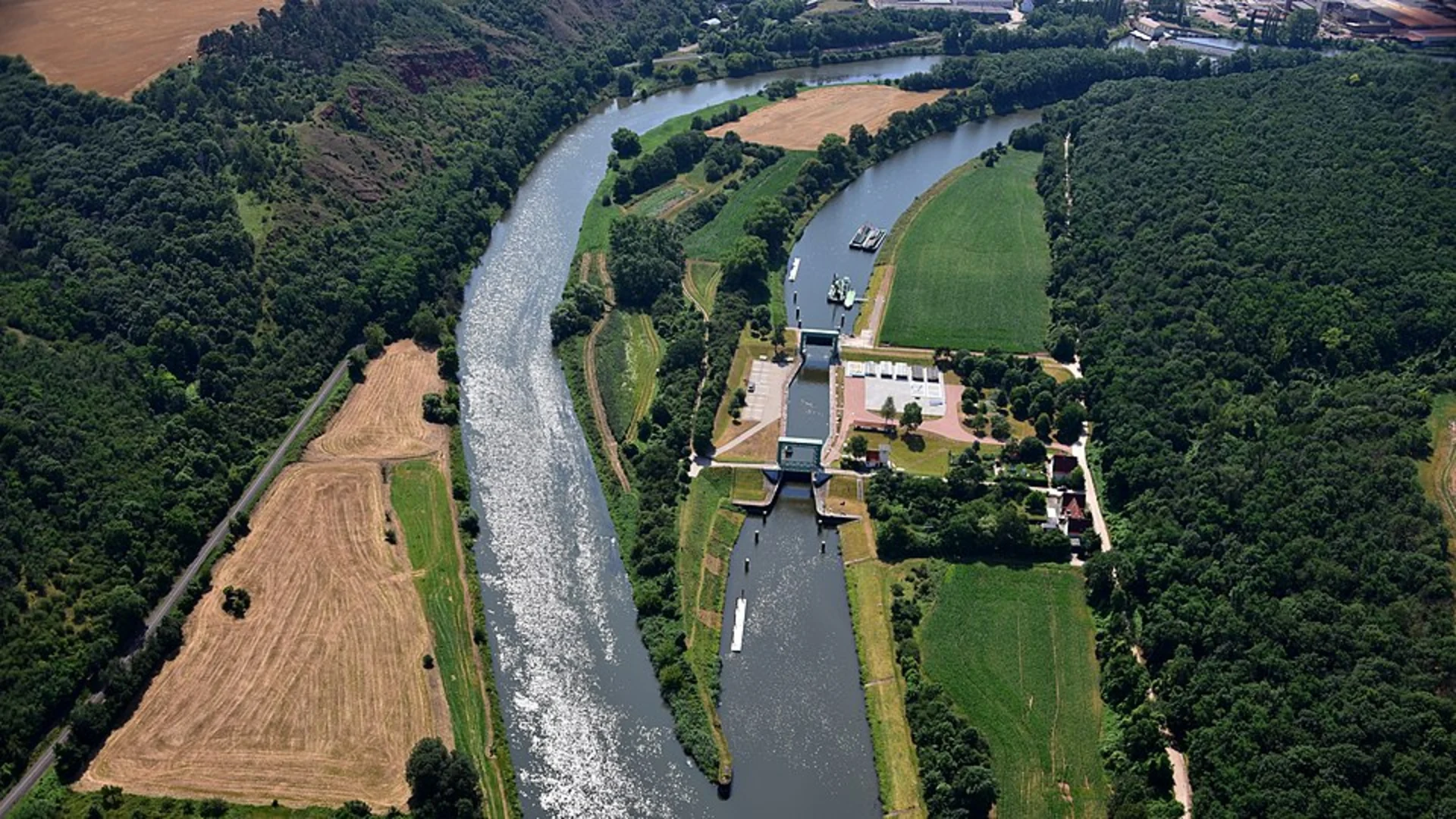
Schleusenkanal
The first section of the trail takes you along the Schleusenkanal, a historic canal that played a significant role in the industrial development of the Ruhr area. As you walk along the canal, you'll notice the old lock systems and industrial relics that tell the story of the region's past. This part of the trail is relatively flat and easy to navigate, making it a great warm-up for the rest of the hike.
Ruhr River
After the Schleusenkanal, the trail leads you to the banks of the Ruhr River. This section offers stunning views of the river and its surrounding landscapes. Keep an eye out for local wildlife, including various bird species and small mammals that inhabit the area. The riverbanks are also a popular spot for fishing and picnicking, so you might encounter locals enjoying these activities.
Mülheim Wasserbahnhof
As you continue, you'll pass by the Mülheim Wasserbahnhof, a historic water station that now serves as a cultural and recreational hub. This is a great spot to take a break, enjoy a snack, or even have a meal at one of the nearby cafes. The Wasserbahnhof is also a departure point for boat tours, offering a different perspective of the Ruhr River.
U Styrum Mintard Wasserbf
The trail then loops back towards the U Styrum Mintard Wasserbf, another significant landmark. This area is known for its lush greenery and tranquil atmosphere, providing a peaceful end to your hike. The path here is well-maintained and easy to follow, ensuring a smooth finish to your journey.
Historical Significance
The Mülheim an der Ruhr area has a rich industrial history, particularly in the context of the Ruhr Valley's development. The Schleusenkanal and various industrial relics along the trail are remnants of this era, offering a glimpse into the past. The Ruhr River itself was a crucial waterway for transporting goods, contributing to the region's economic growth.
Wildlife and Nature
Throughout the hike, you'll encounter a variety of natural habitats, from riverbanks to wooded areas. The diverse ecosystems support a range of wildlife, making it a great trail for nature enthusiasts. Birdwatchers will particularly enjoy the variety of species that can be spotted along the way.
This 8 km loop trail near Mülheim an der Ruhr offers a perfect blend of natural beauty, historical landmarks, and easy accessibility, making it a must-visit for hikers of all levels.

What to expect?
Activity types
Comments and Reviews
User comments, reviews and discussions about the Schleusenkanal and Ruhr via Muelheim Wasserbf Rundweg and U Styrum Mintard Wasserbf, Germany.
4.75
average rating out of 5
4 rating(s)