
Download
3D Flyover
Add to list
More
15.0 km
~3 hrs 8 min
95 m
Loop
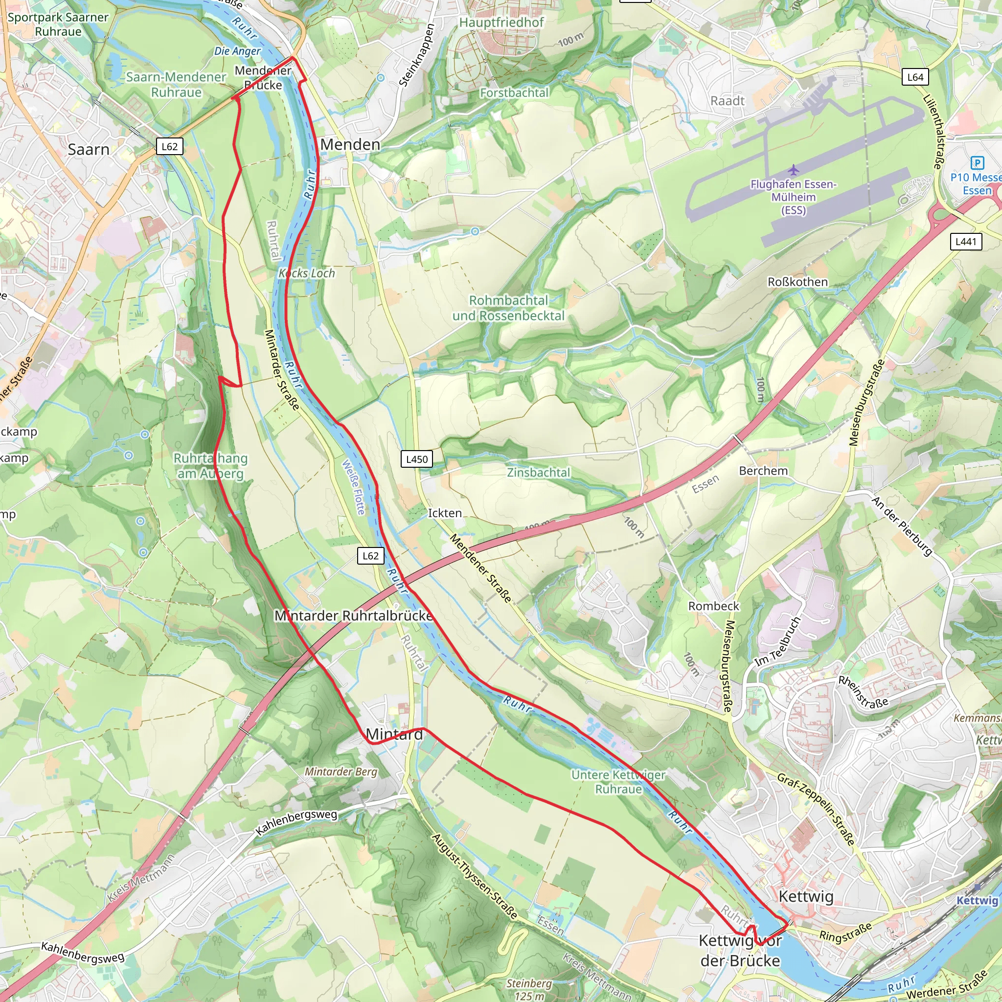
“Explore historical landmarks and scenic riverside paths on this accessible 15 km loop near Mülheim an der Ruhr.”
Starting near Mülheim an der Ruhr, Germany, this 15 km (approximately 9.3 miles) loop trail offers a moderate hiking experience with virtually no elevation gain, making it accessible for a wide range of fitness levels. The trailhead is conveniently located near the Mülheim an der Ruhr Hauptbahnhof (main train station), which is easily accessible by public transport. If you're driving, there are parking facilities available near the station.
Getting There
To reach the trailhead, you can take a train to Mülheim an der Ruhr Hauptbahnhof. From the station, it's a short walk to the starting point of the trail. If you prefer to drive, you can park at the nearby parking facilities and walk to the trailhead.
Trail Overview
The Ruhr via Muelheimer Bodenschaetze trail is a loop that takes you through a variety of landscapes, including urban areas, lush green parks, and serene riverside paths. The trail is well-marked, but it's always a good idea to have a reliable navigation tool like HiiKER to ensure you stay on track.
Key Landmarks and Points of Interest
- Ruhr River: One of the highlights of this trail is the scenic stretch along the Ruhr River. The riverbanks are lined with trees and offer a peaceful setting for a leisurely walk. Keep an eye out for local wildlife, including various bird species and small mammals.
- Broich Castle: Approximately 3 km (1.9 miles) into the hike, you'll come across Broich Castle, one of the oldest preserved castles in the Ruhr region. The castle dates back to the 9th century and offers a glimpse into the area's medieval history.
- Mülheim Water Museum: Around the 7 km (4.3 miles) mark, you'll find the Aquarius Water Museum, housed in a historic water tower. The museum offers interactive exhibits on the importance of water and its role in the region's development.
- Raffelbergpark: As you approach the 10 km (6.2 miles) point, you'll enter Raffelbergpark, a beautifully landscaped park that's perfect for a short rest. The park features well-maintained paths, benches, and a small pond.
Flora and Fauna
The trail offers a diverse range of flora and fauna. In the spring and summer months, the area is lush with greenery, wildflowers, and blooming trees. Birdwatchers will enjoy spotting species like kingfishers, herons, and various songbirds. Small mammals such as rabbits and squirrels are also commonly seen along the trail.
Historical Significance
The region around Mülheim an der Ruhr has a rich industrial history. The trail passes through areas that were once bustling with coal mining and steel production. Informational plaques along the route provide insights into the historical significance of these sites, making the hike both educational and enjoyable.
Practical Tips
- Footwear: Given the trail's moderate difficulty and varied terrain, sturdy hiking shoes are recommended.
- Weather: Check the weather forecast before you set out, as the trail can become muddy in wet conditions.
- Supplies: Bring enough water and snacks, especially if you plan to take your time exploring the various points of interest.
- Navigation: Use HiiKER to keep track of your progress and ensure you stay on the correct path.
This trail offers a perfect blend of natural beauty, historical landmarks, and educational opportunities, making it a rewarding experience for hikers of all levels.
What to expect?
Activity types
Comments and Reviews
User comments, reviews and discussions about the Ruhr via Muelheimer Bodenschaetze, Germany.
4.8
average rating out of 5
5 rating(s)

