Download
Preview
Add to list
More
14.4 km
~4 hrs 19 min
859 m
Loop
“Discover Bavarian Alps' charm and history on this scenic, medium-difficulty 14 km loop from Miesbach.”
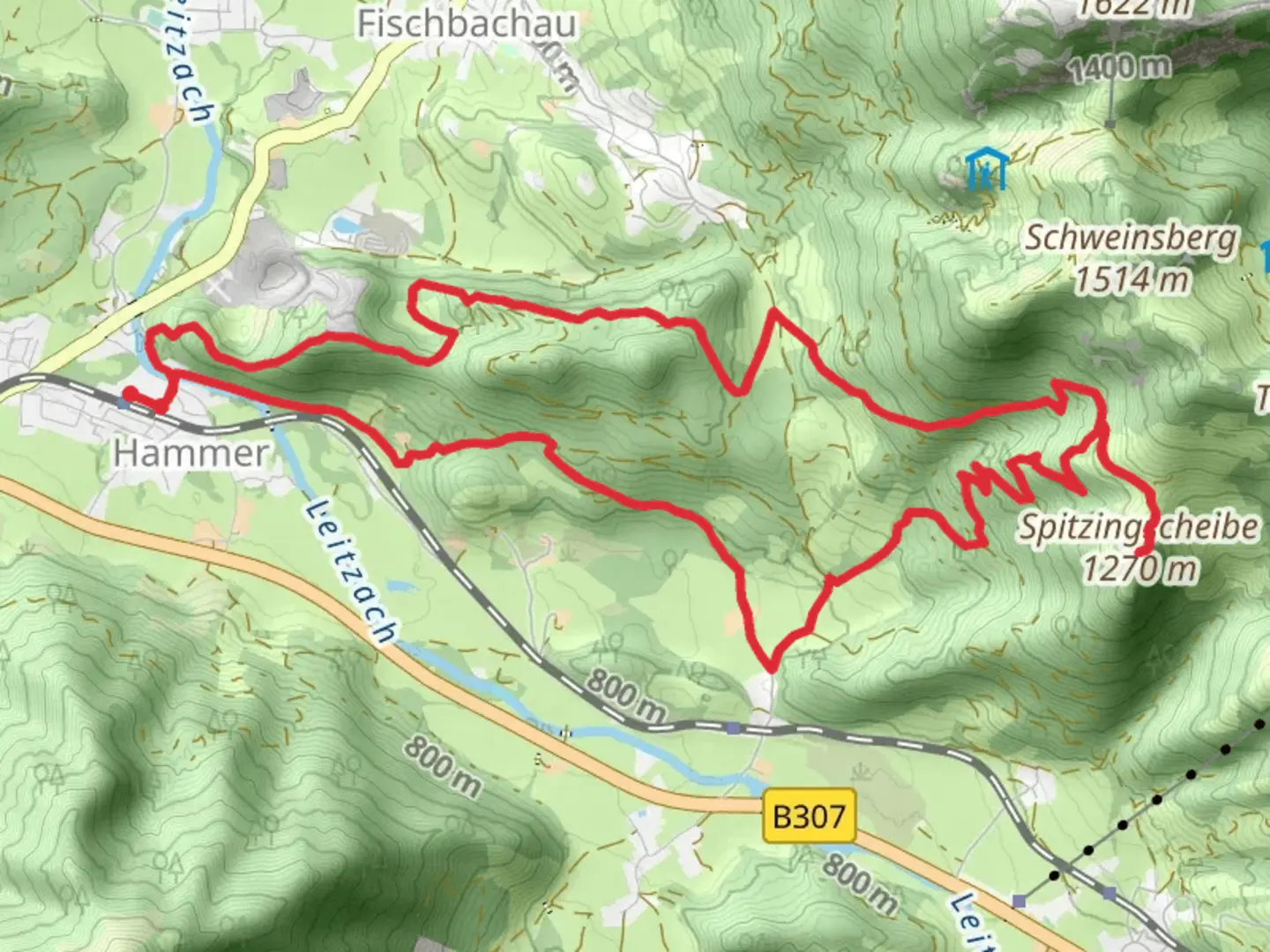
Starting near the charming town of Miesbach, Germany, the Karolinenhoehe and Spitzingscheibe via Wanderweg trail offers a delightful loop hike of approximately 14 km (8.7 miles) with an elevation gain of around 800 meters (2,625 feet). This medium-difficulty trail is perfect for those looking to immerse themselves in the natural beauty and historical richness of the Bavarian Alps.### Getting There To reach the trailhead, you can either drive or use public transport. If driving, set your GPS to Miesbach, a picturesque town located about 50 km (31 miles) southeast of Munich. There are several parking options available in Miesbach. For those using public transport, take a train from Munich to Miesbach, which takes roughly an hour. From the Miesbach train station, the trailhead is a short walk away.### Trail Overview The trail begins near the center of Miesbach, leading you through lush forests and open meadows. Early on, you'll encounter gentle inclines that gradually become steeper as you ascend towards Karolinenhoehe. The first significant landmark is the Karolinenhoehe viewpoint, located approximately 5 km (3.1 miles) into the hike. Here, you can take a break and enjoy panoramic views of the surrounding valleys and peaks.### Flora and Fauna As you continue, the trail meanders through dense forests of spruce and fir, interspersed with clearings that offer glimpses of the alpine landscape. Keep an eye out for local wildlife, including deer, foxes, and a variety of bird species. In the spring and summer months, the meadows are adorned with wildflowers, adding a splash of color to your hike.### Historical Significance The region around Miesbach has a rich history, dating back to the Middle Ages. The trail itself passes near several historical sites, including old farmhouses and remnants of ancient trade routes. One notable landmark is the Spitzingscheibe, a historical marker that dates back to the 18th century, located about 10 km (6.2 miles) into the hike. This marker was used to delineate the boundaries of local territories and is a fascinating glimpse into the area's past.### Navigation and Safety Given the trail's moderate difficulty, it's advisable to use a reliable navigation tool like HiiKER to stay on track. The trail is well-marked, but having a digital map can be invaluable, especially in areas where the path may be less distinct. Make sure to wear sturdy hiking boots and bring plenty of water, as the elevation gain can be quite demanding.### Final Stretch The final stretch of the trail descends back towards Miesbach, offering a more relaxed walk through rolling hills and pastures. This section is particularly scenic, with views of the town and the distant mountains. As you approach the end of the loop, you'll pass by several traditional Bavarian inns where you can stop for a well-deserved meal or refreshment.This hike offers a perfect blend of natural beauty, historical intrigue, and physical challenge, making it a must-do for any avid hiker exploring the Bavarian Alps.

What to expect?
Activity types
Comments and Reviews
User comments, reviews and discussions about the Karolinenhoehe and Spitzingscheibe via Wanderweg, Germany.
4.0
average rating out of 5
2 rating(s)