Download
3D Flyover
Add to list
More
6.6 km
~1 hrs 35 min
166 m
Loop
“Explore Meißen's scenic landscapes and history on this 7 km loop with panoramic views and rich biodiversity.”
Starting near the picturesque town of Meißen, Germany, the Boselspitze and Karlshoehe via Elberadweg and Rautenbergweg trail offers a delightful 7 km (4.3 miles) loop with an elevation gain of approximately 100 meters (328 feet). This medium-difficulty trail is perfect for those looking to explore the natural beauty and historical richness of the region.
Getting There
To reach the trailhead, you can either drive or use public transport. If driving, head towards Meißen and look for parking options near the Elberadweg. For those using public transport, Meißen is well-connected by train from major cities like Dresden. From the Meißen train station, you can take a local bus or a short taxi ride to the trailhead.
Trail Overview
The trail begins near the Elberadweg, a well-known cycling route along the Elbe River. As you start your hike, you'll be greeted by the serene views of the river and the lush greenery that surrounds it. The first section of the trail is relatively flat, making it a good warm-up for the more challenging parts ahead.
Key Landmarks and Sections
Elberadweg to Boselspitze
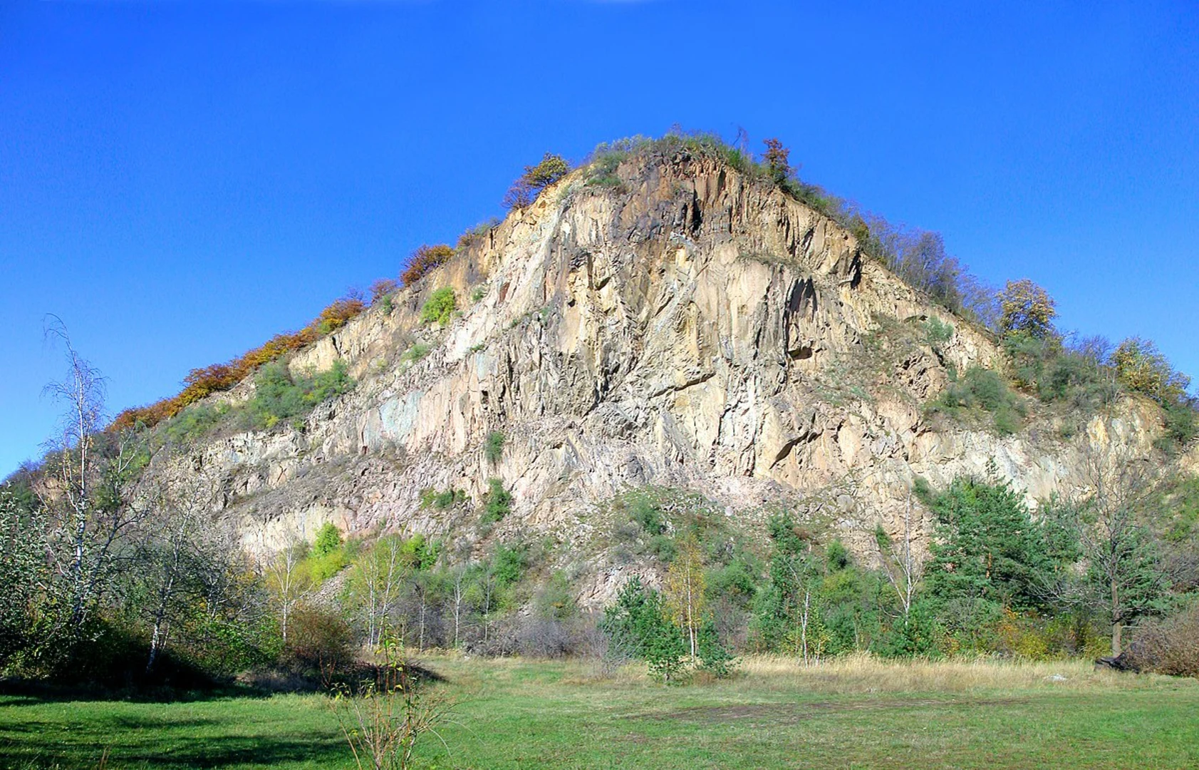
Approximately 2 km (1.2 miles) into the hike, you'll reach the Boselspitze, a small hill offering panoramic views of the Elbe Valley. This spot is perfect for a short break and some photography. The elevation gain here is gradual, making it accessible for most hikers.
Rautenbergweg to Karlshoehe
Continuing along the Rautenbergweg, the trail becomes a bit steeper as you approach Karlshoehe. This section is about 3 km (1.9 miles) from Boselspitze and involves a moderate climb. The effort is well worth it, as Karlshoehe provides stunning vistas of the surrounding countryside and the distant Saxon hills.
Flora and Fauna
The trail is rich in biodiversity. Keep an eye out for native bird species like the European robin and the black woodpecker. The forested areas are home to a variety of trees, including oak, beech, and pine. During spring and summer, the trail is adorned with wildflowers, adding a splash of color to your hike.
Historical Significance
Meißen is renowned for its historical significance, particularly its porcelain manufacturing, which dates back to the early 18th century. As you hike, you'll notice remnants of old trade routes and possibly even ancient boundary stones that mark historical land divisions. The Elbe River itself has been a crucial waterway for trade and transport for centuries.
Navigation
For navigation, it's highly recommended to use the HiiKER app, which provides detailed maps and real-time updates. The trail is well-marked, but having a reliable navigation tool can enhance your hiking experience and ensure you stay on the right path.
Final Stretch
The last 2 km (1.2 miles) of the trail loop back towards the Elberadweg, offering a gentle descent. This section is a great opportunity to cool down and reflect on the beautiful landscapes and historical landmarks you've encountered.
Whether you're a seasoned hiker or a casual walker, the Boselspitze and Karlshoehe via Elberadweg and Rautenbergweg trail offers a rewarding experience filled with natural beauty and historical intrigue.

What to expect?
Activity types
Comments and Reviews
User comments, reviews and discussions about the Boselspitze and Karlshoehe via Elberadweg and Rautenbergweg, Germany.
4.67
average rating out of 5
3 rating(s)