Download
3D Flyover
Add to list
More
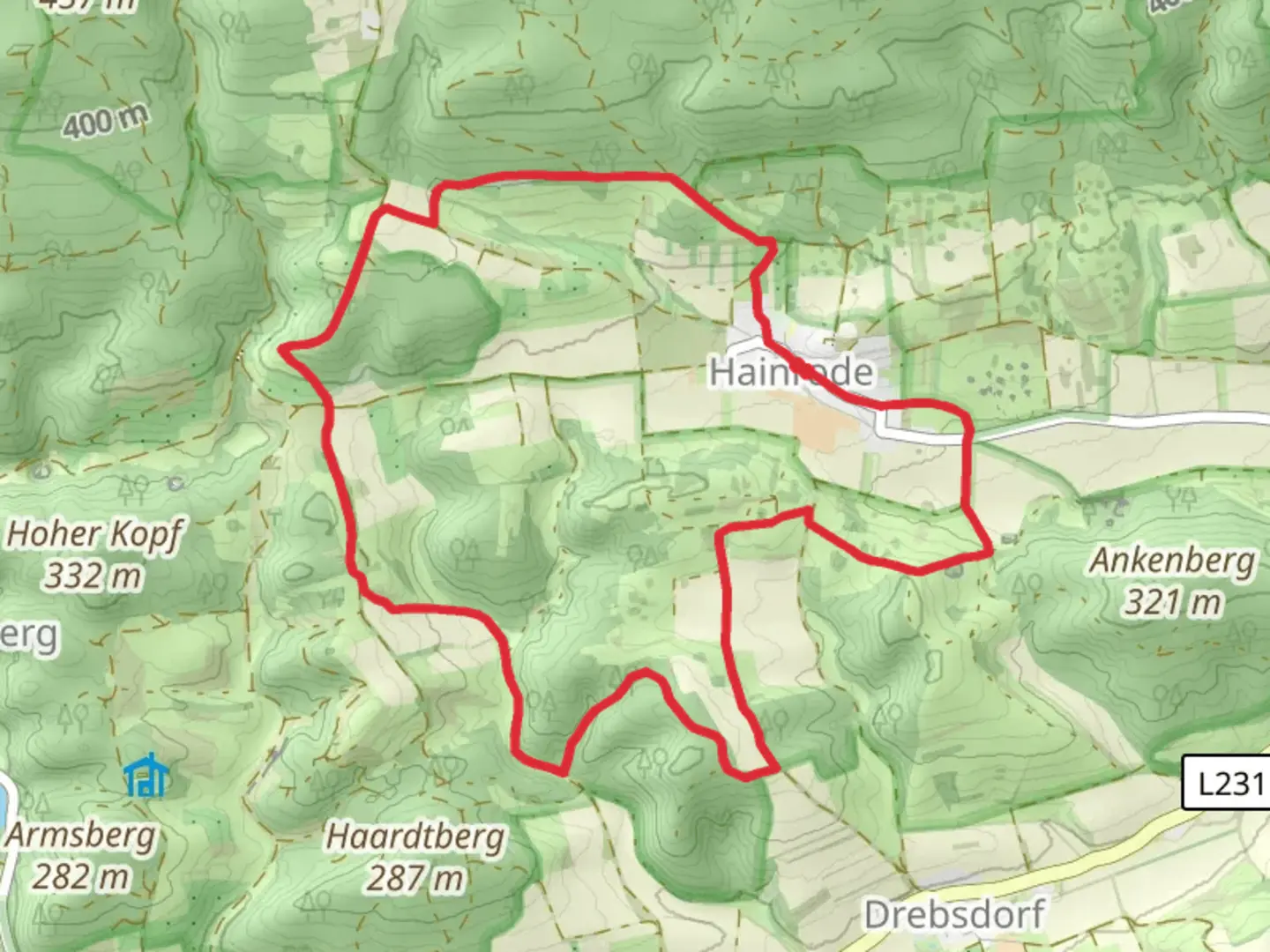
9.8 km
~2 hrs 21 min
236 m
Loop
“Rundweg Hainrode: A 10-kilometer trail blending natural beauty, historical landmarks, and diverse wildlife in Mansfeld-Südharz.”
Starting near the picturesque region of Mansfeld-Südharz in Germany, the Rundweg Hainrode is a delightful loop trail that spans approximately 10 kilometers (6.2 miles) with an elevation gain of around 200 meters (656 feet). This medium-difficulty trail offers a blend of natural beauty, historical landmarks, and diverse wildlife, making it a rewarding experience for hikers.
Getting There
To reach the trailhead, you can either drive or use public transport. If you're driving, set your GPS to Hainrode, a small village in the Mansfeld-Südharz district. For those using public transport, the nearest significant town is Sangerhausen. From Sangerhausen, you can take a local bus to Hainrode. The bus services are relatively frequent, but it's advisable to check the latest schedules on local transport websites.
Trail Navigation and Landmarks
Starting from Hainrode, the trail immediately immerses you in the serene beauty of the German countryside. The initial section is relatively flat, making it a good warm-up for the more challenging parts ahead. As you proceed, you'll encounter a gradual ascent, gaining about 100 meters (328 feet) in the first 3 kilometers (1.86 miles).
Historical Significance
Around the 4-kilometer (2.48 miles) mark, you'll come across the remnants of ancient mining operations. This region has a rich history of copper and silver mining dating back to the Middle Ages. Informational plaques along the trail provide insights into the historical significance of these sites, making it a fascinating stop for history enthusiasts.
Flora and Fauna
The trail is a haven for nature lovers. As you hike, you'll traverse through dense forests of beech and oak trees. In spring and summer, the forest floor is carpeted with wildflowers, including bluebells and anemones. Birdwatchers will be delighted by the variety of species, such as woodpeckers, owls, and various songbirds. Keep an eye out for deer and foxes, which are commonly spotted in this area.
Midpoint and Elevation Gain
At approximately the 5-kilometer (3.1 miles) midpoint, you'll reach the highest elevation of the trail, around 400 meters (1,312 feet) above sea level. This section offers panoramic views of the surrounding countryside, making it an ideal spot for a rest and some photography. The descent begins shortly after, with the trail winding through more forested areas and open meadows.
Navigation Tools
For accurate navigation, it's recommended to use the HiiKER app, which provides detailed maps and real-time updates. The trail is well-marked, but having a reliable navigation tool ensures you stay on track and can explore any interesting detours with confidence.
Final Stretch
The last 2 kilometers (1.24 miles) of the trail are relatively easy, with a gentle descent back into Hainrode. This section passes through agricultural fields and small streams, offering a peaceful end to your hike. As you approach the village, you'll notice traditional German architecture, adding a cultural touch to your journey.
The Rundweg Hainrode is a well-rounded trail that offers a bit of everything—natural beauty, historical intrigue, and a moderate physical challenge. Whether you're a seasoned hiker or a casual walker, this trail provides a fulfilling outdoor experience.

Comments and Reviews
User comments, reviews and discussions about the Rundweg Hainrode, Germany.
average rating out of 5
0 rating(s)