Download
3D Flyover
Add to list
More
8.7 km
~2 hrs 21 min
376 m
Loop
“The Taunusklub Route is a scenic, historical 9 km hike offering diverse nature and Roman ruins.”
Starting near Main-Taunus-Kreis, Germany, the Taunusklub Route is a delightful 9 km (5.6 miles) loop trail with an elevation gain of approximately 300 meters (984 feet). This medium-difficulty hike offers a mix of natural beauty, historical landmarks, and a touch of adventure, making it a perfect day hike for those looking to explore the Taunus region.
Getting There
To reach the trailhead, you can either drive or use public transport. If driving, set your GPS to Main-Taunus-Kreis, and look for parking options near the start of the trail. For those using public transport, take a train to Hofheim am Taunus station, which is the nearest significant landmark. From there, you can catch a local bus or taxi to the trailhead.
Trail Navigation
For navigation, it's highly recommended to use the HiiKER app, which provides detailed maps and real-time updates to ensure you stay on track. The trail is well-marked, but having a reliable navigation tool can enhance your hiking experience.
Trail Highlights
Nature and Wildlife
The Taunusklub Route meanders through dense forests, open meadows, and along serene streams. The diverse flora includes oak, beech, and pine trees, providing ample shade and a refreshing atmosphere. Keep an eye out for local wildlife such as deer, foxes, and a variety of bird species. The trail is particularly beautiful in spring when wildflowers bloom, adding a splash of color to the landscape.
Historical Significance
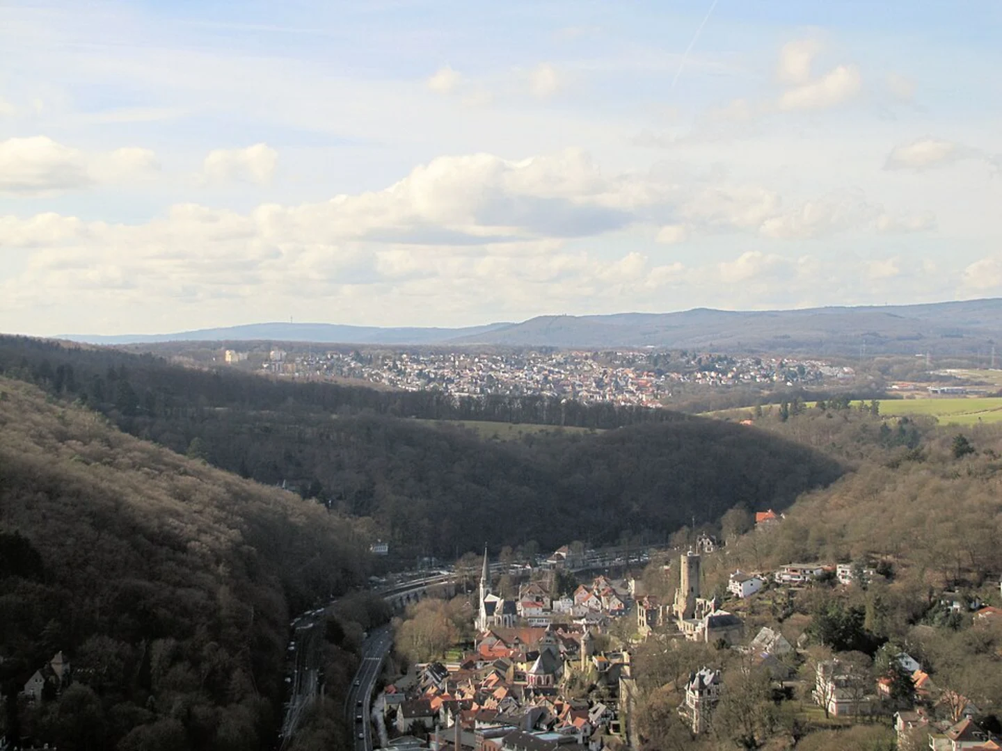
One of the most significant landmarks along the trail is the Staufen, a hill with historical ruins dating back to the Roman era. Approximately 4 km (2.5 miles) into the hike, you'll come across the remnants of an ancient Roman fort, offering a glimpse into the region's rich history. The fort was part of the Limes Germanicus, a line of frontier fortifications that marked the boundaries of the Roman Empire.
Key Sections
Initial Ascent
The first 2 km (1.2 miles) involve a steady ascent, gaining about 150 meters (492 feet) in elevation. This section can be a bit challenging, but the well-maintained path and the surrounding forest make it enjoyable.
Mid-Trail Plateau
After the initial climb, the trail levels out for the next 3 km (1.9 miles), offering a more relaxed hike with stunning views of the Taunus hills. This section is perfect for taking a break and enjoying a picnic.
Final Descent
The last 4 km (2.5 miles) involve a gradual descent back to the trailhead. This part of the trail is less strenuous and allows you to soak in the final views of the landscape.
Practical Tips
- Footwear: Wear sturdy hiking boots, as some sections can be rocky and uneven.
- Water: Carry at least 1.5 liters (50 ounces) of water, especially during warmer months.
- Weather: Check the weather forecast before heading out, as conditions can change rapidly.
- Wildlife: Be respectful of wildlife and maintain a safe distance.
The Taunusklub Route offers a perfect blend of natural beauty and historical intrigue, making it a must-visit for any hiking enthusiast exploring the Taunus region.

Comments and Reviews
User comments, reviews and discussions about the Taunusklub Route, Germany.
4.33
average rating out of 5
6 rating(s)