Download
3D Flyover
Add to list
More
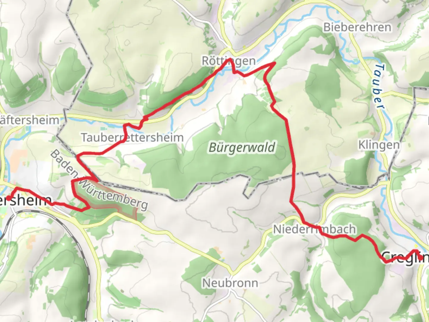
18.4 km
~4 hrs 33 min
528 m
Point-to-Point
“Explore scenic landscapes, rich history, and vibrant wildlife on the accessible Weikersheim to Creglingen trail.”
Embarking on the journey from Weikersheim to Creglingen, hikers will traverse approximately 18 kilometers (about 11 miles) of scenic landscapes with an elevation gain of around 500 meters (approximately 1,640 feet). This point-to-point trail is nestled in the picturesque region of Main-Tauber-Kreis, Germany, and is estimated to be of easy difficulty, making it accessible for hikers of various skill levels.
Getting There
To reach the trailhead near Main-Tauber-Kreis, travelers can opt for public transport or drive by car. If using public transport, the nearest significant town is Weikersheim, which is well-connected by train. From major cities like Frankfurt or Stuttgart, you can take a train to Weikersheim station. For those driving, Weikersheim is accessible via the A81 motorway, with ample parking available near the trailhead.
Trail Highlights
The trail begins in the charming town of Weikersheim, known for its stunning Renaissance palace, Schloss Weikersheim. This historical landmark, with its beautifully manicured gardens, is a perfect starting point for your hike. As you set off, the trail meanders through the idyllic Tauber Valley, offering a blend of lush forests, rolling hills, and open fields.
Nature and Wildlife
Hikers will be delighted by the diverse flora and fauna along the route. The trail passes through deciduous forests, where you might spot native wildlife such as deer, foxes, and a variety of bird species. In spring and summer, the meadows burst into color with wildflowers, providing a vibrant backdrop to your journey.
Historical Significance
As you approach Creglingen, the trail takes you through areas steeped in history. Creglingen is home to the renowned Herrgottskirche, a church famous for its exquisite wooden altarpiece crafted by the master sculptor Tilman Riemenschneider in the early 16th century. This masterpiece is a testament to the region's rich cultural heritage and is a must-see for history enthusiasts.
Navigation and Safety
For navigation, hikers are encouraged to use the HiiKER app, which provides detailed maps and real-time updates to ensure a safe and enjoyable experience. The trail is well-marked, but having a reliable navigation tool is always recommended.
Final Stretch
The final stretch of the trail leads you into the quaint town of Creglingen, where you can explore its medieval architecture and enjoy local cuisine at one of the traditional German eateries. Whether you're drawn by the natural beauty, historical landmarks, or the tranquility of the countryside, the Weikersheim to Creglingen Walk offers a rewarding experience for all who venture along its path.

Comments and Reviews
User comments, reviews and discussions about the Wweikersheim to Creglingen Walk, Germany.
average rating out of 5
0 rating(s)