Download
Preview
Add to list
More
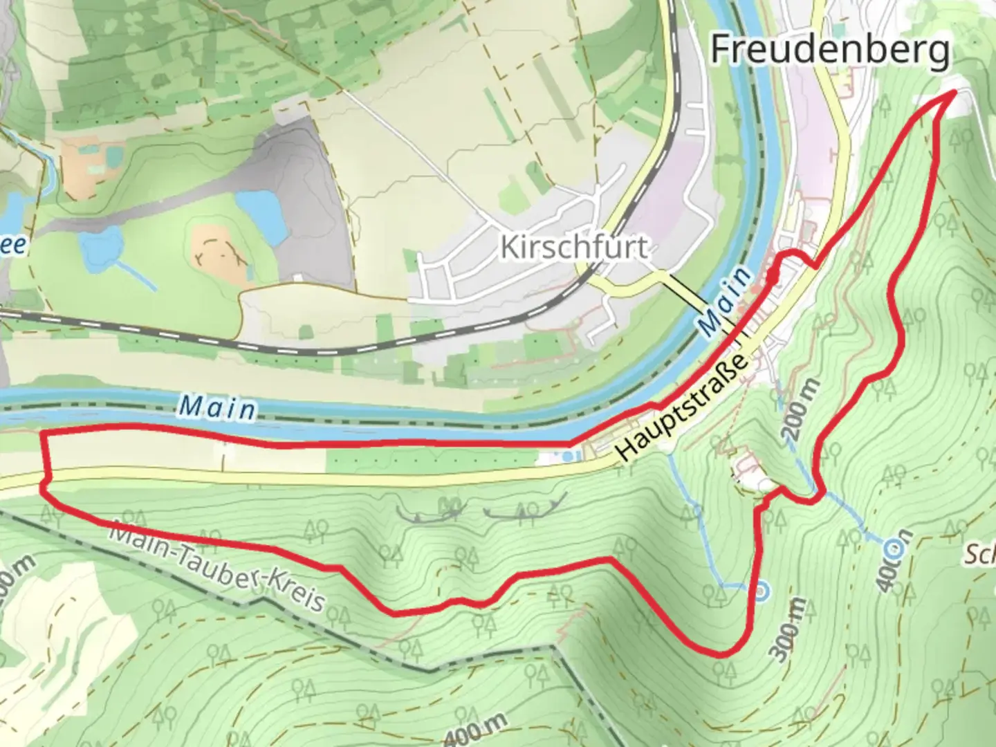
6.5 km
~1 hrs 57 min
388 m
Loop
“Explore the breathtaking Taubertal Valley on a challenging hike rich with nature and history.”
Nestled in the picturesque region of Main-Tauber-Kreis, Germany, this challenging loop trail offers a captivating journey through the heart of the Taubertal Valley. Spanning approximately 7 kilometers (about 4.3 miles) with an elevation gain of around 300 meters (approximately 984 feet), this trail is best suited for experienced hikers seeking a demanding yet rewarding adventure.
Getting There
To reach the trailhead, travelers can opt for public transport or drive. If using public transport, the nearest major town is Bad Mergentheim, which is well-connected by train. From Bad Mergentheim, local buses or taxis can take you to the vicinity of the trailhead. For those driving, the trailhead is accessible via the A81 motorway, with parking available near the starting point.
Trail Highlights
Liebliches Taubertal
The trail begins near the charming landscapes of the Liebliches Taubertal, a region renowned for its scenic beauty and rich cultural heritage. As you embark on the trail, you'll be greeted by rolling hills and lush vineyards, offering a serene backdrop for your hike. The Taubertal Valley is dotted with quaint villages and historic sites, providing a glimpse into the area's storied past.
Mautersbrunnen Weg
As you progress along the trail, you'll encounter the Mautersbrunnen Weg, a path that meanders through dense forests and open meadows. This section of the trail is particularly challenging, with steep inclines that test your endurance. Keep an eye out for the diverse flora and fauna that inhabit the area, including deer, foxes, and a variety of bird species.
Historical Significance
The Main-Tauber-Kreis region is steeped in history, with roots tracing back to the Roman era. Along the trail, you'll find remnants of ancient settlements and medieval architecture, offering a fascinating insight into the area's historical significance. The trail also passes by several traditional German villages, where you can explore half-timbered houses and cobblestone streets that have stood the test of time.
Navigation and Safety
Given the trail's difficulty rating, it's essential to be well-prepared before setting out. Ensure you have sturdy hiking boots, sufficient water, and snacks for the journey. The trail is well-marked, but it's advisable to use the HiiKER app for navigation to stay on track and avoid any potential detours. Weather conditions can change rapidly, so check forecasts and dress accordingly.
This trail promises an invigorating hike through one of Germany's most enchanting regions, offering both natural beauty and a rich tapestry of history to explore.

What to expect?
Activity types
Comments and Reviews
User comments, reviews and discussions about the Main via Liebliches Taubertal and Mautersbrunnen Weg, Germany.
average rating out of 5
0 rating(s)